Flight Delays and Airport Impacts: Feb 28
U.S. flight delays Feb 28 are shaping up as a multi region reliability day, with low ceilings in the Northeast and Southeast, snow risk in the Upper Midwest, and thunderstorm disruption potential across Florida routes. The practical consequence is that itineraries connecting through the New York area and the Florida hub set face the highest late day miss risk, even if your first departure looks fine in the morning.
The FAA planning signal also shifts versus February 27, 2026, because the constraint set broadens into more "network coupling" airports at once, including the New York area airports plus Florida, and that combination tends to convert ordinary delays into missed connections when banks stack. If you need a fast refresher on yesterday's footprint, see Flight Delays and Airport Impacts: Feb 27.
U.S. Flight Delays Feb 28: What Changed
FAA flow planning for February 28, 2026 flags low ceilings and low visibility as the primary terminal limiter around the New York region, plus Philadelphia International Airport (PHL), Charlotte Douglas International Airport (CLT), and Hartsfield Jackson Atlanta International Airport (ATL). Low ceilings matter because they usually reduce arrival acceptance rates first, then spread into departures when gates stay occupied longer than planned.
Florida is a mixed day, with low ceilings called out for central Florida, and thunderstorm risk called out for south Florida, which is the combination that most often produces unpredictable ground stops later, not a clean, all day delay program you can plan around. The FAA plan also keeps a heavy "snowbird volume" posture in play, which means fewer easy reroutes once multiple routes into Florida are constrained at the same time.
Out West, the plan specifically allows for a San Francisco International Airport (SFO) ground stop or ground delay program possibility after mid afternoon, which is a reminder that a West Coast airport can become your hidden risk even if you never set foot there, because aircraft rotations often touch SFO before operating evening departures up and down the coast.
Which Itineraries Are Most Exposed
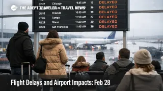
The highest compounding risk sits with travelers connecting through John F. Kennedy International Airport (JFK), LaGuardia Airport (LGA), and Newark Liberty International Airport (EWR), because low ceilings in that airspace complex can slow multiple banks, and those banks carry a high share of onward connections. If your connection is under 90 minutes, treat that as a risk posture problem, not just a comfort issue, because when arrival rates get throttled, the first thing that breaks is the bank timing.
The second hot zone is the Florida funnel. The plan explicitly calls out Orlando International Airport (MCO) and Tampa International Airport (TPA) as possible ground stop candidates, and it calls out Miami International Airport (MIA) and Fort Lauderdale Hollywood International Airport (FLL) as a later window ground stop possibility, which is a classic setup for evening misconnects into leisure destinations and cruises.
A third segment to watch is the Upper Midwest and Great Lakes connections. Snow is flagged around Minneapolis Saint Paul International Airport (MSP) and Detroit Metropolitan Wayne County Airport (DTW), and even "routine" snow days can quietly reduce runway throughput, extend taxi times, and create crew legality failures later if the day starts behind schedule.
What Travelers Should Do Now
Before leaving for the airport, protect your itinerary where it actually breaks. If you are transiting the New York airports, Philadelphia, Charlotte, Atlanta, or the Florida hubs, add buffer to connections and airport arrival times, and assume late afternoon and evening departures are higher risk than the morning wave, because these constraints compound as delays propagate through rotations.
Use a simple decision threshold for rebooking versus waiting. Rebook early if your first leg is already trending toward an hour late, if your connection margin is tight, or if you are on separate tickets, because the constraint pattern here is multi hub, and inventory drains faster when everyone is trying to solve the same routing problem at once. Waiting can make sense only if you have multiple later options that still satisfy your real arrival constraint, not your preferred arrival time.
Over the next 24 to 72 hours, monitor two things, the FAA operations plan updates for ground stop and delay program activation windows, and your aircraft's inbound leg early in the day. If you want the structural context for why these patterns recur and why recovery tails can persist, see U.S. Air Traffic Control Privatization: Reality Check.
Why This Disruption Spreads Through Travel
A ground stop is a hard brake, arrivals are temporarily halted or severely restricted, usually to keep the airport from saturating when conditions drop below safe rates. A ground delay program is a metering tool, flights are held at their origin so the arrival queue stays manageable. On low ceiling days, airports often shift between these modes as visibility and spacing requirements change, which is why travelers experience sudden "looks fine, then degrades" behavior.
February 28, 2026 has multiple propagation paths at once. Low ceilings in the Northeast and Southeast slow arrival rates at the same time Florida routes face convective risk, and that forces reroutes, miles in trail spacing, and occasional route closures that add block time and push crews toward duty limits. First order, you see longer holds and later departures. Second order, you see missed connections, forced overnights near hubs, and fewer same day rebooking options because the remaining seats are being chased by everyone at once.
There is also a smaller but real niche risk for some Mexico routings, the FAA command center issued a volcanic ash advisory for Popocatépetl on February 28, 2026, which can trigger tactical reroutes around ash if the plume affects common airway flows. Most U.S. travelers will never notice it, but if you are connecting into Mexico City area flights or overflying central Mexico, it is a reminder that "weather" sometimes includes hazards that change routings without much warning.