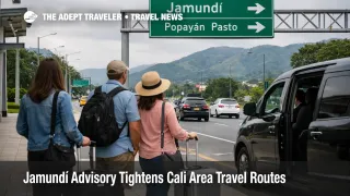
Jamundí Advisory Tightens Cali Area Travel Routes
Colombia travelers building road heavy itineraries around Cali, Colombia, now have a narrower southwest map to work with after the U.K. updated its advice on April 7, 2026, to warn against all but essential travel to the municipality of Jamundí in Valle del Cauca. The change does not shut down Cali or nearby air service, but it does make mixed airport and road plans more brittle for travelers who depend on flexible routing south of the city. Anyone stacking an Alfonso Bonilla Aragón International Airport (CLO) arrival or departure onto a same day road leg should now treat route discipline, extra buffer, and backup transport as part of the trip design, not as optional caution.
Jamundí Travel Advisory: What Changed
The operational change is specific. FCDO says it now advises against all but essential travel to the municipality of Jamundí, Valle del Cauca, and the advisory page shows that update was posted on April 7, 2026. Jamundí sits just south of Cali, so this is not a distant Colombia warning with little practical effect on a mainstream travel geography. It is a fresh tightening near a major southwest urban hub that many travelers use as the air anchor for regional road movement.
The same FCDO guidance also keeps wider warnings in place across exposed western and border areas. In Colombia, the U.K. continues to advise against all but essential travel to the western part of Valle del Cauca, parts of Cauca and Nariño, and within 5 kilometers of the Ecuador border except for the Pan American Highway crossing at Puente Internacional de Rumichaca and the city of Ipiales. That matters because the update does not only add one municipality, it further reduces the amount of slack available in the southwest for travelers who thought they could improvise between Cali, road segments to the south, and cross border alternatives into Ecuador.
Which Travelers Face the Most Exposure
The highest exposure sits with travelers whose itinerary depends on road timing rather than only on flights. That includes airport to hotel transfers that head south of Cali, self drive itineraries, private transfers tied to rural stays, business trips with site visits outside the city, and overland plans that treat Cali as the staging point before moving toward southern Colombia or the Ecuador frontier. A traveler staying in central Cali and flying in and out may face less direct impact than someone depending on route flexibility around the city's southern approaches.
The border angle also matters. FCDO still preserves Rumichaca and Ipiales as exceptions on the Colombia side, and its Ecuador advice similarly preserves the Rumichaca crossing, Tulcán, and the Pan American Highway in Carchi province within a broader caution zone. That means the legal overland corridor is still usable, but it is a concentrated corridor, not a sign that the wider border geography is comfortable for casual touring or ad hoc detours. In an earlier Adept Traveler article, Ecuador Border Crossings Narrow Overland Options showed how quickly border travel becomes fragile when the safe path shrinks to a narrower lane.
What Travelers Should Do Now
Travelers with upcoming southwest Colombia plans should separate the trip into distinct risk layers before departure. Keep Cali based air segments, city stays, and any southbound road movement as separate decisions rather than assuming they form one smooth chain. If the trip purpose is optional and depends on driving through or into Jamundí, the cleaner move is to reroute or cut that segment. If the trip must proceed, use a reputable local operator, avoid stacking a long road leg onto a same day international departure, and build a larger buffer before reaching the airport.
For Ecuador bound overland plans, the threshold is discipline. Use the preserved Rumichaca and Ipiales corridor if the crossing is essential, but avoid treating the wider southern route map as interchangeable. Travelers should also avoid assuming that a scheduled flight solves the problem. The U.S. advisory for Colombia still warns that demonstrations can shut roads and highways without notice, reduce access to public transportation, and interrupt travel within and between cities. That means an itinerary can fail at the transfer leg even when the airport operation itself looks normal. In an earlier Adept Traveler article, Colombia Protest Risks Return to Airport Access explained how Colombia travel risk often hits the curb, highway, or transfer queue before it appears on the departures board.
The next decision point is local monitoring in the final 24 to 72 hours before movement. Watch official travel advice, carrier messages, hotel transport desks, and trusted local traffic reporting. If conditions stay stable, disciplined airport based and city based travel can still work. If additional municipalities, highways, or border approaches are added to advisory language, the case for simplifying the trip becomes much stronger.
Why the Southwest Map Is Getting More Brittle
Jamundí matters because of where it sits in the network. It is close enough to Cali that a change there alters how travelers think about southern approaches, fallback road options, and the reliability of mixed air and ground itineraries. When one municipality near a major city shifts into an all but essential category, the immediate effect is not necessarily a visible shutdown. The more important effect is that route choice narrows, driver options can become less interchangeable, and the value of supplier backed transport rises relative to do it yourself movement.
What happens next depends on whether this remains a contained geography change or becomes part of a wider tightening across southwest Colombia. For now, the key point is not that all Cali travel is broken. It is that the region's flexibility has weakened again. Travelers can still build viable itineraries through the main gateway, but they should do so with fewer road assumptions, more buffer, and a sharper distinction between usable corridors such as Ipiales and Rumichaca, and the growing list of places where discretionary movement is no longer a sensible default. In an earlier Adept Traveler article, Colombia Advisory Broadens Risk Map for 2026 Trips framed the broader national shift. The Jamundí change pushes that logic closer to Cali's practical travel geography.
Sources
- Colombia Travel Advice, GOV.UK
- Regional Risks, Colombia Travel Advice, GOV.UK
- Colombia Travel Advisory, U.S. Department of State
- Ecuador Travel Advice, GOV.UK
- Ecuador Border Crossings Narrow Overland Options, Adept Traveler
- Colombia Protest Risks Return to Airport Access, Adept Traveler
- Colombia Advisory Broadens Risk Map for 2026 Trips, Adept Traveler