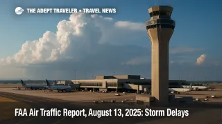
FAA Air Traffic Report, August 13, 2025: Storm Delays

Thunderstorms are set to slow major U.S. hubs on August 13, 2025, with the FAA flagging impacts from Boston and New York to Washington, Charlotte, Atlanta, Florida, Houston, and Denver. Low clouds are expected to affect Seattle, San Francisco, Los Angeles, and San Diego, prompting metering or programs as ceilings lift.
Key Points
- Why it matters: Multiple hub weather threats can cascade into nationwide delays within hours.
- Travel impact: Northeast and Mid-Atlantic hubs may see ground stops or delay programs during peak push periods. * What's next: Transcontinental and Gulf routes could face tactical reroutes if storms close standard flows. * Low clouds likely meter San Francisco and San Diego arrivals until ceilings improve. * Florida, Texas, and Denver carry afternoon convective risk windows. * Monitor the FAA NAS Status for any newly issued ground stops.
Snapshot
The FAA's day-of outlook highlights thunderstorms across the Northeast and Mid-Atlantic, including Boston Logan International Airport (BOS), John F. Kennedy International Airport (JFK), LaGuardia Airport (LGA), Newark Liberty International Airport (EWR), Philadelphia International Airport (PHL), Ronald Reagan Washington National Airport (DCA), Washington Dulles International Airport (IAD), and Baltimore/Washington International Thurgood Marshall Airport (BWI). The same system may extend delays through Charlotte Douglas International Airport (CLT), Hartsfield-Jackson Atlanta International Airport (ATL), Orlando International Airport (MCO), Tampa International Airport (TPA), George Bush Intercontinental Airport (IAH), William P. Hobby Airport (HOU), and Denver International Airport (DEN). Low clouds could slow Seattle-Tacoma International Airport (SEA), San Francisco International Airport (SFO), Los Angeles International Airport (LAX), and San Diego International Airport (SAN).
Background
When demand exceeds capacity at a major airport, the FAA can meter arrivals with a Ground Delay Program, assigning Expect Departure Clearance Times to keep aircraft on the ground rather than holding in the air. Ground stops are more restrictive, temporarily halting certain departures bound for an affected airport until conditions improve or a longer-term solution is in place. Both tools are administered through the Air Traffic Control System Command Center and are frequently used during summer thunderstorms and marine-layer mornings on the West Coast. Travelers will often see new departure times in their airline apps shortly after a program is issued.
Latest Developments
Northeast and Mid-Atlantic storms may trigger terminal programs
The Command Center's operations plan calls out thunderstorms from Boston through New York and Philadelphia to Washington terminals, with multiple facilities listed for potential ground stops or ground delay programs during peak periods. Regional planning discussions and possible Airspace Flow Programs are also on the table if storm coverage expands. Expect escape routes, SWAP, or CDR use around New York and Washington to keep flows moving.
West Coast low clouds likely meter SFO and SAN
Marine-layer ceilings are expected to impact San Francisco and San Diego, where the FAA has pre-planned initiatives to manage arrival rates until ceilings lift. Seattle is also listed for possible programs later in the day if ceilings or visibility fall. Travelers should anticipate metering into San Francisco International Airport (SFO) and San Diego International Airport (SAN) until clouds scatter and runway acceptance rates normalize.
Florida, Texas, and Denver carry afternoon convective windows
Florida terminals, the Houston pair, and Denver sit in the afternoon convective zone. The FAA daily outlook adds Orlando International Airport (MCO) and Tampa International Airport (TPA) by name, while the operations plan expands the watch to include routing constraints and possible Gulf or oceanic route closures if storms organize. Airlines may pre-tank fuel or resequence arrivals to accommodate reroutes and pop-up restrictions.
Analysis
Today's setup matches a classic mid-August pattern. Broad convective coverage in the Northeast and Mid-Atlantic compresses arrival and departure banks at multiple hubs, which forces the Command Center to balance throughput across overlapping metro areas. When New York, Philadelphia, and Washington slow at the same time, airborne holding rises quickly, so planners lean on ground delay programs and structured reroutes to meter flows before they saturate departure fixes. That is why you may see an EDCT even when the skies above your origin look fine. Compounding the picture, marine-layer ceilings at San Francisco and San Diego reduce acceptance rates until late-morning burn-off. Metering on the West Coast overlaps with afternoon storm ramps in Florida, Houston, and Denver, which tightens connection cushions on transcon itineraries. The operations plan also warns that thunderstorms could close portions of the Gulf and oceanic routes, and that transcontinental flows may need alternate structures, adding a few minutes to block times and shifting crew duty windows. For travelers, the practical moves are simple, leave extra time for connections, stay alert for gate or EDCT changes, and keep rebooking options in mind when your itinerary touches two or more of the listed hubs.
Final Thoughts
If your itinerary crosses the Northeast or Mid-Atlantic this evening, or pairs a West Coast morning arrival with a Florida or Texas afternoon departure, build in margin. Low clouds at San Francisco and San Diego, plus storm-driven programs from Boston and New York to Washington, increase the chance of rolling delays. Check your airline app for any EDCT updates, monitor the FAA NAS Status, and consider earlier departures when a tight connection involves today's watch list hubs. Use this FAA Air Traffic Report to anticipate where the pressure points will be and adjust your plans before they harden into missed connections. Helpful references on Adept: See yesterday's wrap for context, FAA Air Traffic Report, August 12, 2025: Delays & Storms, and our hub page, FAA Daily Air Traffic Report.
