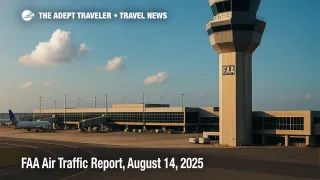
FAA Air Traffic Report, August 14, 2025
Thunderstorms threaten a wide arc from Boston through New York, Philadelphia, and Washington to Charlotte and Atlanta, with Florida and Houston also in the mix. Low clouds are slowing mornings at San Francisco and San Diego, while winds may affect Denver and Salt Lake City. The FAA's Command Center plans tactical initiatives, including possible ground delay programs and ground stops, as windows open through the afternoon and evening. Travelers should expect rolling delays at major hubs, tighter connections, and occasional reroutes as weather moves across key corridors.
Key Points
- Why it matters: Multiple hub impacts can cascade nationwide within hours.
- Travel impact: Morning metering on the West Coast, afternoon storms in the Northeast, Mid-Atlantic, Florida, and Texas.
- What's next: FAA plan flags potential ground stops or GDPs at SFO after 900 a.m. CT, BOS after 1200 p.m. CT, and New York, Philadelphia, D.C., and others after 100-300 p.m. CT.
- Staffing and runway notes may add friction, including closures or construction at select hubs.
- SpaceX launch window near Cape Canaveral may prompt short-term route constraints this morning.
Snapshot
The FAA Daily Air Traffic Report lists thunderstorms as the primary driver of delays for General Edward Lawrence Logan International Airport (BOS), John F. Kennedy International Airport (JFK), LaGuardia Airport (LGA), Newark Liberty International Airport (EWR), Philadelphia International Airport (PHL), Ronald Reagan Washington National Airport (DCA), Washington Dulles International Airport (IAD), and Baltimore/Washington International Thurgood Marshall Airport (BWI). Charlotte Douglas International Airport (CLT), Hartsfield-Jackson Atlanta International Airport (ATL), Orlando International Airport (MCO), Tampa International Airport (TPA), Fort Lauderdale-Hollywood International Airport (FLL), Miami International Airport (MIA), and George Bush Intercontinental Airport (IAH) are also on watch. Low clouds are noted at San Francisco International Airport (SFO) and San Diego International Airport (SAN), with winds at Denver International Airport (DEN) and Salt Lake City International Airport (SLC).
Background
When demand exceeds safe arrival rates, the FAA meters traffic using a Ground Delay Program, which assigns Expect Departure Clearance Times so aircraft wait at origin rather than stack in the air. Brief but intense weather may trigger ground stops, a more restrictive pause on specific departures bound for an affected airport. Planners also use Airspace Flow Programs to spread delay across congested corridors, plus Severe Weather Avoidance Plans and CDR routes to detour around storms. The Command Center updates an operations plan throughout the day, revising programs as weather evolves. For recurring context and tips, see our rolling coverage on FAA Daily Air Traffic Report.
Latest Developments
FAA Air Traffic Report snapshot, timing windows to watch
The 838 a.m. CT operations-plan update outlines likely morning metering on the West Coast, then expanding storm-driven constraints east of the Rockies. SFO is probable for a ground stop or GDP **after 900 a.m. CT**; SAN is possible after the same time. BOS is possible after 12:00 p.m. CT. New York and Philadelphia, including JFK, LGA, EWR, and PHL, are possible after 1:00 p.m. CT, with Washington area airports next, DCA and the IAD, BWI pair possible after 2:00 p.m. CT. ATL is possible after 2:00 p.m. CT. Florida's MCO and TPA are possible after 1:00 p.m. CT, with MIA and FLL possible after 3:00 p.m. CT. Houston's IAH and HOU are possible after 1:00 p.m. CT. Expect CDRs, SWAP, and escape routes if coverage expands.
West Coast marine layer, morning metering
Low ceilings at SFO and SAN continue to shrink arrival rates until mid- to late-morning burn-off, prompting metering and, if needed, a time-boxed GDP at SFO. If ceilings lift on schedule, programs should compress and clear before midday, but late clearing can ripple into transcon banks. Watch for downstream effects on afternoon connections into Florida and the Northeast.
Route constraints, launches, and runway work
The plan highlights active reroute structures across the Ohio Valley to Florida, partial Lake Erie flows, and periodic Western Atlantic closures like L453 during storms. A SpaceX Starlink window out of Cape Canaveral, 547-1029 a.m. CT, may add brief coastal constraints. Notable runway or taxiway projects include work at Palm Beach International Airport (PBI), John F. Kennedy International Airport (JFK), Philadelphia International Airport (PHL), William P. Hobby Airport (HOU), LaGuardia Airport (LGA), Chicago O'Hare International Airport (ORD), Indianapolis International Airport (IND), and long-running construction at San Diego International Airport (SAN). Check airline alerts if your itinerary touches these fields.
Analysis
Today's picture blends classic summer convection in the East with morning marine layers in Southern California. When multiple Northeast metros slow at once, the Command Center leans on GDPs to keep airborne holding from spiking, and pairs them with AFPs and SWAP routings to push flows around cells. That triad raises taxi-out times in New York and Philadelphia and shrinks connection cushions nationwide. Meanwhile, SFO's marine layer often clears before midday; if it lingers, the overlap with afternoon Eastern storms tightens transcon turns, especially Bay Area to East Coast. Houston sits on the western edge of the storm belt, so short-notice initiatives there can throw off hub-and-spoke sequences into the central corridor. Your best hedges are earlier departures, longer connections where practical, carry-on only to stay nimble, and quick action if your airline app compresses an EDCT or offers a better option. For deeper New York-specific tactics, see New York Flight Delays, LGA and JFK Ground Stops, GDPs.
Final Thoughts
If your plans touch BOS, the New York complex, PHL, or the Washington pair this afternoon, build margin and monitor for GDPs and AFPs. West Coast morning metering at SFO and SAN can still ripple into afternoon connections, especially toward Florida and Texas. Turn on airline notifications, ask at the gate whether your flight has an EDCT, and rebook early if a tighter path opens. We will keep tracking programs as they update and fold new specifics into our FAA Air Traffic Report.