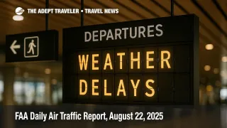
FAA daily air traffic report, August 22, 2025
Gusty winds are expected to slow arrivals at Boston Logan International Airport (BOS) and the New York terminals on August 22, 2025. Thunderstorms could disrupt operations at Hartsfield-Jackson Atlanta International Airport (ATL), Charlotte Douglas International Airport (CLT), Minneapolis Saint Paul International Airport (MSP), George Bush Intercontinental Airport (IAH), William P. Hobby Airport (HOU), Dallas Fort Worth International Airport (DFW), Dallas Love Field (DAL), Phoenix Sky Harbor International Airport (PHX), and Florida hubs, including Fort Lauderdale-Hollywood International Airport (FLL), Orlando International Airport (MCO), Miami International Airport (MIA), Palm Beach International Airport (PBI), and Tampa International Airport (TPA). The FAA will meter demand as weather evolves.
Key Points
- Why it matters: Summer weather and winds may trigger metering, ground delay programs, or ground stops.
- Travel impact: Rolling delays likely in the Northeast, Texas, Florida, and the Desert Southwest.
- What's next: Command Center will adjust initiatives through the afternoon based on demand and radar trends.
- Oceanic routes: An Atlantic track closure window prompts transatlantic reroutes.
- Spaceflight: A Vandenberg Starlink window may require short, localized route holds.
Snapshot
The FAA's morning outlook highlights winds for the New York metro area, with Boston Logan International Airport (BOS) in the mix for delays. Thunderstorms threaten hubs in Georgia, the Carolinas, Minnesota, Texas, Arizona, and Florida. Airports under the greatest risk window include Hartsfield-Jackson Atlanta (ATL), Charlotte Douglas (CLT), Minneapolis Saint Paul (MSP), George Bush Intercontinental (IAH), William P. Hobby (HOU), Dallas Fort Worth (DFW), Dallas Love Field (DAL), Phoenix Sky Harbor (PHX), Fort Lauderdale-Hollywood (FLL), Orlando (MCO), Miami (MIA), Palm Beach (PBI), and Tampa (TPA). The FAA notes no active airspace flow program at press time, with one possible after late evening. Select Atlantic routes face temporary closure periods, and limited reroutes are published for the Great Lakes and Hudson Valley.
Background
Summer convection remains the system's top limiter, reducing airport arrival rates and forcing miles-in-trail, reroutes, or a ground delay program when demand outpaces capacity. In the Northeast, persistent crosswinds and construction add friction that compounds weather impacts. The New York approach environment continues to run tight, so even modest storms can require arrival metering. Yesterday's pattern featured programs in the New York and Philadelphia corridors, with the same geography under scrutiny again. For context on evolving New York capacity management, see FAA seeks to extend Newark flight limits into October 2026. For continuity with this week's weather-driven constraints, review our FAA daily air traffic report, August 21, 2025. Hurricane Erin's offshore circulation continues to influence Atlantic routing and coastal conditions, which aligns with selective oceanic and near-shore route management.
Latest Developments
FAA daily air traffic report: winds in the Northeast, storms from Texas to Florida
The operations plan lists New York TRACON winds, with gusts likely to slow John F. Kennedy International Airport (JFK), LaGuardia Airport (LGA), and Newark Liberty International Airport (EWR). Thunderstorms place Hartsfield-Jackson Atlanta (ATL), Charlotte Douglas (CLT), Orlando (MCO), Fort Lauderdale-Hollywood (FLL), Miami (MIA), Minneapolis Saint Paul (MSP), George Bush Intercontinental (IAH), William P. Hobby (HOU), and Phoenix Sky Harbor (PHX) on the risk board. Possible terminal initiatives include ground stops or a ground delay program for MSP beginning early afternoon UTC, for MCO and Tampa International Airport (TPA) later in the day, then for Houston's IAH and HOU, and for ATL into evening. Additional possibilities include Ronald Reagan Washington National Airport (DCA), Denver International Airport (DEN), Austin-Bergstrom International Airport (AUS), and San Antonio International Airport (SAT) as storms expand.
Atlantic route closure and targeted reroutes
The FAA issued an oceanic advisory closing Atlantic track L453 during a mid day window, requiring alternate routings for affected transatlantic flights. Earlier, certain L-routes reopened, then conditional closures remained possible later in the afternoon as convection redeveloped offshore. The Command Center also published limited-flow constructs, including a Lake Erie West partial and routing for the MGJ airshow, both with defined UTC validity periods. An airspace flow program is not active as of publication, with one possible late evening if sector demand and thunderstorms converge.
Spaceflight and VIP movements
A SpaceX Starlink launch window at Vandenberg Space Force Base could prompt brief, localized Western route management during the mid day to early afternoon UTC period. Blue Origin's suborbital window begins August 23, which does not affect today's scheduling unless preparations overlap with weather constraints. VIP movements include an afternoon departure from Joint Base Andrews and an evening arrival window near Cincinnati, which can drive short security restrictions and minor traffic management in those corridors.
Analysis
Expect a familiar summer playbook. Winds across New York reduce margins, so even routine buildups can tip the system into a ground delay program at one or more metro airports. When airport arrival rates fall, EDCTs stretch and misconnect risk grows for banks arriving from the Midwest and the Southeast. Florida, Texas, and Phoenix carry the day's thunderstorm volatility; any slow moving cells over departure gates or final approaches will prompt compression, reroutes, or short holds. If en route sectors stack weather and volume at the same time, the Command Center can escalate to an airspace flow program to meter flows through constrained airspace. That tool, paired with escape or capping routes, helps protect downstream banks at sprawling hubs like Dallas Fort Worth International Airport (DFW) and Hartsfield-Jackson Atlanta International Airport (ATL).
On the oceanic side, an Atlantic track closure like L453 pushes transatlantic traffic onto longer or less efficient routings, which can cascade into later arrival banks at John F. Kennedy International Airport (JFK) and Newark Liberty International Airport (EWR). Construction and taxiway work at several large airports further narrows the operational envelope. For travelers, the practical move is to build slack into connections touching New York, Florida, Texas, and Phoenix, and to monitor airline apps for EDCT updates. If your itinerary depends on an evening bank, earlier departures reduce rollover risk when a ground delay program or a late airspace flow program is activated.
Final Thoughts
Today's risks are distributed, not concentrated, which argues for targeted programs rather than nationwide disruption. Watch the New York metro for wind driven metering, and treat Florida, Texas, and Phoenix as pop up thunderstorm zones. Transatlantic flights may zigzag around a mid day Atlantic route closure, which can ripple into evening arrivals. If you are connecting through the Northeast or the Sun Belt, add time and turn on flight alerts. The Command Center will adjust initiatives as storms pulse, but steady preparation helps you stay ahead of delays outlined in the FAA daily air traffic report.