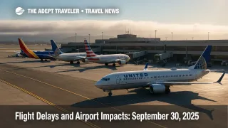
Flight delays and airport impacts: September 30, 2025
Low clouds are the early driver of flight delays at Charlotte Douglas International Airport (CLT), San Francisco International Airport (SFO), and Seattle-Tacoma International Airport (SEA). Offshore weather tied to Hurricane Imelda may prompt reroutes for Florida flows affecting Orlando International Airport (MCO), Tampa International Airport (TPA), Fort Lauderdale-Hollywood International Airport (FLL), and Miami International Airport (MIA). Oceanic route closures and VIP movement routing in the Mid-Atlantic could add spacing and circuitous routings during peak periods.
Key points
- Why it matters: Low ceilings and offshore storm swells raise the risk of extended taxi and holding.
- Travel impact: BOS ground stop or delay program is probable late afternoon into evening.
- What's next: Florida flows may see CDRs or SWAP as Imelda tracks northeast.
- Oceanic routes are closed in sectors impacted by Imelda, affecting trans-Atlantic timing.
- Construction closures persist at multiple hubs, including MCO, TPA, BOS, SFO, and IAH.
Snapshot
The FAA's morning outlook flags low ceilings at CLT, SFO, and SEA, a classic recipe for arrival metering and minor to moderate delays. The Command Center's operations plan adds that Boston Logan International Airport (BOS) is a likely candidate for a ground stop or ground delay program after 12:00 p.m. CDT. En-route thunderstorm activity is anticipated through New York, Washington, Jacksonville, Miami, Denver, Albuquerque, and Salt Lake City centers, with oceanic tracks closed in portions of the western Atlantic because of Hurricane Imelda. Expect periodic reroutes for Florida hubs and potential capping or tunneling in Northeast and Florida flows. Travelers should allow buffer time on connections, especially where weather and runway work overlap.
Background
A persistent marine layer along the West Coast and morning low clouds in the Carolinas often trigger instrument approaches and slower arrival rates. On the East Coast, Hurricane Imelda strengthened this morning and is tracking away from Florida toward Bermuda, but its broad wind field is producing hazardous surf and swells along the Southeast and Mid-Atlantic coasts. While U.S. land impacts are limited, the storm is affecting oceanic tracks and can introduce miles-in-trail spacing for flights skirting the Western Atlantic. Separately, construction projects at several hubs continue to constrain capacity on specific surfaces, which compounds any weather-driven slowdowns during banks.
Latest developments
BOS delays likely; Florida reroutes possible as Imelda alters oceanic flows
The ATCSCC's current plan lists CLT, SFO, and SEA for low-ceiling terminal constraints, with BOS "ground stop/delay program probable" in the late afternoon and evening period. Expect proactive use of Coded Departure Routes and SWAP for flows into and out of Florida, including MCO, TPA, MIA, and FLL, as storm-related swells and convective bands influence routings offshore. Oceanic routes L451-L459 are scheduled closed or limited this afternoon, pushing some trans-Atlantic departures onto alternates and increasing flight times. VIP movement near Quantico adds routing structure inside Washington Center airspace, though impacts to commercial schedules should be modest unless timing overlaps with peak banks. Plan for extra time at BOS, and monitor Florida connections for reroutes and gate holds.
Analysis
Today's picture is a textbook mix of coastal stratus, scattered convection, and special-use constraints that collectively shave throughput. The West Coast marine layer typically burns off, but SFO's geometry and traffic mix mean even short IFR windows can ripple into mid-day banks; SEA can see similar compression when ceilings linger beyond the morning rush. In the East, BOS is the wild card: even a short ground delay program during the late-day push can stack delays across New England and the Mid-Atlantic because BOS shares flows with New York metro fixes. Imelda's significance for U.S. travelers is less about direct land impacts and more about routing: closed oceanic tracks reduce options, push flights onto longer arcs, and can bump fuel loads and ETAs. Add in runway and taxiway closures at hubs like BOS, MCO, TPA, SFO, IAH, and IND, and you have fewer levers to recover from weather hiccups. Practical takeaway: build in 60 to 90 minutes of buffer for BOS-bound itineraries this evening and keep an eye on Florida connections for last-minute CDRs or airborne holding if convective cells pop near arrival fixes.
Final thoughts
If you are flying through BOS after midday, anticipate a program and pad your connection. West Coast travelers should expect morning-into-midday drizzles of delay at SFO and SEA until ceilings lift. Florida routes may look normal on the board yet still take detours due to Imelda's oceanic knock-on effects. Keep your airline app open for gate or routing changes, and consider earlier flights when possible to outrun bank-time compression. These simple moves can help you sidestep the worst of today's flight delays and airport impacts.