Flight Delays and Airport Impacts: October 30, 2025
The Federal Aviation Administration's Air Traffic Control System Command Center (ATCSCC) is running an active operations plan today, Thursday, October 30, 2025, with traffic management programs adjusted through the day. The plan also flags special-use airspace windows this evening that can prompt reroutes on some West Coast flows. Travelers should expect localized delays that ebb and flow by region, along with residual effects from shutdown-related staffing constraints that produced a Newark ground stop on Wednesday. Flights touching Bermuda face additional risk as Hurricane Melissa approaches the island under a Hurricane Warning.
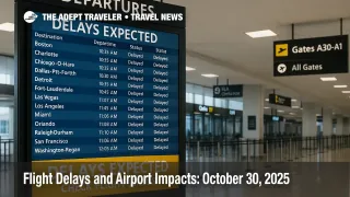
Delays today will be driven by a mix of staffing-managed flow programs in the National Airspace System and weather tied to Melissa in the western Atlantic, so confirm flight status often and build more time between connections.
FAA game plan, at a glance
The ATCSCC "Operations Plan" posted this morning sets the framework for ground delay programs, miles-in-trail restrictions, and reroutes as demand meets staffing and weather. The current advisory highlights a 206 p.m. to 930 p.m. PT primary airspace window for a Vandenberg launch that can trigger route adjustments for some California and transcon flows, with additional upcoming windows listed for Cape Canaveral and Vandenberg in early November. Airspace Flow Programs are not pre-planned at this hour, but may be activated if constraints tighten.
Travelers can also sanity-check local airport status via the FAA NAS Status portal, which reflects evolving arrival and departure programs and any delay advisories the Command Center activates. Expect this page to change throughout the day as weather and staffing evolve.
Shutdown staffing remains a drag on throughput
Shutdown-linked staffing shortfalls at air traffic control facilities remain a visible factor. On Wednesday, the FAA implemented a temporary ground stop at Newark Liberty International Airport, later easing to a ground delay program that produced average delays around forty minutes. Nationally, the share of delays attributed to controller absences has spiked during the shutdown compared with pre-shutdown norms, according to transportation officials and industry reporting. While today's constraints are facility-specific, these dynamics can continue to ripple to New York-area traffic and beyond during peak periods.
Western Atlantic weather, Bermuda flights
At 8:00 a.m. ET, the National Hurricane Center maintained a Hurricane Warning for Bermuda as Hurricane Melissa approaches the island later today and tonight. Carriers typically adjust schedules pre-emptively in these conditions, which can include cancellations, time-shifts, or aircraft swaps. If you are booked to or from Bermuda, monitor airline messages closely and consider moving to an earlier flight where options exist.
Continental U.S. weather and flow pinch points
Convective potential today skews modest but non-zero in parts of the Mid-Atlantic, which can add miles-in-trail spacing and minor reroutes when cells build along common jet routes. Elsewhere, localized low ceilings and morning marine layers at coastal hubs are typical triggers for short ground delay programs and departure metering. Check the Aviation Weather Center's GFA tools and your origin airport's status page for the most current terminal picture before you depart for the airport.
What to do next
If your itinerary connects through the New York area, add buffer time or request an earlier connection while inventory is available. For Bermuda travel, sign up for flight alerts and proactively rebook if your airline issues a waiver, even if your original flight is still showing "on time," since retimed departures can break tight connections later in the day. For West Coast evening departures, particularly long-hauls, expect minor reroutes or updated flight times around the Vandenberg launch window. Finally, watch the FAA NAS Status page in the four hours before departure, when most tactical programs get set.
Final thoughts
"Flight Delays and Airport Impacts" is a live picture, not a forecast locked at breakfast. The mix of staffing-managed flow and Western Atlantic weather makes today a plan-B day. Build margin, move earlier when offered, and keep refreshing official sources as the ATCSCC updates its plan.
Sources
- FAA ATCSCC, Current Operations Plan
- FAA NAS Status, system overview
- FAA ATCSCC, Previous Operations Plan details including planned space operations
- Business Insider, Newark ground stop and staffing context, Oct 29, 2025
- Reuters, controller absences share of delays during shutdown, Oct 28, 2025
- National Hurricane Center, Melissa Public Advisory, 8:00 a.m. ET, Oct 30, 2025
- Aviation Weather Center, GFA tools and convective outlooks