Flight Delays and Airport Impacts: November 16, 2025
The United States flight network is trying to settle into a new normal this Sunday. After the Federal Aviation Administration halved its shutdown related flight cuts from six percent to about three percent at forty major airports, the latest operations plan for November 16 still reads busy rather than calm. Low ceilings, showers, and gusty winds are lining up at both coasts, construction continues at key hubs, and pockets of winter weather and heavy rain keep pressure on a system that has very little spare capacity left.
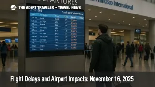
FAA daily plan and today's risk map
The FAA Air Traffic Control System Command Center's current Operations Plan Advisory, ATCSCC Advisory 034 for November 16, frames the day as a weather driven chess match with a few staffing and special use airspace complications layered on top.
The plan notes that low ceilings and showers, plus wind in some corridors, are the dominant constraints at:
- Boston Logan International Airport (BOS), the New York terminal area including LaGuardia and Newark, and Philadelphia International Airport (PHL), where passing showers, low clouds, and wind can trigger arrival spacing programs.
- Seattle Tacoma International Airport (SEA), where low ceilings are expected to keep approaches tightly managed.
- San Francisco International Airport (SFO), which faces both low ceilings and ongoing taxiway Z rehabilitation work that reduces flexibility on the ground.
- Harry Reid International Airport in Las Vegas (LAS) and Los Angeles International Airport (LAX), where showers, low clouds, and visibility issues linger on the edges of the same storm system that has hammered Southern California with flooding rain this week.
For now, the Command Center lists no active terminal programs, but it explicitly warns that ground stops or delay programs are possible later in the day at Washington Dulles International Airport (IAD), Newark Liberty International Airport (EWR), Las Vegas, LaGuardia Airport (LGA), Austin Bergstrom International Airport (AUS), Ronald Reagan Washington National Airport (DCA), and San Francisco. These will be deployed as conditions demand, most likely from mid afternoon into the evening local time when demand peaks overlap with the worst ceilings and winds.
En route, the plan highlights thunderstorms across several air route traffic control centers in the Northeast and along the West Coast, a continuing suspension of preferred random routes in Washington Center airspace, and special handling for general aviation flows into South Florida, which together add friction to cross country and Florida bound traffic. It also flags upcoming space launches from Wallops Island, Cape Canaveral, and Vandenberg that will carve out temporary chunks of airspace over the next few days, something that can force reroutes and minor airborne holding even if it does not cancel flights outright.
The FAA's National Airspace System Status page, updated this morning, shows the familiar pattern that matches the written plan, highlighted delays clustered around weather challenged hubs rather than system wide ground stops.
Latest developments since November 15
Yesterday's Adept Traveler daily update, Flight Delays and Airport Impacts: November 15, 2025, marked the formal shift from a six percent to a three percent mandated flight reduction at forty major airports after the record forty three day government shutdown finally ended. That easing continues to shape today's schedule. Airlines are still operating with trimmed frequencies, but the worst of the blanket cancellations has subsided and carriers are increasingly using those three percentage points as a buffer to absorb weather and local constraints instead of cancelling marquee flights.
Several carriers now say they have completed or nearly completed the required schedule adjustments through this weekend. JetBlue's travel alert page, for example, notes that it has finished the FAA mandated reductions through November 16 and is directing passengers back to normal online flight status tools for up to the minute information. That does not eliminate delays, but it underscores that the cuts are now baked into the timetable rather than imposed on the fly.
Weather remains the other big variable. The National Weather Prediction Center's short range discussion calls out additional heavy rainfall along the Southern California coast on Monday, with flash flooding and rock slide risk on saturated ground, while also highlighting a wintry mix and accumulating snow from the Great Lakes through northern New York and interior New England. At the same time, Texas and parts of the southern Plains are running well above normal, even flirting with record warmth, which boosts demand but does not directly slow operations.
In the background, the FAA's emergency Airworthiness Directive grounding MD 10, DC 10, and MD 11 family aircraft until inspections are completed continues to hit cargo operations hardest, especially overnight integrator networks, although most passenger carriers now rely on newer types. For most travelers, the visible effects show up as subtle changes in departure timing or aircraft type rather than mass cancellations.
Analysis, where delays are most likely today
Background, how the shutdown caps interact with weather
Even at three percent, FAA flight caps at the forty constrained airports act like a permanent headwind. Airlines schedule slightly fewer departures than demand would otherwise support, leaving the system with less slack when storms, low ceilings, or runway closures force controllers to reduce arrival and departure rates. That means a day like today, with multiple weather trouble spots and some construction, can feel worse than the raw flight count suggests, particularly in the afternoon and evening when banks are usually tight.
Northeast and Mid Atlantic
In the Northeast corridor, the operations plan's combination of showers, low ceilings, and wind at Boston, New York, and Philadelphia lines up neatly with Weather Prediction Center guidance and regional hazardous weather outlooks that flag a wintry mix, accumulating snow at higher elevations, and gusty post frontal winds. When this pattern sets in, arrivals into Newark, LaGuardia, and the New York terminal area usually get metered, which pushes holding and departure restrictions upstream to origins across the country.
With Washington National and Dulles both on the "possible ground stop" list for later today, passengers routing through the capital region, especially on shorter shuttles and regional jets, should assume that minor delays are more likely than not during peak banks. The continued suspension of some preferred random routes in Washington Center airspace adds another subtle layer of congestion, since controllers have fewer shortcuts to smooth out traffic.
West Coast and Southern California
On the West Coast, the atmospheric river that Adept Traveler has been tracking in SoCal Storm Brings Flood Risk And Flight Delays still exerts a long tail. Low ceilings at Seattle, Las Vegas, Los Angeles, and San Francisco, plus construction on taxiway Z at SFO, point to a day of slower than normal arrival and departure rates, even if outright ground stops remain conditional.
The practical effect is simple. Morning flights may get out with only modest delay, but as traffic builds and the storm system continues to feed moisture and instability into coastal California, arrival metering and departure holds become more likely. If your itinerary uses West Coast hubs to connect to Hawaii, Latin America, or Asia, treat any layover under ninety minutes as aggressive and, if possible, move to earlier blocks.
Sun Belt, Midwest, and interior
Texas and much of the southern Plains stand out as warm islands in the national map, with temperatures running well above seasonal norms. Warm and dry conditions rarely create direct flight disruptions, but they can amplify demand as people squeeze in last minute trips before the Thanksgiving crunch, which fills seats on still slightly reduced schedules.
In the Midwest and interior Northeast, the lake effect and mountain snow mentioned in national forecast discussions do not always translate into massive airport closures, but they do create intervals of reduced visibility and slippery ramp conditions around the Great Lakes and interior New England. Expect occasional delays at Chicago, Detroit, and regional airports that feed into the larger hubs, especially where construction is also in play, such as ongoing taxiway work at Chicago O'Hare.
Final thoughts, how to travel through today's constraints
For November 16, the story is not widespread meltdown, it is a system that remains tight. The combination of three percent shutdown caps at forty key airports, weather trouble spots on both coasts, and persistent runway and taxiway construction means there is little margin left when anything goes wrong.
If you are flying today, treat the FAA plan as a checklist. If your route touches Boston, New York, Philadelphia, Washington, Seattle, Las Vegas, Los Angeles, or San Francisco, assume at least some risk of holding and connection stress, particularly in the afternoon and evening. Build longer layovers where you can, avoid last departures on critical legs, and rely on airline apps, the FAA's National Airspace System Status page, and tools like FlightAware's Misery Map to watch how delays actually evolve before you leave for the airport.
Sources
- FAA Daily Air Traffic Report
- ATCSCC Advisory 034, November 16, 2025 Operations Plan
- National Airspace System Status
- Weather Prediction Center National Forecast and Short Range Discussion
- NWS Hazardous Weather Outlook, Burlington VT and Binghamton NY
- SoCal Storm Brings Flood Risk And Flight Delays
- Flight Delays and Airport Impacts: November 15, 2025
- FAA Statement on Emergency Airworthiness Directive for MD 10, DC 10, and MD 11
- FAA Halves Flight Cuts To 3 Percent As Airlines Push For End
- FAA Takes First Steps To Restore Flights After Shutdown Strain
- JetBlue Travel Alerts