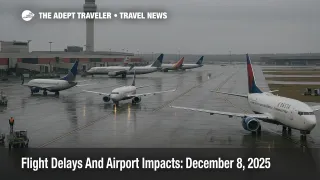
Flight Delays And Airport Impacts: December 8, 2025
U.S. flight delays December 8 are being driven by a familiar mix of coastal wind, low clouds at key hubs, and thunderstorms on Florida routes, according to the Federal Aviation Administration's Monday outlook. The latest FAA daily air traffic report flags wind as a constraint from Boston Logan International Airport (BOS) through the New York airports, Philadelphia International Airport (PHL), and the Washington area airports, while low ceilings are slowing operations at Hartsfield Jackson Atlanta International Airport (ATL), Charlotte Douglas International Airport (CLT), Seattle Tacoma International Airport (SEA), Los Angeles International Airport (LAX), and San Diego International Airport (SAN). Thunderstorms around Tampa, Orlando, Miami, Fort Lauderdale, and West Palm Beach add another layer for Florida bound travelers, and the system is still working through backlogs from Sunday's fog in Atlanta and snow around Chicago.
In practical terms, the FAA's December 8 daily air traffic report and operations plan show U.S. flight delays December 8 clustering around the Northeast corridor, Atlanta and Charlotte, Florida gateways, and Seattle, with additional risks emerging later in the day at San Francisco International Airport (SFO) and some mid Atlantic airports as flow control programs come into play.
Northeast winds and D.C. bottlenecks
The strongest early signal in the FAA report is wind along the busy Northeast spine. Boston Logan, John F. Kennedy International Airport (JFK), LaGuardia Airport (LGA), Newark Liberty International Airport (EWR), Philadelphia, Baltimore Washington International Thurgood Marshall Airport (BWI), Washington Dulles International Airport (IAD), and Ronald Reagan Washington National Airport (DCA) are all highlighted for wind related arrival and departure constraints. When that many closely spaced hubs are on instrument approaches, even modest crosswinds can force longer spacing between aircraft and trigger ground delay programs that ripple into missed connections.
The current operations plan builds on that picture by giving Newark and the broader New York terminal area a conditional slot for potential ground stops or ground delay programs later in the day, particularly around the late afternoon and evening departure waves. For travelers, that means treating any sub ninety minute domestic connection at BOS, JFK, LGA, EWR, PHL, BWI, IAD, or DCA as fragile, especially when linking from a regional feeder into a Florida, Caribbean, or transatlantic flight.
Washington area travelers also face a quieter but important constraint in the form of high general aviation volume. The FAA operations plan notes that non airline traffic is likely to keep trimming runway capacity at Dulles and National through December 11, which can turn routine weather into meaningful queues during the afternoon push. If you are flying into Washington for a same day connection to a train, meeting, or onward flight, build extra time into the ground side.
Atlanta, Charlotte, and a still messy Southeast
In the Southeast, low clouds are already in the mix at Atlanta and Charlotte, two of the country's most important connecting hubs. Monday morning coverage from Atlanta describes an airport still digging out from Sunday's dense fog and associated ground stop, which delayed more than a thousand flights and canceled dozens as crews waited for conditions to improve. By early Monday, FlightAware data cited by local outlets showed roughly 130 delays and around 140 cancellations still affecting Hartsfield Jackson flights, with Delta bearing much of the impact.
That backlog matters because low ceilings today mean crews may have less slack to recover if another band of fog or showers slows arrivals. Travelers connecting through Atlanta or Charlotte should assume that short suburban spokes and regional jets will bear the brunt if airlines need to trim schedules, and that late afternoon connections into Florida, the Caribbean, or the West Coast are the most vulnerable to knock on delays.
Florida thunderstorms and evening ground program risk
The FAA daily air traffic report explicitly calls out thunderstorms for Tampa International Airport (TPA), Orlando International Airport (MCO), Miami International Airport (MIA), Fort Lauderdale Hollywood International Airport (FLL), and Palm Beach International Airport (PBI), which are key gateways for Florida vacations, cruises, and Caribbean connections. The operations plan goes further, keeping the option open for ground stops or ground delay programs at Miami, Fort Lauderdale, and Palm Beach after roughly 2000 Zulu, aligning with the late afternoon and evening bank of Northeast and Midwest arrivals.
On top of the storms, the same plan notes offshore airspace constraints around Florida linked to a planned Starlink 6 92 launch from Cape Canaveral, with a window that stretches from 2114 Zulu into the overnight hours. That kind of temporary hazard area can force reroutes for some Atlantic and Caribbean flights even when airports appear green on delay maps, adding a quiet 10 to 30 minutes to some itineraries.
If your trip into Florida on December 8 connects to a cruise or an escorted tour, the safest move is to arrive at least a day early or pivot to earlier inbound flights where seats exist. Same day arrivals into Miami, Fort Lauderdale, Port Canaveral, or Tampa for afternoon embarkations should be treated as higher risk.
Seattle, Southern California, and a building West Coast storm pattern
Seattle, Los Angeles, and San Diego are in the FAA's low cloud column today, with the operations plan also flagging San Francisco for possible ground stops or ground delay programs after 1630 Zulu as marine layer clouds and banked arrivals converge. Seattle remains partly constrained by runway and taxiway work, meaning there is less margin to absorb even small surges in delays during morning and evening peaks.
Beyond today, meteorologists are watching an unusually long atmospheric river stretching from near the Philippines to the Pacific Northwest, which is expected to bring several days of heavy rain, mountain snow, and flood risk to Washington and Oregon starting around Monday and intensifying into midweek. Even if December 8 only sees low ceilings and light delays at SEA, the setup argues for caution on Tuesday and Wednesday flights into Seattle, Portland, Spokane, and regional fields that rely on those hubs.
For travelers heading to or from Asia, Hawaii, or Alaska using West Coast connections, early morning departures into Seattle or San Francisco remain the best bet. Midday and afternoon banks have less slack if ground programs materialize, which can strand long haul connections until the next day.
Chicago and other snow belt hubs still recovering
While Chicago O Hare International Airport (ORD) and Chicago Midway International Airport (MDW) are not in the FAA's headline list today, they are not starting from a clean slate. Weekend snow triggered a Sunday ground stop and ground delay program at O Hare, with local reporting citing hundreds of cancellations and delays as crews cycled plows and deicing trucks across the airfield. By Monday, national trade coverage that aggregates FlightAware data described roughly 571 cancellations and nearly 6,900 delays across U.S. carriers, with Chicago, Atlanta, New York City, and Boston among the top contributors as snow and storms disrupted operations.
For passengers, the key point is that crews and aircraft are still slightly out of position. Flights into and out of ORD and MDW on December 8 may show "on time" labels but still face last minute swaps or rolling departure holds if crews time out or if deicing needs return during heavier bursts of snow. Anyone using Chicago to connect into Florida, the Mountain West, or Europe today should treat short connections as an avoidable risk rather than a convenience.
Practical moves for flyers on December 8
Taken together, the FAA's narrative and real time tracker data point to a system that is stressed but not in full meltdown. U.S. flight delays December 8 are concentrated at coastal hubs, Atlanta, and Florida gateways, with a developing risk picture on the West Coast as the atmospheric river approaches.
The most reliable moves remain straightforward. Book or move to earlier departures wherever you can, especially if you are connecting through BOS, JFK, LGA, EWR, PHL, BWI, IAD, DCA, ATL, CLT, SEA, MIA, FLL, or PBI. Aim for at least two hours between domestic legs and three hours when a domestic flight connects into a long haul international or a cruise departure. Avoid last flights of the day on regional spokes, since a single cancellation there can easily turn into an unplanned overnight stay.
Lean heavily on digital tools. Airline apps and text alerts remain the fastest way to see gate changes, rolling delay estimates, and equipment swaps, while the FAA's National Airspace System Status dashboard and delay map show whether your origin or hub is under a ground stop, a ground delay program, or simply operating at reduced rates. Check those before leaving for the airport, then again at the gate, and be prepared to self rebook through alternative hubs if your first connection starts to wobble.
For travelers who want a deeper structural view of how these patterns tend to play out, it is worth pairing today's outlook with Adept Traveler's recent coverage of November and early December disruptions and with the evergreen Guide To US Airport Delays And Cancellations, which walks through insurance, backup planning, and refund rules in more depth.
Sources
- FAA Daily Air Traffic Report, December 8 2025
- ATCSCC Operations Plan Advisory, December 8 2025
- Atlanta airport delays, cancellations continue Monday after weather trouble
- Fog delays more than 1,000 flights Sunday at Atlanta airport after ground stop
- Thousands of passengers stranded in US as major airlines face 571 cancellations and 6,898 delays amid snowstorms
- US flight delays November 30 2025 outlook
- Flight Delays And Airport Impacts: November 24, 2025
- Unusually long atmospheric river stretches from Philippines to U.S.