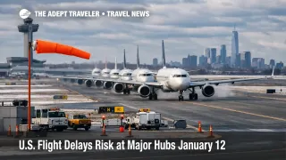
U.S. Flight Delays Risk at Major Hubs January 12
High winds are the main operational risk for U.S. air travel on Monday, January 12, 2026, with the Federal Aviation Administration warning that wind could slow traffic at several Northeast and Mid Atlantic hubs. Passengers flying through General Edward Lawrence Logan International Airport (BOS), Newark Liberty International Airport (EWR), John F. Kennedy International Airport (JFK), LaGuardia Airport (LGA), Philadelphia International Airport (PHL), Baltimore Washington International Thurgood Marshall Airport (BWI), Ronald Reagan Washington National Airport (DCA), and Washington Dulles International Airport (IAD) are the most exposed to knock on delays. Travelers should protect tight connections, check for airline waivers, and consider proactive same day changes if afternoon programs appear.
The change for travelers is simple: U.S. flight delays January 12 risk rises because wind can reduce safe arrival rates at the busiest Northeast banks, and the FAA is signaling that traffic management initiatives may be needed.
The FAA Daily Air Traffic Report specifically calls out high winds as a potential delay driver for Boston, the New York area airports, Philadelphia, and Washington, D.C. area airports. In the FAA Command Center's Current Operations Plan Advisory, wind is listed as a terminal constraint for BOS, New York TRACON, Philadelphia, and DCA, with planners also flagging that a ground stop or delay program is possible at LaGuardia after 1800Z [about 100 p.m. Eastern] and at Newark after 2000Z [about 300 p.m. Eastern]. As of the FAA's airport status dashboards early Monday, the major airports listed above showed on time conditions, which is common before wind programs ramp up later in the day as demand peaks.
Who Is Affected
The most directly affected travelers are those departing from, arriving into, or connecting through the Northeast corridor hubs, especially on itineraries that rely on short connection windows into the afternoon and evening banks. Even if a traveler is not flying to Boston, New York, Philadelphia, or Washington, flights that touch those airports can pull delay into other cities because aircraft and crews are scheduled to keep moving across multiple legs, and a late inbound often becomes a late outbound somewhere else.
Travelers on multi segment domestic trips are particularly exposed because a wind slowed first leg can erase the buffer needed for the second leg, and reaccommodation options may shrink quickly if several airports in the same region start managing demand at the same time. International travelers are also at risk when domestic feeders into transatlantic departures arrive late, because missed connections can push rebooking into the next available bank, sometimes the next day, depending on load factors.
There is also a second layer of disruption that shows up off the aircraft. When arrival banks compress, rideshare pickup lines, hotel shuttles, and curbside traffic can slow, and that can matter for travelers stacking airport to rail, airport to cruise transfer, or airport to event schedules on the same day.
What Travelers Should Do
Start with defensive scheduling. If you have a connection through the Northeast and Mid Atlantic hubs, add buffer wherever you still can, and aim to arrive at the first airport earlier than usual because wind days often turn into rolling gate and taxi delays once departure queues build. If your itinerary includes an airport change, a commuter rail transfer, or a time sensitive onward booking, treat the afternoon as the high risk window and plan an alternate path.
Rebooking versus waiting should hinge on two thresholds, time of day and connection tightness. If you are on an early departure and your hub remains on time, waiting may be rational because the system still has daylight to recover and airlines still have more flexibility with gates and spare aircraft. If you are scheduled late afternoon or evening through New York or Washington area airports, or your connection is under about 60 to 90 minutes, proactive changes usually win once the FAA starts hinting at ground stops or delay programs because the day has less slack, and missed connections pile up quickly.
Over the next 24 to 72 hours, monitor three signals. First, watch the FAA airport status pages and your airline app for a shift from on time to formal delay programs. Second, watch your inbound aircraft, because a late inbound is often the earliest warning that your flight will not depart on schedule. Third, look for waivers and expanded same day change options, and move early if they appear, because inventory on alternate routings can tighten fast when multiple hubs in one region slow at once.
How It Works
When wind or other conditions reduce the safe arrival rate at a busy airport, the FAA Air Traffic Control System Command Center can manage demand by holding flights on the ground at their origin rather than letting aircraft stack in airborne holding. For travelers, that often shows up as gate holds, longer taxi times, and delayed pushback, even if skies look acceptable at the departure airport, because the constraint is at the destination or along the flow.
This is why a wind driven slowdown at New York area airports can ripple outward. The first order effect is local, fewer arrivals and departures per hour at the constrained airport. The second order effect hits airline networks, aircraft that arrive late miss their next scheduled leg, crews run into duty time limits, and gates stay occupied longer, which blocks arriving aircraft and stretches turnaround times. Those ripples can extend beyond aviation into hotel demand near hubs and delayed ground transfers for passengers who miss late day arrivals and need an unplanned overnight.
Travelers looking for broader context on why small capacity cuts can still cascade nationwide can reference U.S. Air Traffic Control Privatization: Reality Check. For a recent example of how FAA operational items like construction and reduced surface flexibility can add resilience stress even when weather is manageable, see FAA Runway Closures at US Airports Raise Delay Risk. For continuity with the current daily series framing and how to set rebooking thresholds by bank timing, see U.S. Flight Delays Risk at Major Hubs January 9.