US Winter Storm Flights, Delays Likely Jan 24 to 28
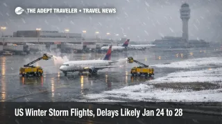
A significant winter storm is forecast to bring a mix of snow, sleet, and freezing rain into parts of the South and the Eastern Seaboard over the weekend, then keep travel conditions unstable into early next week. Travelers are most affected when their plans rely on morning airport access, tight connection windows, or long highway transfers in areas that do not routinely handle ice. The practical move is to protect time, shift travel dates if you can, and avoid itineraries that fail if one flight, or one road segment, slips by a few hours.
The US winter storm flights setup matters because it combines precipitation impacts with a widening cold snap that can slow recovery after the worst weather passes, which is when many travelers assume the system will quickly reset. NOAA forecasters also flag that hazardous cold is expected to persist across much of the central and eastern United States, with additional winter weather risk possible along the East Coast later in the period.
Forecasters highlight a corridor of heavy snow north of the primary icing zone, with freezing rain more likely farther south where even light glaze can shut down airports and interstates. In NOAA's medium range discussion, confidence has increased in widespread and significant impacts, including the potential for heavy snow reaching major Northeast metros, while freezing rain continues to pose a shutdown risk across the Lower Mississippi Valley, the Southeast, and into parts of the southern Mid Atlantic.
Who Is Affected
Travelers flying through major hubs that feed the national network are exposed first, even if their origin or destination looks clear. Hartsfield Jackson Atlanta International Airport (ATL), Charlotte Douglas International Airport (CLT), and Dallas Fort Worth International Airport (DFW) matter in this pattern because southern ice risk can slow turn times, reduce arrival acceptance rates, and force airlines to cancel banks to keep crews and aircraft legal. Once that happens, disruptions propagate into other hubs, including Chicago O Hare International Airport (ORD), Denver International Airport (DEN), and the New York City area airports, because aircraft and crews do not arrive where the next schedule assumes they will be.
Travelers in the Mid Atlantic and Northeast corridor face a different failure mode, heavy snow and wind that can compress arrival rates and trigger traffic management initiatives that delay departures from far away origins. When the Northeast is constrained, the ripple is national because flights are held at departure airports to prevent airborne holding near destinations. That dynamic can affect John F Kennedy International Airport (JFK), LaGuardia Airport (LGA), Newark Liberty International Airport (EWR), and Philadelphia International Airport (PHL), while the Washington area can be affected through Washington Dulles International Airport (IAD), Baltimore Washington International Thurgood Marshall Airport (BWI), and Ronald Reagan Washington National Airport (DCA).
Road travelers are at highest risk where freezing rain overlaps with bridges, overpasses, and untreated secondary roads. Ice zones also amplify the risk of missed flights and missed cruise, or tour handoffs, because airport access becomes the constraint even when the runway itself is still open. Rail travelers can see delays or cancellations where frozen switches and safety restrictions slow service, which then pushes more stranded demand into last minute hotel inventory near airports and downtown stations.
What Travelers Should Do
Act like you are protecting time, not just a seat. If you can move your trip, leaving Friday, January 23, or traveling after Monday, January 26, usually reduces exposure to the peak icing and the first recovery wave. If you must travel during the weekend window, pad airport arrival time, plan for slower curbside and security flow, and assume rideshare and rental car availability can tighten quickly when highways degrade.
Use a clear decision threshold for rebooking versus waiting. If your route, or your connection hub, is in a freezing rain zone within 24 to 36 hours of departure, proactive rebooking is often safer than waiting for day of irregular operations, when flights sell out and phone lines spike. If you are on separate tickets, or you have a cruise embarkation, a wedding, or a nonrefundable tour pickup, the threshold should be stricter, avoid the tightest connection, or shift to a routing that stays out of the icing corridor.
Monitor the next 24 to 72 hours with the same sources airlines and dispatchers watch. Track National Weather Service winter alerts for your specific counties, then watch FAA airport status and National Airspace System updates for ground delay programs, ground stops, and sustained arrival delays. Pay attention to the cold snap behind the storm, not only snowfall totals, because extreme cold can slow deicing, stress equipment, and extend recovery timelines even after precipitation ends.
Background
Winter storms disrupt travel through capacity loss at the surface and through network fragility after the first cancellations. At the source, snow and ice slow aircraft turns because deicing adds minutes per departure, runway braking action can reduce allowable arrival rates, and low visibility can require wider spacing on approaches. In southern airports, freezing rain is the bigger operational threat because equipment and staffing are often sized for occasional events, not prolonged ice, so a relatively small amount of glaze can force ramp closures and cascade into cancellations.
The second order effects tend to be what travelers actually feel. When a hub cancels a bank, aircraft are left out of position for later segments, and crews time out under duty limits, which means the next day starts short staffed and short on aircraft. That can create a multi day hangover where even travelers outside the storm footprint see delays, because the network is reshuffling scarce planes and crews to protect core routes. On the ground, highway closures and slowdowns block airport access and rental car returns, while rail reductions push more demand into buses, rideshares, and hotels, tightening local availability and pricing.
NOAA's hazard outlooks also emphasize that hazardous cold is expected to expand and persist across much of the central and eastern United States into early February, with the most anomalous cold shifting into parts of the Ohio Valley, the Mid Atlantic, and the Southeast later in the window. For travelers, that means the storm is not only a weekend problem. It can be a scheduling problem that stretches into next week because cold slows recovery, and because additional winter weather risk remains possible along the East Coast as the pattern stays active.
Sources
- WPC's Extended Forecast Discussion
- Day 3-7 U.S. Hazards Outlook
- Key Messages for Late January Extreme Cold
- U.S. Week-2 Hazards Outlook
- Winter Weather Resources
- Winter Weather Warnings, Watches and Advisories
- Weekend Winter Storm Threat Builds Across US South and East
- Flight Delays at US Airports, January 21, 2026