Flight Delays and Airport Impacts: January 23, 2026
Wind and low clouds are the core drivers shaping U.S. air traffic today, with the FAA calling out the Northeast corridor plus several major hub regions. Travelers are most affected if they connect through Boston Logan International Airport (BOS), the New York City area airports, Philadelphia International Airport (PHL), Hartsfield Jackson Atlanta International Airport (ATL), or the Texas and West Coast gateways that feed long domestic rotations. The smart move is to treat midday "normal" conditions as a snapshot, check airport status again before heading to the airport, and set a rebooking threshold before the late day risk windows.
The FAA's daily outlook is essentially a warning label for how US airport flight delays January 23, 2026, can emerge fast when hub arrival rates drop and the system starts metering flights on the ground.
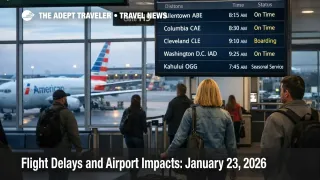
As of the late morning and midday UTC updates, many major airports were still reporting general departure and arrival delays at 15 minutes or less, including Chicago O'Hare International Airport (ORD), Philadelphia International, Seattle Tacoma International Airport (SEA), and Dallas Fort Worth International (DFW). That is encouraging, but it does not cancel the FAA's planning posture, which explicitly keeps several tactical initiatives "possible" later in the day if winds, ceilings, or snow showers degrade.
The operations plan sets out the risk map. Wind is the named constraint for Boston, the New York terminal airspace complex, and Philadelphia. Low ceilings are flagged across a wide arc that includes Atlanta, San Francisco International Airport (SFO), Seattle Tacoma, ski country airports, and several Texas markets. Snow showers are also listed as a possible constraint around Detroit Metropolitan Wayne County Airport (DTW), Chicago O'Hare, and Chicago Midway International Airport (MDW). Even light winter precipitation matters at these nodes because it slows turn times and can force more conservative spacing on approaches, which is how a modest weather day becomes a connection problem.
The plan also highlights something travelers rarely account for, reduced recovery slack from airfield work. Orlando International Airport (MCO) is listed with a runway closure into January 24, and Chicago O'Hare is listed with ramp and taxiway impacts tied to a United ramp reconfiguration. When the system is already metering arrivals for wind or ceilings, less runway or taxi flexibility can make gate holds and missed connections show up sooner.
Who Is Affected
If you are connecting through the Northeast corridor, you are exposed even if your origin and destination look clear. Winds in the Boston, New York, and Philadelphia corridor are a classic trigger for traffic management initiatives because runway configuration efficiency drops, and arrival rates get capped. When that happens, flights are often held at their departure airports to keep airborne holding from stacking up near the destination, and that is why travelers in other regions suddenly see delays that do not match their local weather.
Tight connectors are the first group that gets punished. If your itinerary depends on a sub 90 minute connection at John F. Kennedy International Airport (JFK), LaGuardia Airport (LGA), Newark Liberty International Airport (EWR), Dallas Fort Worth, or Chicago O'Hare, you are betting that inbound arrival rates stay stable and that gates, crews, and ramp staffing stay synchronized. On a day where the FAA is openly planning for possible initiatives later, that bet is weaker than the airport status pages make it feel in the morning.
The second group at risk is anyone with a hard arrival deadline, cruise embarkation, wedding, resort check in window, or prepaid pickup that cannot slide. Late day ground stop or delay programs tend to create the worst rebooking competition because they hit peak banks and compress the remaining schedule. If a hub starts canceling flights to protect tomorrow's operation, the overnight hotel and alternate routing scramble begins fast.
Finally, ski country travelers should assume outsized fragility even when the big hubs look manageable. The FAA plan includes ski country volume and lists Aspen Pitkin County Airport (ASE) as a possible ground stop or delay program into the late day UTC window. The failure mode here is simple, ceilings drop, alternates get tight, and you lose the ability to "make it work" with minor tweaks, which pushes travelers into long road transfers and last minute lodging.
What Travelers Should Do
Act as if the late day risk windows are real, because the FAA plan is telling you the system may need tactical controls if winds or ceilings do not cooperate. If you are flying after midday local time through the New York area, Dallas hubs, San Francisco, or San Diego, check airport status again before you leave for the airport, then again before you commit to a long drive, parking, or a nonrefundable curbside transfer. A calm morning does not protect an afternoon bank.
Use a decision threshold for rebooking versus waiting. If your first flight is delayed enough that your connection drops under 60 minutes at a hub, or if you would land inside a forecast initiative window for that hub, rebook early rather than hoping the schedule snaps back. On days like this, the time cost is not the delay itself, it is getting trapped behind a rolling ground delay program where seats on later flights disappear while you are still walking to the gate.
Monitor the next 24 to 72 hours with the same lens airlines use, network position and recovery slack. Today's plan includes ongoing runway and taxiway constraints at several airports, and those can keep the system brittle into tomorrow if weather triggers even a short metering program. If your trip matters this weekend, pair this daily report with the forward looking storm setup in US Winter Storm Flights, Delays Likely Jan 24 to 28, and use yesterday's pattern as a reference point in Flight Delays and Airport Impacts: January 22, 2026.
How It Works
The FAA's daily outlook starts with a capacity problem at the source. Strong wind can force less efficient runway configurations, and low ceilings push more arrivals onto instrument approaches with wider spacing. Either way, an airport that can normally accept a high arrival rate per hour gets capped, and once a hub is capped, the network must meter inbound flows to keep airborne holding safe and manageable.
That metering is what travelers experience as gate holds, longer taxi out, missed connections, and late inbound aircraft that arrive after the next flight has already boarded. The first order effect is local, slower arrivals and departures at the constrained airport. The second order effect is national, because flights to that hub are delayed at their departure points, which ties up aircraft and crews that are supposed to operate later segments elsewhere.
On top of weather, construction and airfield constraints reduce resilience. If a runway is closed, a taxiway is constrained, or a ramp is reconfigured, the airport has fewer ways to absorb disruption and recover quickly once the weather improves. That is why a day that looks "mostly fine" on airport status pages at midday can still end with widespread evening misconnects if the late day initiatives activate.
If you want a deeper structural view of why these shocks repeat and why bottlenecks matter more than any single storm, the context in U.S. Air Traffic Control Privatization: Reality Check is the right evergreen explainer to pair with this daily operational scan.
Sources
- FAA Daily Air Traffic Report
- Current Operations Plan Advisory
- ATCSCC Flight Delay Information
- Chicago O'Hare International Airport (ORD) Real-time Status
- Dallas/Ft Worth International (DFW) Real-time Status
- Philadelphia International Airport (PHL) Real-time Status
- Seattle-Tacoma International Airport (SEA) Real-time Status