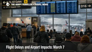
Flight Delays and Airport Impacts: March 7
Flight delays and airport impacts March 7 are shaping up as a split system day, not a coast to coast shutdown. The Federal Aviation Administration said low clouds and visibility may slow flights in Boston, the New York metro airports, Philadelphia, the Washington area, Indianapolis, Detroit, and Chicago, while thunderstorms could affect Tampa and Louisville and rain and snow showers could complicate Salt Lake City. The bigger real time shift is in Texas, where Dallas Fort Worth International Airport (DFW) is already under a traffic management program for thunderstorms, with arriving flights delayed an average of 1 hour and 11 minutes and departing traffic facing gate hold and taxi delays of just over an hour. For travelers, that means March 7 is more dangerous for connections and late day recovery than for early nonstop flying.
The key change from Flight Delays and Airport Impacts: March 6 is that some of the airports the FAA flagged this morning are still moving with only minor general delays, while the strongest confirmed disruption has shifted into an active thunderstorm program at DFW. At the same time, the FAA operations plan still warns that Newark Liberty International Airport (EWR), General Edward Lawrence Logan International Airport (BOS), Ronald Reagan Washington National Airport (DCA), Detroit Metropolitan Wayne County Airport (DTW), Houston area airports, and DFW or Dallas Love Field (DAL) could face additional programs later in the day, so this remains a rolling risk story rather than a single hub problem.
Flight Delays and Airport Impacts March 7: What Changed
The FAA's March 7 daily report paints a familiar weather pattern, low ceilings in the Northeast and Midwest, plus convective risk in parts of the South, but the live status picture makes the national story more specific. DFW is the clearest active choke point right now, with an FAA traffic management program tied to thunderstorms. That matters because DFW is a major connecting hub, so even a one hour delay there can knock later aircraft, crews, and passenger banks out of sequence across multiple airlines.
Elsewhere, the broad warning zone has not yet hardened into severe airport specific delays at several major eastern hubs. As of the latest FAA status updates, Boston Logan, Chicago O'Hare International Airport (ORD), Newark, Reagan National, and Detroit were each showing general gate hold or taxi delays of 15 minutes or less, which is better than the early forecast alone might have implied. That does not mean the risk is gone. It means the network is still in the stage where a few airports are absorbing the damage while others remain vulnerable if weather, demand, or late inbound aircraft stack up through the afternoon and evening.
Which Travelers Face the Most Disruption
The most exposed traveler on March 7 is not necessarily the person departing from the worst weather. It is the person relying on a short connection through a hub that is already being metered, especially DFW, or through airports the FAA still lists as possible later program candidates. That includes travelers connecting into the Northeast corridor, Washington, Dallas, or Houston late in the day, plus anyone chasing the last practical departure to a smaller city.
There is also a second risk lane building outside the headline weather cities. Miami International Airport (MIA) was reporting departure delays of 16 to 30 minutes because of compacted demand, even without a destination specific delay program. In plain language, that is what happens when too many flights and passengers pile into the same operational window. On a day when other hubs are already less flexible, compacted demand matters because it reduces the system's ability to absorb reaccommodated passengers and late running aircraft.
Travelers with the least exposure are those on early nonstop flights, those with longer connection windows, and those who still have multiple later departures on the same route. Travelers with the highest exposure are those headed to cruises, tours, weddings, same day meetings, or last bank regional connections where even a 45 minute slip can turn into an overnight problem. For structural context on why these disruptions spread so fast through U.S. aviation, U.S. Air Traffic Control Privatization: Reality Check is still useful background.
What Travelers Should Do Now
For March 7 travel, the smartest move is to protect margin, not the prettiest itinerary. If you are still choosing between flight options, favor the earlier departure and the longer connection, especially for any itinerary touching DFW, the New York area, Washington, Boston, or Houston later today. If your current itinerary depends on a sub 90 minute connection at a major hub, rebooking sooner is often safer than waiting for the board to turn red.
If your airport still looks mostly normal, do not stop at checking your own departure status. Check your inbound aircraft, because many March 7 disruptions will hit as late equipment and late crews rather than early cancellations. Also watch whether an airport moves from "possible" FAA action into an active ground stop or ground delay program, because that is the point where reaccommodation windows usually tighten fast.
For broader same week context, Flight Delays and Airport Impacts: March 5 and DC Ground Stop Risk at Reagan National After 1 p.m. show how these FAA planning flags often develop before passengers feel the full effect. The main decision point over the next 24 hours is simple, if your trip purpose cannot tolerate a missed connection or a late arrival, buy time now, because tonight's recovery may be thinner than this morning's airport boards suggest.
Why the Disruption Spreads Through Travel
The mechanism on March 7 is throughput reduction in more than one form. In the Northeast and Midwest, low clouds and visibility can reduce arrival rates because aircraft need more spacing and controllers have less room to compress traffic safely. In Texas, thunderstorms create a different problem, they force reroutes, flow controls, and destination specific arrival delays. Both failures lead to the same traveler outcome, less schedule precision at the hub.
Once a hub loses timing, the first order effect is visible delay. The second order effect is what actually ruins trips, late inbound aircraft, missed onward connections, smaller rebooking menus, bags separated from passengers, and more pressure on hotels and rental cars when recovery slips into the evening. That is why March 7 looks manageable at some airports right now while still being a real national reliability problem. The FAA's morning map shows where the system may bend, and DFW's active thunderstorm program shows what happens when one of those risk zones becomes real.
Sources
- FAA Daily Air Traffic Report, March 7, 2026
- FAA Current Operations Plan Advisory, ATCSCC ADVZY 068 DCC 03/07/2026
- Dallas/Fort Worth International Airport (DFW) Real-time Status, FAA
- General Edward Lawrence Logan International Airport (BOS) Real-time Status, FAA
- Chicago O'Hare International Airport (ORD) Real-time Status, FAA
- Newark Liberty International Airport (EWR) Real-time Status, FAA
- Ronald Reagan Washington National Airport (DCA) Real-time Status, FAA
- Detroit Metropolitan Wayne County Airport (DTW) Real-time Status, FAA
- Miami International Airport (MIA) Real-time Status, FAA