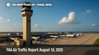
FAA Air Traffic Report: August 16, 2025
Thunderstorms across the Upper Midwest, Florida, Texas, and the Central Plains lead today's FAA outlook, with a morning ground stop at Minneapolis-Saint Paul International Airport (MSP) and intermittent holding. Oceanic route closures around Hurricane Erin continue to shape East Coast and Caribbean traffic flows. Winds may complicate operations at select Western and Northeast hubs, while low ceilings linger along parts of the West Coast and Mid-Atlantic. Travelers should expect airport delays at peak banks, especially where convective weather overlaps with staffing constraints or runway work. Always verify status with your airline before heading to the airport.
Key Points
- Why it matters: Thunderstorms, staffing triggers, and construction combine to create airport delays at multiple hubs.
- Travel impact: MSP ground stop early, plus potential GDPs or ground stops at SFO, Florida hubs, Chicago, and Houston.
- What's next: Afternoon risk window expands, with additional routes and swap initiatives possible as storms redevelop.
- Oceanic routes: Caribbean and western Atlantic closures continue around Hurricane Erin, affecting long-haul routings.
- Equipment: Runway and taxiway projects persist at several hubs, adding buffers to taxi and arrival times.
Snapshot
As of the late-morning Command Center update on August 16, 2025, the ATCSCC operations plan shows thunderstorms driving most constraints. A morning ground stop at Minneapolis-Saint Paul International Airport (MSP) set the tone, with single-runway arrival rates possible after storms pass. The plan also highlights winds at Philadelphia International Airport (PHL), Harry Reid International Airport (LAS), and Los Angeles International Airport (LAX), plus low ceilings at John F. Kennedy International Airport (JFK), LaGuardia Airport (LGA), Newark Liberty International Airport (EWR), Ronald Reagan Washington National Airport (DCA), Seattle-Tacoma International Airport (SEA), and San Francisco International Airport (SFO). Caribbean and western Atlantic oceanic routes are closed due to Hurricane Erin, which is nudging transatlantic and island operations onto alternates. Expect rolling airport delays where weather, staffing, and construction overlap.
Background
The FAA daily air traffic report synthesizes the Command Center's national plan for the day, describing where weather, staffing, or equipment limits capacity. The ATCSCC operations plan is updated frequently, and it outlines real-time and potential initiatives such as ground stops, ground delay programs, miles-in-trail, and preferred reroutes. Today's plan cites thunderstorms across multiple Air Route Traffic Control Centers, including New York, Washington, Jacksonville, Miami, Atlanta, Houston, Chicago, Minneapolis, Denver, Albuquerque, and Salt Lake City. Route closures include key western Atlantic and Caribbean tracks, with Lake Erie West published to assist NAV CANADA capacity reductions. Runway and taxiway projects at hubs like Palm Beach International Airport (PBI), LaGuardia Airport (LGA), Chicago O'Hare International Airport (ORD), Indianapolis International Airport (IND), and George Bush Intercontinental Airport (IAH) add predictable friction. For recent pattern context, see FAA Air Traffic Report: August 15, 2025.
Latest Developments
MSP ground stop, Hurricane Erin oceanic impacts
A morning ground stop at Minneapolis-Saint Paul International Airport (MSP) was issued for thunderstorms, paired with a holding advisory. Depending on post-storm winds, MSP may operate a single-runway 28 arrival rate. In oceanic airspace, San Juan Center has closed multiple routes, including L459, L461, and L462, due to Hurricane Erin's footprint, with additional closures on M525 and M597. New York Center closed L453 and L455 for thunderstorms. To help manage Canadian capacity, a Lake Erie West partial route is active, steering traffic around weather and sector constraints. Staffing triggers in the Philadelphia area add miles-in-trail this morning, which can ripple into Northeast flows. The ATCSCC operations plan lists no Airspace Flow Programs at this time, but changing convective trends could prompt additional initiatives as the day evolves.
Later-day risk at SFO, Florida, Mid-Atlantic, Chicago, and Houston
Potential ground stops or ground delay programs are on the board later for San Francisco International Airport (SFO), Orlando International Airport (MCO), Tampa International Airport (TPA), Ronald Reagan Washington National Airport (DCA), Detroit Metropolitan Wayne County Airport (DTW), Chicago O'Hare International Airport (ORD), Chicago Midway International Airport (MDW), George Bush Intercontinental Airport (IAH), William P. Hobby Airport (HOU), Hartsfield-Jackson Atlanta International Airport (ATL), Denver International Airport (DEN), and Phoenix Sky Harbor International Airport (PHX). Terminal constraints cited include thunderstorms at ATL, MCO, TPA, MSP, Chicago TRACONs, AUS, SAT, DEN, and IND, winds at PHL, LAS, and LAX, and low ceilings at the New York metro, DCA, SEA, and SFO. With storms expected to redevelop during peak connection banks, travelers should anticipate airport delays and plan for longer connection buffers at the listed hubs. Monitor airline alerts for gate holds and reroutes.
Analysis
Today's setup features a classic summer pattern, with storm lines marching across the Upper Midwest and Gulf states while marine layers and winds complicate coastal hubs. The morning ATCSCC operations plan already forced a conservative start at MSP, and the afternoon slate raises the probability of programs at SFO, Florida hubs, Chicago, and Houston. When a metro area has overlapping constraints, small schedule shocks can cascade into network-wide airport delays. Expect the biggest swings when convective cells fire during bank times, when runway projects reduce flexibility, or when staffing triggers add separation requirements.
Oceanic closures around Hurricane Erin matter for travelers on transatlantic and Caribbean routes. Even if your flight remains scheduled, a lost track can lengthen great-circle distances, push crews against duty windows, or force fuel-burn tradeoffs. That often appears as departure holds, off-route vectors, or missed connections downline. If you have tight connections through Northeast hubs later today, consider same-carrier rebooking to a longer minimum-connect or an earlier departure if seats are open.
Finally, remember that terminal projects are predictable drags on capacity. Check NOTAM-driven runway closures at PBI, HOU, LGA, ORD, IND, IAH, and SAN before selecting tight layovers. Travelers bound for Spain should also watch handling actions that could slow turnarounds and baggage at Ryanair bases, which can add latency to U.S.-Europe itineraries; see Ryanair strike Spain starts, peak delays likely. Build a 2-hour domestic and 3-hour international buffer whenever feasible.
Final Thoughts
Convective weather, staffing triggers, and runway work define the U.S. airspace picture today. The morning MSP ground stop and the prospect of afternoon programs at SFO, Florida hubs, Chicago, and Houston suggest longer taxi-out queues, off-route vectors, and tighter bank recoveries. Oceanic closures around Hurricane Erin will continue to ripple into transatlantic and island flying. If your itinerary threads these hotspots, monitor airline notifications, pad connections, and consider earlier departures where possible. We will keep tracking initiatives as the FAA daily air traffic report and Command Center advisories update.