Flight delays and airport impacts: October 14, 2025
Flight delays are easing in parts of the Northeast and Bay Area after a turbulent start to the day. The FAA's midday plan kept Boston Logan International Airport (BOS) and San Francisco International Airport (SFO) under ground delay programs, with potential ground stops flagged later for Newark, LaGuardia, Reagan National, and Denver as storms, low clouds, and a New York radio-frequency outage complicated traffic management. A required reroute to John F. Kennedy International Airport (JFK) remained in effect for several southern and central U.S. departures.
Key points
- Why it matters: Weather and equipment constraints are still creating pockets of flight delays.
- Travel impact: Expect rolling holds in the New York, Boston, and San Francisco metros through the afternoon.
- What's next: Potential ground stops at Newark, LaGuardia, Reagan National, and Denver in peak push periods.
- SFO and BOS faced morning GDPs for low ceilings and runway work.
- A ZNY equipment issue triggered required routes into JFK from several regions.
Snapshot
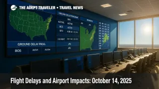
The FAA's 1:47 p.m. EDT operations plan cited BOS and SFO under active ground delay programs, with thunderstorms and low ceilings affecting multiple centers. New York TRACON conditions improved compared with the weekend system, yet a ZNY frequency problem persisted, leading to structured routes toward JFK for traffic from Nashville, New Orleans, Houston-area fields, and parts of the Mid-South. The plan also highlighted possible arrival routing at Phoenix, Dallas Fort Worth, and Dallas Love Field later in the day. Oceanic routes L453 and L455 were shut due to storms, pushing transatlantic flows onto alternates. Travelers should build buffer time, especially on connections touching New York, Boston, or the Bay Area.
Background
Low ceilings and lingering coastal weather have kept arrival rates suppressed at Boston Logan, extending delays alongside ongoing runway construction. On the West Coast, bands of rain and embedded thunderstorms reduced SFO's acceptance rate, a common trigger for GDPs when ceiling and visibility remain below thresholds. The FAA noted broader convective risks across the Rockies and Southern California in national outlooks, with heavy precipitation in mountain regions and snow in higher Sierra and Northern Rockies zones. These patterns can ripple into national programs through reduced en-route capacity and reroutes. For context on yesterday's ripple effects and continuing shutdown-era staffing pressures, see our coverage of Flight delays and airport impacts: October 13, 2025 and Government shutdown travel impacts.
Latest developments
Ground delay programs at Boston and San Francisco, with New York reroutes
The FAA listed terminal constraints of wind, low ceilings, and rain for Boston Logan and the New York metro, and rain, thunderstorms, and low ceilings for SFO. As of early afternoon, a BOS GDP ran "until 1059 p.m. EDT," tied partly to runway work, while SFO's GDP was posted "until 359 p.m. PDT," subject to updates as ceilings lift. En-route constraints included thunderstorms across ZNY, ZDC, ZAB, ZDV, and ZOA. A required route to JFK covered departures from Nashville International Airport (BNA), Louis Armstrong New Orleans International Airport (MSY), and selected flows from the Houston and Memphis Centers, reflecting a ZNY radio-frequency outage mitigation. Oceanic routes L453 and L455 were closed for thunderstorms, with an update set by 12:00 p.m. EDT. Travelers with transatlantic connections via the New York area should watch for off-track routings and longer times in trail. For an evening operations recap pattern similar to tonight's setup, review our Northeast and West FAA programs roundup.
Analysis
Today's picture is classic shoulder-season complexity. Two major coastal hubs, Boston and San Francisco, were simultaneously constrained by low ceilings, which immediately compresses arrival banks and turns minor in-trail spacing into full GDPs. Boston's extended runway and taxiway work keeps acceptance rates conservative even when clouds lift, so a slower return to normal is expected. In the New York area, the improvement from the weekend nor'easter is tempered by a ZNY frequency issue, which is why the FAA leaned on required routes into JFK from parts of the Southeast, Gulf Coast, and Mid-South. Those routes add miles and sequencing overhead, which can spill into LaGuardia and Newark if meter fixes saturate. Downstream, Denver is flagged for potential ground stops or a GDP late day if frontal storms and mountain wave activity nibble at arrival rates around the peak push. Phoenix and Dallas may see structured arrival routes this evening, a typical preemptive tool when convection or volume threatens merge points. The net effect for travelers is uneven: many flights operate on time, but if your itinerary touches BOS, SFO, or the New York complex, plan for holds, rolling gate changes, and occasional diversions as traffic management initiatives flex with the weather.
Final thoughts
Build an extra hour of buffer today if your plans include Boston Logan, San Francisco, or any New York-area connection. Monitor your airline app for reroute notices into JFK if starting from Nashville, New Orleans, or Houston-sector airports. If a ground stop pops at Newark, LaGuardia, or Reagan National during the evening push, rebooking into a later bank can prevent a missed connection. Staying proactive remains the best defense during variable flight delays.