Bahamas, Turks and Caicos, Bermuda: Melissa Outlook
Hurricane Melissa is exiting eastern Cuba and setting up its next impacts across the Southeastern and Central Bahamas on Wednesday, with Turks and Caicos under Tropical Storm Warnings and Bermuda under a Hurricane Watch. The National Hurricane Center's latest advisory keeps Hurricane Warnings posted for the Southeastern and Central Bahamas and a Hurricane Watch for Bermuda, while Turks and Caicos remains under a Tropical Storm Warning. Travelers should expect deteriorating conditions to spread from the far southeast Bahamas northwestward through Wednesday night, with airline waivers in effect and cruise lines already flexing itineraries.
Forecast track and timing, island groups first in line
As of Wednesday morning, Melissa continues to move away from eastern Cuba and toward the Bahamas. NHC highlights Hurricane Warnings for the Southeastern and Central Bahamas, including Exuma and its Cays, Ragged Island, Rum Cay, Long Island, San Salvador, Cat Island, Acklins, Crooked Island, Long Cay, Mayaguana, and Inagua. Turks and Caicos carries a Tropical Storm Warning. Bermuda is under a Hurricane Watch as conditions are expected to deteriorate late Thursday into Friday local time.
Bahamas authorities and U.S. Embassy Nassau echo this timeline, urging heightened readiness across the Central and Southeast Bahamas and Turks and Caicos. Expect the strongest winds, surge, and squalls earliest across the far southeast, then the central islands by late day into tonight, with Nassau and the northwest Bahamas more likely to see schedule thinning, gusts, and heavy rain rather than prolonged hurricane conditions.
For Bermuda, the Bermuda Weather Service and local media indicate a rapid deterioration late Thursday into Friday as Melissa passes to the near west, with hazardous surf and likely flight impacts if crosswinds exceed limits. Keep an eye on airline rebooking notices starting today.
Airport and cruise-port operational envelopes
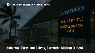
Airports across the far southeast Bahamas, including Inagua and Mayaguana, are typically first to pause operations under hurricane conditions, followed by central out-island fields such as San Salvador and Long Island; closures and curfews can be announced on short notice by the Bahamas Airport Authority. Nassau's Lynden Pindling International Airport may remain open with reduced schedules if winds stay below critical thresholds, but expect knock-on delays and cancellations as airlines consolidate flying.
Cruise lines have already begun shifting calls. Royal Caribbean and Celebrity ships have swapped Eastern Caribbean stops for Western alternatives and adjusted Bahamas timing windows around sea states. These changes often include same-day swaps to Cozumel or Roatán, and automatic refunds of pre-paid shore excursions when calls are canceled.
Private-island sensitivity depends on infrastructure. Tender-only destinations such as Half Moon Cay and Great Stirrup Cay are usually the first to cancel when swells rise, because safe tendering becomes impossible. Pier-equipped destinations, including Perfect Day at CocoCay and Ocean Cay MSC Marine Reserve, have better wind and swell tolerance but still close under strong winds or surge. Expect quick, app-based notifications the evening prior or morning of call.
Airline waivers and the 72-hour decision tree
American, Delta, United, JetBlue, and Southwest have been posting rolling flexibility for Melissa-affected itineraries. Delta's dedicated page lists affected cities that include Providenciales, with Jamaica already covered; American has a corporate update and SalesLink exception policy live. JetBlue and Southwest maintain active travel-alerts portals that update as watches escalate to warnings. These waivers typically allow one change to the same origin and destination within a defined window and fare-difference waivers when rebooking like-for-like cabins.
Should I move my trip? Wednesday through Friday travelers
If you are booked into Nassau or the out-islands Wednesday or Thursday, move to an earlier flight today if seats exist under a waiver, or push to the weekend when seas and winds subside. Out-island flyers should avoid last-flight-of-day arrivals given the risk of curfews or sudden closures. If you connect via Miami or Fort Lauderdale, pad connections to at least three hours in case of flow-control delays. Turks and Caicos travelers should anticipate tropical-storm-force crosswinds and intermittent ground stops during heavier squalls. For Bermuda, begin proactive moves now for late-Thursday or Friday arrivals, since a watch is active and a warning could be posted on short lead time.
Background: why tender ports cancel before pier ports
Tender calls rely on small boats ferrying passengers between ship and shore. Even when winds seem modest, a long-period swell in the lee of the islands can make tender approaches unsafe, prompting same-day cancellations. Piers eliminate the transfer step, but lines will still cancel or shorten calls when wind over the pier exceeds safe gangway limits or surge threatens moorings, which is common in the outer bands of a hurricane. Royal Caribbean's CocoCay, for example, uses a fixed pier, while Half Moon Cay and Great Stirrup Cay predominantly rely on tenders.
Final thoughts
For the next 24-72 hours, plan around a moving window: Southeastern and Central Bahamas first, Turks and Caicos under tropical-storm conditions, and an early signal for Bermuda by late Thursday into Friday. Use airline waivers while they are generous, and assume tender-only private-island calls are the most likely to be dropped. Keep monitoring the NHC advisory feed, Bahamas Met alerts, DDME Turks and Caicos updates, and your airline or cruise app for rapid changes.
Sources
- National Hurricane Center, watches and warnings for the Bahamas, Turks and Caicos, and Bermuda (Hurricane Watch)
- Bahamas Met and Government updates on warnings and readiness for Southeastern and Central Bahamas
- U.S. Embassy Nassau weather alert for the Bahamas and Turks and Caicos
- Bermuda Weather Service and Royal Gazette on Bermuda Hurricane Watch and timing
- Delta waiver page for Melissa, American update and SalesLink exception policy details
- Royal Caribbean and third-party updates on cruise itinerary changes and private-island operations