Winter Storms Threaten US Flights December 1 To 3
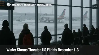
US winter storms flight delays are now baked into the first days of December for anyone connecting through Chicago, Detroit, Minneapolis, Cleveland, Boston, or New York, after a record setting Thanksgiving weekend snowstorm helped cancel more than 1,400 flights at Chicago airports and disrupt over 15,000 flights nationwide. A follow up system, named Winter Storm Chan by The Weather Channel, is lining up to bring fresh snow and ice from the Midwest into the Appalachians and interior Northeast from December 1 to 3, 2025, adding a second wave of risk for early week business and holiday travel. Travelers using the big hubs will need to treat tight connections as fragile, favor overnight buffers, and keep a close eye on weather waivers as the pattern evolves.
In practical terms, US winter storms flight delays will dominate early December schedules through the core Midwest and Northeast hubs, forcing many travelers to reschedule or reroute trips rather than rely on one hour domestic turns or same day transatlantic connections.
Where The First Storm Hit Hardest
The first storm, widely labeled Winter Storm Bellamy, slammed the Upper Midwest and Great Lakes across the Thanksgiving return window, dropping more than 8 inches of snow at Chicago and setting a new November daily record at Chicago O Hare International Airport (ORD), while parts of Iowa and Michigan saw more than a foot. By Saturday night, local tallies showed about 1,232 flights canceled at O Hare and 246 at Chicago Midway International Airport (MDW), with ground stops in place at both airports as heavy snow and crosswinds made runway conditions unsafe.
Nationwide, the storm and its knock on effects fueled at least 2,500 flight cancellations over the core return period and helped disrupt more than 15,000 flights when delays are included, as deicing queues, crew misplacements, and diversions rippled out to Detroit Metropolitan Wayne County Airport (DTW), Minneapolis Saint Paul International Airport (MSP), and busy East Coast hubs. On the ground, highway agencies reported hundreds of crashes on snow covered roads, and a Delta Air Lines jet skidded off the runway at Des Moines International Airport, closing the field overnight and underscoring how marginal conditions had become.
For travelers, the important point is that the system did not just cause one bad afternoon in Chicago. It reset where aircraft and crews are positioned across multiple airlines just as the next storm is forming.
What To Expect From Winter Storm Chan
Winter Storm Chan, the third significant winter event in about a week, will bring additional snow to the Plains and Midwest on Monday, December 1, then shift toward the Northeast and Appalachians through Tuesday night and into early Wednesday, December 2 to 3. Forecasts from The Weather Channel and other outlets point to general Midwest snow totals of 1 to 3 inches, with locally higher bands, enough to slick runways and access roads even where Bellamy already compacted snowbanks near gates and taxiways.
The bigger aviation risk sits in the interior Northeast and higher terrain along the Appalachians. Confidence is rising in a corridor of 6 inches or more of new snow from just north of New York City up the Hudson Valley into New England, with some models showing localized totals near 12 inches west of Boston and across parts of New Hampshire and Maine. Along the Interstate 95 corridor itself, including New York City and Boston, the storm will likely flip between wet snow and cold rain, which cuts totals but still forces deicing and can create slushy ramp conditions that slow ground operations.
For airport operations, that mix means a fresh round of ground delay programs and flow constraints through the Federal Aviation Administration, FAA, especially once the system reaches the dense Northeast airspace where many long haul flights connect.
Which Hubs Face The Highest Risk
Chicago O Hare remains the single most fragile node in the network for early December, because it has already absorbed record snowfall and more than a thousand cancellations, and it sits under lingering lake effect snow bands and cold temperatures that keep ramp surfaces marginal. Travelers connecting through O Hare on December 1 should expect residual delays from backlogged aircraft swaps, extended deicing, and staffing strain.
Chicago Midway will likely see shorter queues but still faces meaningful risk, especially on Southwest heavy domestic banks that depend on quick turns and where runway contamination can quickly ripple through short haul networks.
To the east, Detroit Metropolitan Wayne County Airport and Cleveland Hopkins International Airport (CLE) have already logged hundreds of delays and dozens of cancellations during Bellamy. With Chan adding another round of snow and gusty winds, both airports are likely to see periodic holding, ground stops, or extended departure queues, especially during the late morning and afternoon of December 1 and 2.
Minneapolis Saint Paul International Airport has been less headline grabbing, but FAA operations plans have already flagged snow as a driver of traffic management initiatives there, which means it is not a low risk alternative for very tight connections.
By Tuesday, December 2, attention shifts to Boston Logan International Airport (BOS) and the New York City area airports, John F Kennedy International Airport (JFK), LaGuardia Airport (LGA), and Newark Liberty International Airport (EWR). Forecasts call for 3 to 6 inches of snow in parts of eastern Massachusetts, with several inches possible in inland New England and the lower Hudson Valley, while the airports themselves may see lower totals but prolonged periods of mixed precipitation that require deicing and cut departure rates.
In practice, that means the peak risk window for those Northeast hubs runs from early Tuesday morning through late Tuesday night, with some lingering slush and suboptimal runway conditions into the Wednesday morning commute.
How Airlines Are Handling Waivers And Rebooking
Major US carriers have already rolled out weather waivers for Bellamy and the immediate early winter pattern, and those policies create the main lever travelers can use to rebuild their itineraries. American Airlines lists a Winter Storm Bellamy Midwest U S alert that covers tickets bought by November 25 or 27 for travel on November 29 and 30, allowing passengers to move trips into roughly November 26 through December 4 without change fees, as long as origin and destination remain the same and rebooking stays in the same cabin.
Delta Air Lines has issued a Midwestern Winter Weather exception bulletin for dozens of affected airports, including Chicago, Detroit, Minneapolis, and Des Moines, waiving change fees for impacted November 29 to 30 itineraries when rebooked and reissued by December 3 and permitting later travel under standard fare difference rules. United Airlines has a parallel Upper Midwest Winter Weather waiver that allows voluntary changes for travel November 29 to 30 through a long list of Midwest airports, again focusing on fee free changes rather than broad refunds.
Low cost carriers, including Southwest Airlines and Frontier Airlines, are steering customers to their travel advisory pages, where storm specific flexible change policies are posted when conditions warrant. Even when your particular route is not explicitly listed, agents often have some discretion during severe weather, which makes it important to check your reservation in the airline app and contact support before airport lines build.
Because the same aircraft and crews that were disrupted by Bellamy will still be rebalancing as Chan arrives, these early waivers effectively become tools for managing the broader early December pattern, not just a single weekend event.
How To Rebuild Your Itinerary
For travelers who have not yet flown, this is the moment to redesign any December 1 to 3 itinerary that treats Chicago, Detroit, Minneapolis, Cleveland, Boston, or New York as a simple one hour pass through point. Aim for three hour domestic and four hour international connections through snow belt hubs, and whenever possible, move to a single through ticket on one carrier rather than separate tickets that force you to self insure misconnects.
If you can shift routes entirely, favor hubs that are more likely to see cold rain and strong winds rather than heavy snow and freezing rain, such as Dallas Fort Worth, Houston, Atlanta, or Charlotte, while still recognizing that thunderstorms and low ceilings can slow those airports too. For East Coast trips inside the Northeast corridor, trains often offer a better bet than short haul flights when snow and ice threaten, because they are less sensitive to deicing queues and runway contamination, although they can still slow for frozen switches and signal problems.
If you are already midtrip and face a misconnect, prioritize getting to a major hub where hotels, alternative flights, and ground transport options are plentiful, even if that means a backtrack. In the US and Canada, asking to be protected on an earlier feeder into your hub, or even to start the trip a day earlier using a waiver, can reduce the risk of sleeping in an airport chair while the next storm comes through.
On the ground, treat airport access as part of the risk. Allow extra time on highways leading to Chicago O Hare, Detroit Metro, Cleveland Hopkins, Boston Logan, and the New York area airports, where snow, spinouts, and occasional closures can add an hour or more to what is normally a straightforward drive. Consider earlier departures from city centers to avoid evening rush hours that coincide with heavy snow bands, and avoid planning late night arrivals that leave you driving on icy roads when plow coverage is thinner.
Background: Why A Multi Storm Pattern Matters
This early December pattern is not just about two named storms. Forecast discussions from NOAA and private forecasters point to a winter with an active storm track from the Plains into the Midwest and Northeast under a La Niña influenced setup, which tends to produce frequent snow and mixed precipitation events across the Great Lakes, Ohio Valley, and parts of New England. In aviation terms, that means many days will feature suboptimal but flyable weather, where capacity is formally reduced by air traffic control to keep operations safe.
For passengers, that translates into chronic schedule fragility through the core winter season. Building conservative connection plans and getting comfortable with airlines travel alert mechanisms now will pay off in fewer surprises as December rolls into January.
Adept Traveler has already mapped how Bellamy and Chan broke Thanksgiving operations in detail for US flights, and those patterns, such as which hubs held up better and how specific airlines applied their waivers, are a useful reference point for early December planning as well.
Sources
- More than 1,400 flights canceled at Chicago airports amid winter storm
- Post Thanksgiving travelers in Chicago see hundreds of flights canceled and delayed after snowstorm
- Midwest weather causes travel nightmare with 15,000 disrupted flights
- Winter Storm Chan will wring out more snow in Midwest and Northeast
- Early December winter storm to bring dangerous travel conditions across the Northeast and Appalachians
- Winter Storm Bellamy, Chan Disrupt Chicago And U.S. Flights
- American Airlines Winter Storm Bellamy Midwest U.S. travel alerts
- Delta Midwestern Winter Weather travel exception policy
- United Airlines Upper Midwest Winter Weather travel waiver
- FAA ATCSCC operations plan advisories