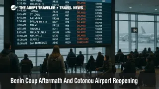
Flight Delays And Airport Impacts: December 10, 2025
US flight delays December 10 2025 are being driven by a familiar winter mix, with snow in the Upper Midwest slowing operations at Chicago O'Hare International Airport (ORD), Chicago Midway International Airport (MDW), Detroit Metropolitan Wayne County Airport (DTW), and Minneapolis Saint Paul International Airport (MSP), while gusty winds and low clouds pressure major hubs from Boston Logan International Airport (BOS) through the New York and Washington corridors. The Federal Aviation Administration, FAA, daily air traffic report also highlights low ceilings around Seattle Tacoma International Airport (SEA) and San Francisco International Airport (SFO), settings where traffic managers often cut arrival rates to keep approaches safe. For travelers, this is a day to assume longer queues, slower turns, and a higher risk of missed connections through the big snow and wind exposed hubs, and to build extra time into any trip that passes through them.
In practical terms, US flight delays December 10 2025 are likely to be moderate but concentrated at the Chicago, Detroit, Minneapolis, New York, Washington, Boston, Seattle, and San Francisco hubs that sit under the FAA weather flags, with ripple effects spreading along their domestic and transatlantic spokes.
Midwest Snow Targets Chicago, Detroit, And Minneapolis
The headline constraint today is snow and winter weather across the Upper Midwest. The FAA daily air traffic report calls out snow and reduced visibility around Chicago, Detroit, and Minneapolis, a pattern that usually forces air traffic control, ATC, to slow arrival streams, stretch departures, and occasionally institute ground delay programs when runway and de icing capacity cannot keep up.
At Chicago O'Hare and Chicago Midway, even a relatively modest snow event can cascade quickly because both airports run near capacity on normal days. Add plow convoys, extended braking action checks, and de icing queues, and the effective number of usable movements per hour drops, which in turn triggers longer taxi times and airborne holding for inbound flights. Detroit and Minneapolis have more experience with sustained winter operations, but they still see pressure when snowfall rates spike, especially during the late morning and afternoon banks when connecting traffic is heavy.
Travelers who must connect through these hubs on December 10 should treat short layovers as a luxury rather than a default. Two hour domestic connections and three hour domestic to international connections are sensible minimums through Chicago, Detroit, and Minneapolis, particularly on itineraries that cannot easily be rebooked, such as once daily long haul flights or separate tickets. Where possible, moving to earlier departures provides more recovery options if an inbound segment runs late.
Wind And Low Ceilings Around New York, Washington, And The Coasts
The same FAA outlook points to gusty winds in the New York and Washington regions, covering Newark Liberty International Airport (EWR), John F Kennedy International Airport (JFK), LaGuardia Airport (LGA), Ronald Reagan Washington National Airport (DCA), Washington Dulles (IAD), and Baltimore Washington International Thurgood Marshall Airport (BWI). Strong crosswinds and shifting gusts can force controllers to use fewer runways, increase spacing between arrivals, or temporarily pause operations while the airport reconfigures, and those moves often produce rolling delays that are invisible on the weather radar but very real at the gate.
Low ceilings and visibility around Boston, Seattle, and San Francisco add a second layer of friction. These coastal hubs already run complex arrival and departure procedures, and when cloud bases drop, instrument approaches and go arounds become more likely, which again reduces safe throughput. This is the sort of day when a flight can leave its origin more or less on time but sit in a holding pattern outside the arrival gate, or divert to a nearby airport if the arrival queue lengthens beyond fuel reserves.
For passengers, the practical implication is that any same day chain that involves New York, Washington, Boston, Seattle, or San Francisco deserves extra margin. That applies especially to domestic to international links, where missing a transatlantic or transpacific bank can mean an overnight delay rather than a simple rebooking a few hours later. Travelers with flexibility can sometimes route around the most constrained hubs by using alternatives such as Philadelphia for New York area trips or Oakland for some San Francisco Bay itineraries, but those workarounds should be weighed against ground travel time and schedule convenience.
Florida Corridors, Special Use Airspace, And Western Constraints
While the core weather story sits in the snow belt and Northeast, the FAA daily report and operations plan also flag en route constraints from convective weather and special use airspace in parts of Florida and the Gulf region. Thunderstorms along the peninsula and offshore, combined with military training blocks, can narrow the number of usable routes in and out of Florida, especially for flows bound to or from the Northeast and Midwest.
Even when individual Florida airports are reporting good local conditions, traffic managers may need to meter arrivals more carefully because only a subset of the usual arrival gates and en route corridors are available. That sort of constraint is less visible to casual travelers than a snowstorm on the ramp, but it still shows up in the form of airborne holding, minor reroutes, or arrival times that slip by 15 to 45 minutes. If your itinerary chains a Florida leg to a tight domestic connection through Atlanta, Charlotte, or an already stressed Northeast hub, it is worth stretching that layover or moving to an earlier flight if space permits.
West Coast passengers should also keep an eye on Seattle and San Francisco, where the combination of low cloud, winter rain, and heavy long haul traffic creates an environment with little slack. Long distance transpacific flights have limited wiggle room for rebooking, so travelers heading to Asia out of these hubs may want to arrive the previous evening or choose routings that offer more frequent onward options.
Background, How The FAA Daily Report Turns Into Real Delays
The FAA daily air traffic report is essentially a morning forecast for the National Airspace System, summarizing where controllers expect weather, runway work, or special use airspace to slow flows and where ground delay programs or ground stops are possible. It is not a guarantee that every flagged airport will suffer severe delays, but it is a strong indicator of where the system has the least flexibility.
Airlines then layer their own schedules, aircraft rotations, and crew duty limits on top of that blueprint. On a day like December 10, snow in the Midwest, wind in the Northeast, and low ceilings on both coasts mean there are multiple places where schedules can start to fray. Once an aircraft goes out of position or a crew bumps up against duty time, delays can spread into airports that never saw adverse weather at all. That is why Adept Traveler often pairs daily outlooks like this one with evergreen explainers such as the Guide To US Airport Delays And Cancellations and the Guide To US Airport And Air Traffic Control Delays, which walk through the tools FAA uses to manage demand and the steps travelers can take to cushion the impact.
Practical Steps For Travelers On December 10
For travelers flying on December 10, the most useful framing is to treat the day as a moderately stressed winter weekday with clearly identified choke points rather than a full system meltdown. The first move is to favor early departures where you can, particularly out of Chicago, Detroit, Minneapolis, New York, Washington, Boston, Seattle, and San Francisco. Early morning flights tend to leave closer to schedule, give you more backup options if something slips, and are less exposed to the compounding effect of multiple earlier delays.
Second, revisit your connection strategy. If your current bookings give you less than two hours between domestic segments or less than three hours between a domestic feeder and an international departure through the affected hubs, use same day change tools or call center waivers to stretch those layovers. That is especially important if your trip connects into a cruise departure, escorted tour, or long distance train, where missing the first leg can have expensive knock on effects.
Third, lean heavily on digital tools and first party information. Airline apps remain the fastest way to see evolving departure times, gate changes, and equipment swaps, while the FAA National Airspace System Status page and public delay map show whether your origin or connection is under a formal ground delay program, a ground stop, or simple volume related spacing. Checking both before leaving for the airport and again at the gate gives you a clearer sense of whether a delay is likely to worsen, stay stable, or improve.
Finally, if you are planning trips later in December, use the December 10 pattern as a rehearsal. Adept Traveler's recent daily coverage, including Flight Delays And Airport Impacts: December 8, 2025 and Flight Delays And Airport Impacts: December 9, 2025, shows how similar weather setups and holiday traffic loads have played out across multiple days, and the evergreen Guide To US Airport Delays And Cancellations offers a deeper look at insurance, backup routing, and compensation rules that can make future disruptions less painful.
Sources
- FAA Daily Air Traffic Report, December 10 2025
- FAA ATCSCC Operations Plan Advisory, December 10 2025
- FlightAware Live Flight Delay And Cancellation Statistics
- Flight Delays And Airport Impacts: November 22, 2025
- Flight Delays And Airport Impacts: November 30, 2025
- Flight Delays And Airport Impacts: December 8, 2025