Flight Delays And Airport Impacts: December 11, 2025
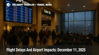
Travellers across the United States on December 11, 2025 are facing a patchy but real disruption risk, as US flight delays December 11 line up with a fresh winter storm belt from the Upper Midwest to New England and gusty winds at key Northeast and Rocky Mountain hubs. The biggest exposure today sits at Boston, the New York area, Philadelphia, Washington DC, Denver, San Francisco, and Seattle, where weather and capacity limits can quickly turn small slowdowns into long queues and missed tight connections. Anyone flying through these cities should budget extra time at check in, pad connections by at least two hours where possible, and keep a close eye on waivers and same day change options as the day develops.
December 11, 2025 looks like a moderate disruption day rather than a full scale meltdown, but US flight delays December 11 are clustered around storm affected corridors and already constrained hubs where reduced arrival rates and winter road conditions can sharply raise the odds of misconnects and overnight delays.
National Picture: Winter Storm Belt Meets Busy Hubs
National Weather Service alerts compiled by outlets such as Newsweek and Hindustan Times describe winter storm warnings and advisories stretching across roughly 14 states from the Upper Midwest through the Great Lakes into interior New England, with some areas forecast to receive up to 15 inches of snow, strong winds, and dangerous driving conditions. That storm belt covers key feeder markets for major hubs, including Minneapolis, Chicago, Detroit, Cleveland, Buffalo, and parts of upstate New York, so it will not take much for regional cancellations or holding patterns to spill up into trunk routes.
At the same time, the FAA's National Airspace System Status page for the morning of December 11 shows a generally functional system but highlights local delays tied to weather and volume at several large airports, with the map updated at 07:00 Pacific. Compared with the worst shutdown days in November, when more than 1,500 flights were cancelled and over 7,000 delayed in a single day, current disruption levels are lower but still significant enough that travellers with tight schedules need to treat storm exposed hubs as higher risk.
There is at least one piece of good news in the background. NOAA's hurricane center confirms there are no tropical cyclones in the Atlantic or eastern Pacific basins, so there is no hurricane or tropical storm layer on top of the winter pattern. The day's aviation risks are about snow, wind, and low cloud, not tropical systems.
Northeast And Mid Atlantic: Winds And Snow Driven Delays
For many travellers, the practical choke points today are the dense cluster of Northeast and Mid Atlantic hubs. On first mention, that list includes Boston Logan International Airport (BOS), John F. Kennedy International Airport (JFK), LaGuardia Airport (LGA), Newark Liberty International Airport (EWR), Philadelphia International Airport (PHL), Baltimore/Washington International Thurgood Marshall Airport (BWI), Ronald Reagan Washington National Airport (DCA), and Washington Dulles International Airport (IAD).
High wind alerts and winter storm warnings in the region are expected to produce a mix of crosswinds, low level wind shear, and periods of poor visibility that reduce the rate at which aircraft can safely land and depart at Boston Logan, New York's three major airports, and the Washington area fields. That, in turn, forces the FAA and tower controllers to stretch out arrival and departure gaps, usually resulting in ground delay programs that build average delays from a few minutes toward an hour or more as peak banks roll through.
Because many transatlantic flights to and from Europe depend on evening banks at JFK, Newark Liberty, and Boston Logan, any afternoon or early evening slowdown will be especially painful for travellers trying to connect into overnight departures or onto early morning European short haul flights the next day. Philadelphia International also plays a critical role for connections into the US Southeast and smaller Northeast markets, so delays there can cascade onto routes that never touch New York or Boston directly.
Rockies And West Coast: Denver, San Francisco, And Seattle
Farther west, Denver International Airport (DEN) sits close to the southern flank of the current winter system, with periods of snow, low cloud, and gusty winds likely to cut into arrival rates and to force deicing on many departures. As with the Northeast, the problem in Denver is not only local passengers but also the huge volume of connections that cross the Rockies on United and other carriers, so relatively small slowdowns can strand travellers heading between the coasts.
Along the Pacific coast, low clouds and fog are expected at San Francisco International Airport (SFO) and Seattle-Tacoma International Airport (SEA), both of which are familiar bottlenecks when ceilings drop. When San Francisco or Seattle need to shift to instrument approaches with wider spacing, holding patterns and ground delay programs often follow, and these can spill back into departure banks at Los Angeles, Portland, Phoenix, and smaller West Coast cities that rely heavily on connections at those hubs.
Anyone booked on morning and midday banks into or out of San Francisco or Seattle should monitor flight status closely, as these banks often see the first signs of system stress in the form of creeping delays and aircraft swaps. Later in the day, tight same day turns at SFO and SEA become more vulnerable to rolling delays and missed onwards connections.
Shutdown Flight Cuts Still Shape The Baseline
All of this weather unfolds against a structural backdrop that is less forgiving than in previous winters. In early November, the FAA issued an emergency order forcing airlines to cut flights at around 40 high volume US airports, including major hubs, as controller shortages and an extended government shutdown strained the system. News coverage from Reuters and other outlets made clear that those cuts translated into thousands of cancellations and delays over a few days, and airlines warned that the new regime would make it harder to recover when storms hit.
Although the worst of those mandated cuts have already been absorbed into published schedules, the net effect is that there is less slack in day to day operations. Fewer spare crews and aircraft mean that when winter storms or strong wind events like today's hit Boston, New York, Washington, or Denver, there are fewer easy ways to re route passengers, especially in peak holiday periods. Travellers should not assume that a modest delay in the app will automatically be absorbed later in the day.
Practical Strategies For December 11 Travellers
For travellers still booking, the best strategy for December 11 is to avoid unnecessary connections through the most storm exposed hubs, particularly Boston Logan, the New York area airports, Denver, and Seattle, where weather and volume pressures intersect. When there is a choice between a hub in the core storm belt and an alternative such as Atlanta, Dallas Fort Worth, or Houston, it is often worth taking the routing that looks slightly indirect on the map but offers better odds of running close to schedule.
If plans are fixed, the main lever is time. Two hour buffers between flights through Boston, the New York area, Washington, Denver, San Francisco, and Seattle should be treated as a minimum today, not a luxury, especially on itineraries that involve regional jets or smaller Midwest and Great Lakes stations that may see the first cancellations if snow bands intensify. Where possible, travellers should work with airlines to move from tight evening connections into earlier departures, even if that means a longer layover.
On the ground, winter storm warnings and advisories across the Midwest and Northeast mean that driving conditions on highways that feed airports may be as much of a constraint as the flights themselves. Anyone heading to airports in affected states should build extra time for snow clogged roads, minor accidents, and periodic closures of bridges and higher passes, and should keep in mind that airport parking operations can also slow down during plowing and icing operations.
For more context on how this week's pattern evolved from an earlier atmospheric river and blizzard combination, Adept travelers can refer back to US Atmospheric River And Midwest Blizzard Snarl Holiday Travel, and for a baseline view of how flight cuts and early December weather played out yesterday, see Flight Delays And Airport Impacts: December 10, 2025. For structural background on dealing with disruption, the site's Guide To US Airport Delays And Cancellations remains the best starting point for understanding compensation rules, rebooking tactics, and when to push for hotel support.