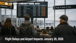
Flight Delays and Airport Impacts: January 28, 2026
FAA daily planning for Wednesday focuses on weather driven throughput limits at several major hubs, with gusty winds highlighted for General Edward Lawrence Logan International Airport (BOS) and the New York City area airports, plus low clouds flagged for Dallas Love Field Airport (DAL), Dallas Fort Worth International Airport (DFW), and San Francisco International Airport (SFO). For travelers, the practical meaning is not necessarily mass cancellations, but a higher chance of metering and rolling delays that show up first at your departure airport, even when skies look fine where you are.
The core risk mechanism today is reduced arrival and departure rates during peak banks. Winds can force runway configuration changes and increase spacing on final, while low ceilings and low visibility push more conservative arrival rates and longer intervals between aircraft. FAA traffic management initiatives, when activated, often hold flights at origin airports to keep airborne holding manageable, which is why delay minutes can accumulate far from the weather footprint.
Beyond weather, a short operational note matters in New York. The FAA Command Center issued an advisory for LaGuardia Airport (LGA) warning of possible arrival delays and airborne holding of up to 30 minutes during a runway 4/22 survey work window, centered on late morning local time. That kind of targeted constraint can ripple quickly because New York flights are tightly banked and highly connected, so even a short cap can knock aircraft and crews off sequence for the afternoon.
Who Is Affected
Travelers connecting through the Northeast corridor are first in line for disruption risk because Boston and the New York complex sit at the center of dense, banked networks. If winds reduce arrival rates into Boston Logan, Newark Liberty International Airport (EWR), John F. Kennedy International Airport (JFK), or LaGuardia, the system often responds by holding departures at their origin airports, which means your flight can be delayed before boarding even begins, and your connection cushion shrinks without warning.
North Texas itineraries are vulnerable in a different way. Low clouds around Love Field and Dallas Fort Worth can slow arrival streams and gate turns, then compound into longer taxi times, missed departure slots, and late aircraft swaps. When the Dallas banks are stressed, the impact is not confined to Texas, because those aircraft and crews are also scheduled to operate later legs into the Midwest, the Mountain West, and the East Coast.
West Coast travelers routed through San Francisco should watch for the classic low visibility pattern: arrival metering that creates upstream departure delays from Los Angeles, Seattle, and other West Coast spokes. That first order effect, reduced runway acceptance rate, becomes a second order schedule problem when aircraft arrive late for their next assignment and crews approach duty limits. If your itinerary has two legs or more, a 30 to 60 minute delay in the first bank can become an overnight misconnect by the evening bank if rebooking inventory is thin.
What Travelers Should Do
Start with immediate actions and buffers. Check your flight status before leaving for the airport, and keep checking, because flow programs can turn on quickly when winds or ceilings tighten. If you are traveling through Boston Logan, the New York airports, the Dallas airports, or San Francisco, add time for slower taxi and gate cycles, and keep essentials in your personal item so an unplanned overnight is survivable without access to checked bags.
Use clear decision thresholds for rebooking versus waiting. If your first delay compresses a hub connection below roughly 90 minutes, or if you see an FAA ground stop or ground delay program tied to your connection airport, rebooking earlier is usually safer than hoping the bank recovers in time. If your trip has a hard arrival deadline, prioritize nonstop options first, then routes with one connection and a longer layover, even if the itinerary looks less convenient on paper.
Over the next 24 to 72 hours, monitor three layers rather than one feed. Watch the FAA daily outlook and Command Center planning for whether "possible" initiatives at JFK, the Dallas airports, and SFO become active programs, watch your airline for waiver expansion or tightened rebooking rules, and watch local weather trends that can keep ramps slow even when precipitation is not the story. For broader context on how flow control and staffing constraints can magnify weather days, see U.S. Air Traffic Control Privatization: Reality Check, and for recent precedent on how a recovery posture can behave, review Flight Delays and Airport Impacts: January 27, 2026 and Winter Storm Fern US Flight Delays January 27.
How It Works
FAA air traffic flow management is built to prevent demand from exceeding what airports and airspace can safely handle. When winds, low ceilings, or low visibility reduce the number of arrivals an airport can accept per hour, the system often uses tools like ground stops and ground delay programs to meter inbound traffic, favoring held departures at origin airports over long airborne queues near the destination. This is why "my departure airport looks fine" is not a reliable signal on days when the constraint is at a hub.
Those first order controls produce predictable second order ripples across the travel system. Metered arrivals break connection banks, increase misconnect rates, and push aircraft and crews out of position for later flights, which can turn a weather delay into a downstream cancellation late in the day. When that happens at high volume hubs, hotels near terminals tighten, rideshare and taxi demand spikes at irregular hours, and rebooking lines grow because fewer aircraft are available to recover the schedule. Today's mix, winds in the Northeast plus low ceilings in Dallas and San Francisco, is a classic setup where multiple hubs can be simultaneously constrained, and that is when delays propagate most efficiently across the national network.
Sources
- FAA Daily Air Traffic Report
- ATCSCC Current Operations Plan Advisory
- ATCSCC Advisory Database, LGA Arrival Delays
- General Edward Lawrence Logan International Airport (BOS) Real time Status
- John F Kennedy International Airport (JFK) Real time Status
- La Guardia Airport (LGA) Real time Status
- Dallas Fort Worth International Airport (DFW) Real time Status
- Dallas Love Field Airport (DAL) Real time Status
- San Francisco International Airport (SFO) Real time Status