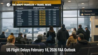
US Flight Delays February 18, 2026 FAA Outlook
Low clouds and reduced visibility are setting up a capacity management day across major Northeast airports on February 18, 2026, while wind and winter conditions add friction at several large Midwest and Western hubs. Travelers connecting through Boston Logan International Airport (BOS), the New York terminal area airports, Philadelphia International Airport (PHL), and the Washington region are the most exposed because arrival rate cuts in one corner of the network quickly propagate into missed connections and thinner same day options elsewhere. The practical move is to treat the afternoon and evening banks as the risk window, add buffer to any tight connections, and be ready to shift to earlier departures if flow programs go from possible to active.
The FAA outlook for US flight delays February 18 is a low ceiling Northeast story layered with wind in Chicago and snow shower risk in Seattle, which collectively reduces system slack and makes recovery harder once banks bunch up.
Who Is Affected
Travelers using the Northeast corridor hubs face the highest compounding risk because multiple airports can be constrained at the same time under the same weather regime. FAA planning flags low visibility and low ceilings as the primary constraint set across Boston, the New York terminal area complex, Philadelphia, and the Washington region, which is the classic pattern that turns into metering and longer spacing on approach. Even if your departure airport has clear skies, your flight can still be held at the gate or on the taxiway because traffic managers prefer holding aircraft on the ground rather than building large airborne queues into tight terminal airspace.
New York City area itineraries deserve extra caution later in the day because FAA planning also points to a scheduled runway closure that can introduce about 20 minutes of airborne holding into LaGuardia Airport (LGA) during the affected hour. Layer that with ongoing runway and taxiway constraints, and the system can become more brittle, meaning a short disruption can create a longer tail of gate holds and misconnects. Travelers who are routing through New York on separate tickets, or who are trying to make a same day cruise embarkation, rail departure, or event start time, should treat this as a higher risk day to rely on tight margins.
Florida and the Caribbean connection flows can be affected as well when Miami International Airport (MIA) is under a managed arrivals program. FAA planning shows an active ground delay program window for Miami, and even when reported arrival delays are modest, the downstream effect can still be departure sequence compression, late inbound aircraft, and missed connections to evening international departures. If you are connecting at Miami, the practical concern is not only the arrival delay number, it is the knock on risk to your aircraft rotation and whether your connection is the last viable same day option.
Outside the Northeast, low ceilings are also flagged for Detroit Metropolitan Wayne County Airport (DTW), Austin Bergstrom International Airport (AUS), and Los Angeles International Airport (LAX). Those airports can shift from routine to constrained quickly when ceilings sit near approach minimums, especially during peak arrival banks when spacing increases cascade into longer taxi in times and gate conflicts. Wind is also a stated constraint for Chicago O Hare International Airport (ORD), Chicago Midway International Airport (MDW), and Salt Lake City International Airport (SLC), and those hubs matter because they are common transfer points that can absorb, or amplify, delays depending on runway configuration and traffic volume.
What Travelers Should Do
Start with immediate actions and buffers that match your failure points. If you are connecting through Boston, New York, Philadelphia, Washington area airports, Chicago, Miami, Seattle, Los Angeles, Detroit, Austin, or Salt Lake City, pull up your inbound aircraft and watch whether it is being held at its origin, because that is often the earliest signal you will not recover later. If you have a checked bag and a short connection, assume you need more time than usual when low ceilings and wind are in play, because ramp congestion and gate conflicts tend to lengthen taxi and turn times.
Use a clear decision threshold for rebooking versus waiting. If your connection is under 90 minutes through any of the Northeast hubs, or you are on separate tickets, treat the first sustained delay trend as a trigger to move earlier or reroute through a different hub while seats still exist. Waiting is most rational when you are protected on one ticket and you still have multiple later same day options, but the cutoff is when you are down to the last viable departure that gets you to your destination without an overnight.
Over the next 24 to 72 hours, monitor whether programs that are listed as possible become active in the New York and Philadelphia area, and whether wind constraints in Chicago or Salt Lake City persist into late day banks. Also keep an eye on how runway and taxiway constraints interact with weather, because those do not create delays on their own, but they reduce flexibility when the system is already metering. For continuity with yesterday's network setup, compare against Flight Delays and Airport Impacts: February 17, 2026, and for the specific New York constraint context, see LaGuardia Runway Closures Raise Delay Risk This Week.
How It Works
The FAA Air Traffic Control System Command Center manages network flow by matching demand to reduced capacity using tools such as arrival rate reductions, ground delay programs, and ground stops. When low ceilings or wind reduce the rate at which aircraft can land, traffic managers often hold aircraft at their departure airports, then meter arrivals into the constrained airport so the terminal area does not overload. To travelers, that shows up as delayed departures, longer taxi times, gate holds, and sometimes airborne holding close to the destination, even when the weather at the origin looks fine.
The system ripple is where the real traveler cost lands. Aircraft and crews operate in linked rotations, so a delay into a hub pushes the next legs late, compresses connection windows, and creates gate conflicts that keep arriving aircraft waiting for a parking spot. When multiple regions are constrained on the same day, for example low ceilings in the Northeast plus wind at Chicago and winter constraints in Seattle, the network has fewer unconstrained alternates to absorb disruption. That is why late day recovery can fail, and why rebooking options shrink quickly once afternoon banks are already near full.
For deeper context on why these capacity management days keep recurring, and why staffing, modernization, and governance decisions matter to reliability, see U.S. Air Traffic Control Privatization: Reality Check.
Sources
- FAA Daily Air Traffic Report (February 18, 2026)
- ATCSCC Current Operations Plan Advisory (02/18/2026)
- Chicago O'Hare International Airport (ORD) Real Time Status (FAA)
- Miami International Airport (MIA) Real Time Status (FAA)
- LaGuardia Airport (LGA) Real Time Status (FAA)
- John F Kennedy International Airport (JFK) Real Time Status (FAA)