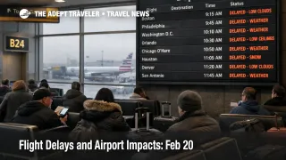
Flight Delays and Airport Impacts: Feb 20

The FAA's daily outlook points to a classic winter capacity squeeze across multiple U.S. hubs on February 20, 2026. Morning rain and low clouds are expected to slow operations at Boston Logan International Airport (BOS), the New York area airports, Philadelphia International Airport (PHL), and the Washington, D.C. region airports, which is the kind of shared weather regime that compresses the whole Northeast corridor at once. Low clouds are also forecast in central Florida and parts of Texas, while snow is expected in Chicago and Denver, and wind is flagged for Las Vegas.
The practical point is not that every flight will be late, it is that arrival rates can be cut at several major connecting gateways simultaneously. When that happens, traffic managers typically meter inbound demand using ground delay programs and other flow tools, and the delay you feel often starts at your origin gate rather than in the air. That is why "looks fine at my departure airport" is a trap on days like this.
Who Is Affected
Travelers touching the Northeast spine carry the highest compounding risk because multiple airports share the same airspace complexity and weather constraints. If you are flying through John F. Kennedy International Airport (JFK), LaGuardia Airport (LGA), Newark Liberty International Airport (EWR), Boston Logan, Philadelphia, or the Washington region trio, Ronald Reagan Washington National Airport (DCA), Baltimore Washington International Thurgood Marshall Airport (BWI), and Washington Dulles International Airport (IAD), your itinerary is exposed to both local ceiling limits and upstream metering that protects those arrival streams from stacking into airborne holding.
Florida and Texas itineraries are also in the blast radius. Low ceilings at Orlando International Airport (MCO) and Tampa International Airport (TPA), plus Houston area airports including George Bush Intercontinental Airport (IAH) and William P. Hobby Airport (HOU), can force spacing increases during peak arrival banks, which then ripples into missed connections because inbound flights arrive late in clusters. Austin Bergstrom International Airport (AUS) and San Antonio International Airport (SAT) are called out in the same low cloud bucket, which matters because mid day compression can spill into evening departures when there is less slack left to recover.
Midwest and mountain travelers should treat this as a higher cancellation risk day, even if the morning looks manageable. Snow at Chicago O Hare International Airport (ORD) and Chicago Midway International Airport (MDW), plus snow risk at Denver International Airport (DEN) and surrounding ski country airports, is the kind of constraint that breaks rotations. The first order effect is slower arrivals and longer taxi times, the second order effect is that the aircraft meant to operate your later flight never arrives, or the crew hits duty limits and the airline cuts the last bank to reset.
Las Vegas exposure is different but still meaningful. Wind at Harry Reid International Airport (LAS) can trigger runway configuration changes, arrival rate cuts, and intermittent holding initiatives, which often show up as late day recovery failure when the network is trying to catch up.
What Travelers Should Do
Start with immediate actions and buffers that protect your options. If your trip touches the Northeast corridor, Chicago, Denver, Florida, Houston, Austin, San Antonio, or Las Vegas, check the inbound aircraft for your flight and watch whether it is being held at its origin, because that is often the earliest signal that your departure will not "make up time" later. Build buffer around ground side choke points too, since weather days increase gate crowding and customer service lines even when security is moving normally.
Use a clear decision threshold for rebooking versus waiting. If you have a connection under about 90 minutes through the New York area, Washington, or Chicago, or you are on separate tickets, the rational play is usually to move earlier, simplify to nonstop, or reroute before the reaccommodation wave consumes seats. Waiting only makes sense when you are protected on one ticket and you still have multiple later same day backups that work for your real constraints, like hotel check in, cruise boarding cutoffs, or last onward departures.
Over the next 24 to 72 hours, monitor whether today's constraints are producing active flow programs and reroutes, not just whether the forecast looks better. You are watching for signs the system is losing slack, repeated arrival rate reductions at the same hubs, and reroute requirements that lengthen block times and push crews toward legality limits. For continuity with the current pattern and how it tends to cascade, compare against Flight Delays and Airport Impacts: Feb 19, 2026 and the recent Denver example, Denver Wind Ground Delay at DEN Triggers Missed Links.
How It Works
The FAA's air traffic system manages demand when weather reduces how fast aircraft can arrive and depart safely. Low ceilings and reduced visibility typically force more conservative approach spacing, which lowers arrival rates at the exact moments airlines schedule dense banks of flights. To prevent unsafe airborne holding from building up, traffic managers often hold flights at departure airports, then release them on controlled times, so passengers see gate holds, delayed pushbacks, and compressed connections even when their origin weather is clear.
Snow adds another layer because it directly eats runway and taxiway capacity through braking action limits, plowing cycles, and de icing demand, and it increases the odds of gate conflicts when inbound flights cannot park on schedule. Once Chicago or Denver loses throughput, aircraft rotations drift, and that creates second order impacts far from the storm, because later flights elsewhere lose their assigned aircraft and crews. Wind at places like Las Vegas can compound the same dynamic by forcing configuration changes that reduce usable arrival rates during key banks, which makes late day recovery harder.
If you want the broader structural context for why "capacity days" have become more brittle, not just more annoying, the incentives and staffing constraints are laid out in U.S. Air Traffic Control Privatization: Reality Check.
