Flight Delays and Airport Impacts: Feb 25
Feb 25 flight delays are shifting from the Northeast storm peak into a weather, and runway, constrained operations day, with the highest real time exposure centered on New York, New York, especially LaGuardia. The FAA is flagging high winds and low clouds for Boston and the New York metro, snow showers around Chicago and Detroit, gusty winds around Denver, and low clouds around San Francisco and Washington, D.C., which is the kind of mixed setup that produces uneven reliability across hubs and connection banks.
Feb 25 Flight Delays: What Changed Across Key Hubs
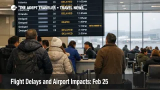
As of the FAA's latest airport status updates, most major hubs in today's weather footprint were still showing general arrival and departure delays of 15 minutes or less, including General Edward Lawrence Logan International Airport (BOS), Newark International Airport (EWR), John F Kennedy International Airport (JFK), Chicago OHare International Airport (ORD), Chicago Midway Airport (MDW), Detroit Metropolitan Wayne County Airport (DTW), Denver International Airport (DEN), and San Francisco International Airport (SFO).
La Guardia Airport (LGA) was the clear outlier, with a snow, ice traffic management program in effect and posted departure delays in the 46 minutes to 1 hour range, plus arrival delays in the 31 to 45 minute range, both increasing.
Where The Disruption Risk Is Highest Today
Travelers connecting through the New York area remain the most exposed, because even modest average delays at John F. Kennedy and Newark can turn into missed connections when LaGuardia is running materially behind, and when winter runway treatment forces intermittent arrival flow cuts. The FAA's system planning advisory explicitly called out published ground stops for both JFK and LGA tied to runway closures for snow treatment, which is a strong signal that surface operations, not just airborne spacing, are part of today's constraint picture.
The second highest exposure band is the "looks fine until it doesn't" group, Boston, Chicago, Detroit, Denver, San Francisco, and Washington, D.C., because short weather driven slowdowns during peak arrival banks can spill into gate availability, crew legality, and same day rebooking depth. The FAA's daily outlook puts winds and low clouds in the Northeast, snow showers in Chicago and Detroit, gusty winds in Denver, and low clouds around San Francisco and Washington, D.C., in the same 24 hour window, which increases the odds of rolling delays that move around the map rather than staying pinned to one airport.
What Travelers Should Do Now
If you are flying through LaGuardia today, treat the posted averages as a baseline, not a ceiling. Rebook proactively if your itinerary depends on a tight connection, a last flight of the night, or a timed event on arrival, because once runway treatment and low visibility stack together, the recovery lever becomes schedule trimming, not heroic catch up.
If you are connecting through JFK or Newark, you can often preserve the itinerary by adding buffer, shifting to an earlier departure, or swapping to a nonstop, but you should still check your inbound aircraft and your first leg's departure airport, because arrival metering into New York can delay flights at their origin even when your departure weather looks fine. This is also the day when waiting for an airline waiver can cost you seat inventory, so the tradeoff is simple, rebook early if your connection is short or your arrival time matters, and wait if you have time flexibility and multiple later options.
Over the next 24 to 72 hours, watch for program escalation signals rather than focusing only on the weather forecast. The FAA planning advisory flagged possible stop or delay programs later in the day for SFO, DEN, and EWR, and it also noted a probable LGA ground delay program into the late window, which is the kind of planning posture that can extend disruptions past the most obvious weather moment.
Why This Is Happening, And How Delays Spread
Winter operations disruptions propagate in two stages. First order, runway treatment, low visibility, and wind reduce arrival rates, and controllers meter arrivals to keep spacing safe, which shows up as airborne holding, or ground delay programs that hold flights at their departure airports.
Second order, once arrival banks drift, the airport surface starts to bind, gates fill, taxi out times stretch, and crews time out, which pushes airlines into cancellation decisions that may not look "weather related" to travelers standing in a different city. That is why a day with mostly modest averages can still produce expensive misconnects, particularly through the Northeast corridor where multiple large hubs share the same airspace constraints and reroute patterns. For continuity with yesterday's recovery framing, see Flight Delays and Airport Impacts: Feb 24, and for structural context on why these constraint days keep recurring, see U.S. Air Traffic Control Privatization: Reality Check.
Sources
- FAA Daily Air Traffic Report (February 25, 2026)
- ATCSCC Current Operations Plan Advisory (02/25/2026)
- La Guardia Airport (LGA) Real Time Status (FAA)
- John F Kennedy International Airport (JFK) Real Time Status (FAA)
- Newark International Airport (EWR) Real Time Status (FAA)
- General Edward Lawrence Logan International Airport (BOS) Real Time Status (FAA)
- Chicago OHare International Airport (ORD) Real Time Status (FAA)
- Chicago Midway Airport (MDW) Real Time Status (FAA)
- Detroit Metropolitan Wayne County Airport (DTW) Real Time Status (FAA)
- Denver International Airport (DEN) Real Time Status (FAA)
- San Francisco International Airport (SFO) Real Time Status (FAA)