Flight Delays and Airport Impacts: April 17
April 17 flight delays are starting as a watch-and-act day rather than an early nationwide meltdown, but the Federal Aviation Administration is already signaling a broad afternoon and evening risk map that can tighten connections quickly. The FAA's April 17 operations plan flags low ceilings at Boston Logan International Airport (BOS) and Seattle-Tacoma International Airport (SEA), wind in the New York area, Philadelphia International Airport (PHL), and Harry Reid International Airport (LAS), thunderstorms and low visibility in Chicago, and snow showers around Denver International Airport (DEN) and Salt Lake City International Airport (SLC). Travelers with short layovers, last flights of the day, cruise embarkations, or fixed ground transfers should treat Friday as a buffer day, especially if Boston, San Francisco International Airport (SFO), Denver, Chicago O'Hare International Airport (ORD), or Chicago Midway International Airport (MDW) sit in the middle of the itinerary.
April 17 Flight Delays: What Changed
The clearest change from Thursday is that the FAA's planning map has widened and shifted west and central before the Northeast fully hardens. The current April 17 operations plan lists possible ground stops or ground delay programs for Denver after 1400 Zulu, a probable ground delay program for San Francisco after 1500 Zulu, possible action for Las Vegas after 1500 Zulu and Minneapolis-Saint Paul International Airport (MSP) after 1600 Zulu, then a possible Boston program after 1800 Zulu, with John F. Kennedy International Airport (JFK) and both Chicago airports on the board after 2200 Zulu. That is a more distributed risk pattern than the FAA's still-stale public daily report page, which remains dated Thursday, April 16, 2026.
That matters operationally because widely separated pressure points break recovery in different ways. Denver and San Francisco can interfere with westbound and transcontinental fallback options earlier in the day, Boston can compress East Coast and transatlantic flows later, and Chicago can turn a manageable afternoon into a much broader evening reaccommodation problem if thunderstorms verify near the banks when ORD and MDW are already in the FAA plan.
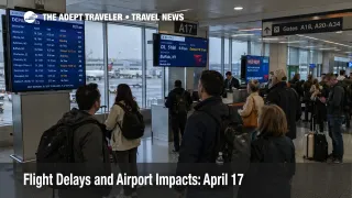
The early live status picture is still relatively calm. As of the FAA snapshots available Friday morning, Boston, San Francisco, Denver, and O'Hare were each showing only general arrival or departure delays of 15 minutes or less, with no destination specific delays posted. That means the risk is still more about what is planned and likely than what has already broken, which is exactly when travelers have the most room to protect an itinerary.
Which Travelers Face the Most Airport Impacts
The most exposed travelers are not just passengers originating at the airports named in the FAA plan. The higher risk group includes anyone connecting through BOS, SFO, DEN, LAS, ORD, or MDW, especially on separate tickets, on long haul onward flights, or into the last practical departure bank of the day. A legal connection is not the same thing as a resilient one once the FAA starts spacing arrivals or slowing departures.
Boston deserves extra attention because the FAA has already issued a Collaborative Decision Making proposed ground delay program there. The advisory says arrivals are estimated for delayed handling from 1800 Zulu on April 17 through 0359 Zulu on April 18, with an anticipated program rate of 38, covering all contiguous U.S. departures in a long list of centers plus several Canadian departure airports. In plain language, that means Boston is no longer just a forecast concern, it has already moved into formal delay-planning territory that can push waiting time back to origin airports across a large part of the network.
Chicago is the other major watch point because Friday's broader national weather setup favors severe thunderstorms and flash flooding from the Midwest into the central and southern Plains. The Weather Prediction Center said Friday brings widespread severe weather and flash flood threats across much of the Midwest and central and southern Plains, with an Enhanced Risk of severe weather from the Upper Mississippi Valley into parts of the Plains, plus a damaging wind threat into the Middle Mississippi Valley. When the FAA plan also shows Chicago terminal constraints tied to low ceilings, visibility, and thunderstorms, plus planned Chicago route constraints after 1800 Zulu and possible airport programs after 2200 Zulu, the evening bank risk becomes much more credible.
What Travelers Should Do Now
Travelers flying on April 17 should plan from the FAA risk windows, not just from the current airport boards. If your trip depends on Boston, San Francisco, Denver, Las Vegas, or Chicago running close to schedule later today, the safer move is to add buffer before formal programs deepen. For same-day trips, that can mean shifting to earlier departures, preserving more connection time, or avoiding voluntary airport changes that remove rebooking flexibility.
The main decision threshold is simple. Rebook early if one missed segment would cost a cruise embarkation, an international long haul departure, a paid tour, a final rail connection, or a hotel night in a city with limited late arrivals. Waiting makes more sense when the itinerary is nonstop, the arrival time is flexible, and the airline still shows multiple later options on the same route. Boston passengers should be especially conservative because the proposed FAA program there reaches deep into the evening and overnight arrival window.
What to watch next is also clear. The first key signal is whether Denver or San Francisco move from planned risk into formal programs this afternoon. The second is whether Boston's proposed delay framework turns into a live ground delay program with assigned times. The third is whether Chicago thunderstorms force ORD and MDW from forecast concern into actual traffic management action by the evening bank. If those signals line up, April 17 flight delays will stop behaving like isolated local friction and start acting like a broader network recovery problem.
Why the Risk Is Spreading, and What Happens Next
The mechanism today is not one giant failure point. It is a chain of regional weather and flow constraints layered across the system. The FAA plan lists low ceilings in Boston and Seattle, wind across the New York and Philadelphia airspace plus Las Vegas, thunderstorm and visibility pressure in Chicago, snow showers in Denver and Salt Lake City, and en route thunderstorm constraints across multiple control centers including Minneapolis, Chicago, Kansas City, Memphis, and Fort Worth. That kind of spread reduces reroute flexibility, slows aircraft turns, keeps gates occupied longer, and makes later recovery less efficient even at airports that never become the top headline.
The broader federal weather outlook supports that reading. The Weather Prediction Center said thunderstorms on Friday should be widespread across the central U.S., with severe risks focused from the Upper Mississippi Valley southwest into the central and southern Plains, along with flash flood potential and late season wintry weather in parts of the Rockies and Upper Midwest. That is the kind of setup that can keep route structure constrained well beyond the airport where a traveler actually boards.
What happens next depends on timing. If Denver and San Francisco stay manageable and Boston's program remains modest, the day may remain frustrating but workable. If Boston strengthens, San Francisco goes active, and Chicago storms arrive on schedule, the practical result will be weaker connection reliability, thinner same-day reaccommodation, and more pressure on overnight recovery. In an earlier Adept Traveler article, Flight Delays and Airport Impacts: April 16, the main pressure leaned East Coast first. In another earlier Adept Traveler article, Chicago Flight Delays Lead Broad U.S. Weather Day, Chicago was the clearer focal point. The structural backdrop is still relevant, and U.S. Air Traffic Control Privatization: Reality Check remains useful context for understanding how limited slack can spread local delay into a broader network problem.
Sources
- FAA Daily Air Traffic Report
- FAA Current Operations Plan Advisory, April 17, 2026
- FAA Most Recent ATCSCC Advisory, BOS Proposed Ground Delay Program
- FAA Boston Logan International Airport (BOS) Real-time Status
- FAA San Francisco International Airport (SFO) Real-time Status
- FAA Denver International Airport (DEN) Real-time Status
- FAA Chicago O'Hare International Airport (ORD) Real-time Status
- NOAA Weather Prediction Center Short Range Forecast Discussion, April 17, 2026