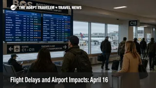
Flight Delays and Airport Impacts: April 16
April 16 flight delays are shaping up as an East Coast and connection-bank problem, not a full U.S. system breakdown. The Federal Aviation Administration said on Thursday, April 16, 2026 that low clouds and visibility could slow Boston Logan International Airport (BOS), wind could affect John F. Kennedy International Airport (JFK), LaGuardia Airport (LGA), Newark Liberty International Airport (EWR), and Harry Reid International Airport (LAS), while thunderstorms could disrupt Detroit Metropolitan Wayne County Airport (DTW) and Chicago O'Hare International Airport (ORD) plus Chicago Midway International Airport (MDW). By late morning, the FAA's command center had removed Chicago from the day's initiative list and was instead pointing to a later risk window around Boston, the New York area, Philadelphia, San Francisco, Detroit, and Nashville. Travelers with short layovers, same-day onward ground transport, or evening arrival deadlines should treat today as a buffer day, especially on East Coast hub connections.
April 16 Flight Delays: What Changed
The FAA's public forecast and its command-center planning notes are telling a more specific story than yesterday's broader Chicago-centered pattern. The daily report names Boston, New York, Las Vegas, Detroit, and Chicago as the main weather pressure points, but the operations plan shows Chicago was removed from planned initiatives early on April 16, while Boston and the New York region remained positioned for possible ground stops or ground delay programs after 1800 Zulu, with Newark and Philadelphia on the same later watch list. The same plan also lists San Francisco International Airport (SFO) as probable for a ground stop or delay program after 1500 Zulu and Detroit as possible for a later ground stop.
That is a meaningful shift for travelers. Chicago is still in the FAA's weather narrative, but the more credible late-day network risk has moved toward the Northeast corridor and transcontinental flow points, where a slowdown in one hub can compress available seats, late aircraft rotations, and recovery options across multiple airlines at once. Early FAA status snapshots for Boston, JFK, Las Vegas, O'Hare, and SFO were still showing only minor general arrival delays, which means the day had not yet hardened into a severe nationwide disruption by midday.
Which Travelers Face the Most Airport Impacts
The most exposed travelers are the ones connecting through Boston and the New York airports later today, especially passengers bridging to long-haul departures, last flights of the day, cruises, tours, or separate-ticket onward segments. Boston's issue is low ceilings and visibility, which can reduce arrival rates even before a thunderstorm headline appears. In New York, the FAA is watching wind, and that matters because the region's tightly packed arrival and departure banks leave less room to absorb even moderate traffic management action without pushing delays into the rest of the day.
The second group to watch is travelers connecting across airports that are not the headline problem but sit inside the same flow network. The FAA's operations plan lists en route thunderstorm constraints across a broad band of control centers from the Northeast through the Midwest and into the South Central system, while the National Weather Service said severe thunderstorms were expected from the Northeast to the Mid-Mississippi Valley on April 16. That kind of footprint reduces reroute flexibility and makes a later Boston or New York slowdown more likely to export delays into cities that remain flyable locally.
Las Vegas, Detroit, and San Francisco sit in a different category. They are not the main East Coast connection story, but each can still tighten the national recovery picture if forecast conditions verify. San Francisco is especially worth watching because the FAA planning note calls a later ground stop or delay program probable even though the airport's public status page was still only showing minor delays in the latest snapshot.
What Travelers Should Do Now
Travelers flying on April 16 should plan from the FAA risk map, not only from the current departure board. If your itinerary depends on Boston Logan, JFK, LaGuardia, or Newark working close to schedule this afternoon or evening, the safest move is to protect short layovers before formal programs post. A legal connection is not the same as a resilient one on a day when the FAA is already signaling possible traffic management action at the hub level.
The main decision threshold is practical. Rebook early if one missed segment would trigger a hotel night, a cruise miss, a long surface transfer, or an international misconnect with limited backup seats. Waiting makes more sense when the trip is nonstop, the arrival time is flexible, and the airline still shows multiple later options on the same route. Travelers heading westbound from the Northeast should also watch San Francisco, because a late program there can remove one of the cleaner fallback options for transcontinental reaccommodation.
Over the next several hours, the key signals are whether Boston moves beyond minor delay territory, whether the New York airports shift from forecast concern into formal ground stops or ground delay programs, and whether San Francisco's probable later program becomes active. If those signals line up together, April 16 flight delays will stop looking like isolated airport friction and start behaving like a broader connection and reaccommodation problem.
Why the Delay Risk Has Moved East, and What Happens Next
The operational story on April 16 is not simply "bad weather somewhere." It is a timing and geography problem. Boston faces low visibility, the New York airspace is dealing with wind risk, San Francisco is flagged for a probable later program, and the FAA is also tracking thunderstorms across multiple en route control centers. When those pressure points are spread across major origin, destination, and connection flows, the system loses slack quickly. Aircraft arrive late, gates stay occupied longer, crews turn later, and rebooking options thin out even at airports that never become the primary headline.
That is why the seriousness today is best described as meaningful disruption with room to worsen, not a coast-to-coast meltdown. In an earlier Adept Traveler article, Flight Delays and Airport Impacts: April 15, the FAA map still leaned more toward Boston, New York, Detroit, Chicago, and Las Vegas. In another earlier Adept Traveler article, Chicago Flight Delays Lead Broad U.S. Weather Day, Chicago was the clearer live failure point. The structural backdrop also remains relevant, and the Insight U.S. Air Traffic Control Privatization: Reality Check helps explain why a network with limited slack can spread local delay more aggressively once several hubs tighten at once.
The next decision point for travelers is the late afternoon into evening push. If Boston and the New York airports avoid formal programs, the day may stay manageable outside the usual weather friction. If they do not, April 16 flight delays are likely to hit connection reliability harder than the headline airport boards suggest.
Sources
- FAA Daily Air Traffic Report, April 16, 2026
- FAA Current Operations Plan Advisory, April 16, 2026
- FAA Boston Logan International Airport Real-time Status
- FAA John F. Kennedy International Airport Real-time Status
- FAA LaGuardia Airport Real-time Status
- FAA San Francisco International Airport Real-time Status
- National Weather Service National Forecast