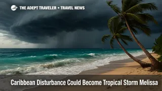
Caribbean disturbance could become Tropical Storm Melissa
Forecasters say Invest 98L in the central Caribbean has a very high chance to develop, with the National Hurricane Center indicating near certain formation later on October 21. The system already shows winds near tropical storm strength and could slow over warm waters, which would prolong heavy rain bands near the track. Travelers across the ABC Islands, Puerto Rico, Hispaniola, Jamaica, and Cuba should monitor updates closely as timing and exact path remain uncertain.
National Hurricane Center outlook for Invest 98L
As of the 8:00 a.m. Eastern outlook on October 21, the National Hurricane Center reported a consolidating low in the central Caribbean, producing winds up to 45 miles per hour. Formation odds are listed as near 100 percent over both 48 hours and seven days, and Air Force Hurricane Hunters are scheduled to investigate. The outlook highlights potential heavy rain and gusty winds for the ABC Islands within the next day or two, with expanding risk to parts of the Greater Antilles later this week. If named, the storm would be Tropical Storm Melissa per the 2025 Atlantic list.
Latest developments
Outlook language points to weak steering currents, which can slow a system and keep rain bands parked over land. A slower, strengthening storm would be more prone to a northward bend toward Hispaniola; a weaker, faster system could continue west toward Jamaica or Cuba. Either scenario favors squalls, localized flooding, and rough surf along exposed coasts through late week.
Analysis
This is a classic watch setup for travelers. Airlines typically post change-fee waivers once watches or warnings are issued for key islands, or when forecast confidence improves. Keep an eye on carriers serving the northern Caribbean, then build longer connections across the region once convective bands start pulsing. Within cruising, lines may preemptively swap port calls or shift sea days if harbor conditions deteriorate; our prior Caribbean disturbance watch provides a baseline for how those changes roll out, and Haiti calls remain suspended on many Eastern Caribbean itineraries due to separate security advisories. See our recent coverage for context and planning. Caribbean tropical disturbance may alter late-week cruises, Haiti calls suspended, Labadee winter.
If the system becomes Tropical Storm Melissa, the immediate traveler impact will be timing. Rain bands and surf arrive before the center, so shore excursions and beach plans can be curtailed even without a direct pass. You can reduce friction by enabling airline and cruise app alerts, staying flexible on port days, and tracking official advisories. The naming convention matters for search and alerts as well, since carriers and lines will reference "Tropical Storm Melissa" in customer notices.
Final thoughts
Confidence is high that Invest 98L will be classified as Tropical Storm Melissa, but confidence is lower on how quickly it strengthens and where it turns. Treat the next forty eight hours as a planning window, then pivot once watches or waivers post. We will update this watch with airline waivers and cruise itinerary changes once official notices publish, and we will continue tracking Tropical Storm Melissa through the week.