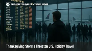
Thanksgiving Storms Threaten U.S. Holiday Travel
Two developing storm systems are now the main weather risk for Thanksgiving travel in the United States, with forecasters warning of heavy rain, pockets of snow, and low clouds moving across major highway and air corridors between Monday, November 24, and Sunday, November 30. That timing overlaps almost perfectly with a record Thanksgiving travel period, when AAA projects 81.8 million Americans will go at least 50 miles from home, including roughly 73 million drivers and just over 6 million flyers, which raises the odds that even routine delays can snowball in busy corridors.
AAA and multiple outlets are now framing weather, not the recently lifted Federal Aviation Administration flight caps or the earlier shutdown driven demand shock, as the dominant variable for Thanksgiving trips. That shift means the evolving forecast should actively shape plans, from adjusting departure days to building larger buffers around connections at vulnerable hubs and watching for the first wave of airline change fee waivers.
Thanksgiving Week Storm Setup
Meteorologists now outline a two storm pattern for Thanksgiving week. The first system is expected to organize over the southern Plains on Monday, November 24, then pull a shield of rain across Texas and the lower Mississippi Valley into the Southeast and possibly the Mid Atlantic and Northeast on Tuesday. That track would put major hubs such as Dallas Fort Worth International Airport (DFW), Houston George Bush Intercontinental Airport (IAH), Hartsfield Jackson Atlanta International Airport (ATL), Charlotte Douglas International Airport (CLT), and the New York airports under a band of rain and low clouds during one of the single busiest pre holiday travel windows.
A second disturbance is forecast to come ashore in the Pacific Northwest early in the week, bringing rain to coastal Washington and Oregon before sweeping inland over the Rockies and central United States. As it taps colder air, this system could flip some locations in the Upper Midwest and northern New England from rain to several inches of snow, with early scenarios highlighting parts of Iowa, Minnesota, northern Michigan, and interior New England for slick roads and visibility drops, even though formal winter storm or blizzard warnings are not yet posted.
Background. The National Weather Service and its Weather Prediction Center issue these outlooks several days in advance, focusing first on large scale rain and snow patterns, then tightening the forecast toward specific cities, snowfall totals, and severe weather risks as shorter range models come into focus. Travelers should expect the picture to sharpen every 6 to 12 hours as new model runs arrive, while key messages about timing and general storm tracks often stay consistent even when details move.
Latest Developments
The most useful way to think about this pattern is day by day, aligning the forecast with the main Thanksgiving travel peaks.
Monday, November 24. The first storm begins to organize over the southern Plains, with rain and embedded thunderstorms likely across parts of Texas and Oklahoma and along stretches of Interstates 10, 20, and 35. Flight operations at Dallas Fort Worth and Houston Bush should still be manageable, but heavier showers or isolated storms could trigger brief ground stops or slowed arrival rates, especially in the evening.
Tuesday, November 25. This is the biggest early pinch point. As the first storm taps Gulf moisture and races east, forecasters expect a broad swath of rain and low clouds from Texas across the Deep South into the Carolinas and potentially up the Interstate 95 corridor into the Mid Atlantic and parts of the Northeast. That aligns almost perfectly with AAA's projected outbound peak, which sees heavy afternoon traffic around major metros and very full flights at hubs such as Atlanta, Charlotte, the New York area airports, and Washington, D.C. area airports. Heavy rain, ponding on runways, and reduced visibility can cut arrival and departure rates, which is how delay chains spill into airports far from the storm itself.
Drivers on Tuesday should expect the worst conditions along I 10 from Houston to New Orleans, I 20 between Dallas and Atlanta, and I 95 from at least the Carolinas northward wherever the rain shield sets up. Even where thunderstorms do not reach severe thresholds, heavy downpours can hide standing water or cause brief hydroplaning, especially in the late afternoon peak when fatigue and distraction are common.
Wednesday, November 26. As the first storm lifts away from the East Coast, attention shifts to the second system emerging from the Rockies. Forecasts point to a corridor of rain stretching from roughly Missouri to Texas, with colder air dropping south on the western and northern flank of the storm. That brings a rain to snow transition risk into play across parts of the Upper Midwest, especially northern Minnesota and northern Wisconsin, and possibly into northern Michigan by late day or overnight. Minneapolis Saint Paul International Airport (MSP), Chicago O Hare, and Detroit Metropolitan Wayne County Airport (DTW) are among the big hubs to watch for tighter arrival spacing, deicing delays, and occasional ground holds as bands of heavier precipitation move through.
On the roads, this is the day when long north south runs on I 35 and I 29 and east west stretches of I 80, I 90, and I 94 in the Upper Midwest could encounter slushy or snow covered sections, especially after dark. Drivers who can leave earlier in the day, or shift their long legs into Tuesday or Friday instead, will have more room to dodge the worst bands.
Thanksgiving Day, Thursday, November 27. Early outlooks keep much of the Mid Atlantic, New York City, and Boston relatively dry or only seeing passing showers on Thanksgiving itself, which is good news for parades and short hop visits. The more active weather at this stage looks focused on a stripe from the central Plains into the Great Lakes and interior Northeast, where lingering rain and snow could continue to affect secondary airports and mountain passes. Most West Coast cities, outside the Pacific Northwest and parts of northern California, should see seasonable conditions with only light rain in the forecast.
Friday, November 28, through Sunday, November 30. Details for the post Thanksgiving return window are still less certain, but the broad idea is a cooler pattern settling into the central and eastern United States with pockets of rain and mountain or lake effect snow, while the West sees additional impulses driving showers into the Pacific Northwest and along parts of the California coast. Sunday remains the highest risk return day, as usual, because traffic volumes peak even when weather is only marginally bad. Any fresh storm pulses that align with that Sunday night rush would amplify delays at hubs like Atlanta, Chicago, and the New York airports.
Monday, December 1. By the official end of the AAA Thanksgiving travel period, most holiday travelers will already be home, and any lingering systems will interact more with routine commuter flows. Residual airline delays are still possible if crews and aircraft end Sunday out of position, but fresh disruption will depend on how quickly the pattern calms down after the second storm exits.
Analysis
For travelers, the key point is that weather, not capacity restrictions, is now the most important lever for Thanksgiving 2025. FAA flight caps put in place during the autumn government shutdown have been lifted at 40 busy airports, and staffing is improving, so the system is structurally better prepared than it was earlier in the month. However, high demand plus storm driven disruptions can still trigger rolling ground stops and missed connections when big hubs are hit on the wrong day.
The record forecast of 81.8 million travelers, including about 73 million drivers and more than 6 million air passengers, keeps pressure on highways and hubs even before a single raindrop falls. That means small changes in timing can deliver outsized benefits. Leaving by Sunday, November 23, or early Monday, November 24, for long drives in the South, or shifting outbound flights into Monday morning or very early Tuesday where the first storm has not arrived yet, may reduce both congestion and weather exposure. On the return side, travelers who can fly or drive home on Friday or Monday instead of Sunday often avoid the worst of the queues.
Airlines typically begin issuing travel waivers once confidence in a disruptive forecast increases, often 24 to 72 hours before the biggest impacts. Given the current guidance, watch for the first wave of flexible rebooking options focused on the southern Plains and Southeast sometime over the weekend, then for expanded waivers that cover East Coast and Upper Midwest hubs if model consensus strengthens. When those waivers appear, use them proactively to move flights away from the Tuesday outbound peak and the Sunday return peak, and, when possible, to non stop options that cut the risk of a missed connection.
Drivers have different levers. Shifting departure times off the late afternoon peak, planning alternate routes that avoid low lying, flood prone connectors, and checking real time state Department of Transportation maps for crashes and closures are all more useful during a busy storm week than the usual generic advice to "leave early." For anyone crossing mountain passes in the West or high terrain in the Upper Midwest and New England, carrying winter grade tires, traction devices where legal, and basic emergency supplies becomes more important when a rain to snow changeover is in play.
If you are already booked for flights that connect through Atlanta, Dallas, Houston, Chicago, Charlotte, or the New York area between November 24 and November 30, now is the time to check your airline's app for travel alerts, review your connection times, and decide which days offer the cleanest weather window along your specific route. If you still need to book, consider avoiding tight 35 to 45 minute connections at the largest hubs, and think about flying into or out of secondary airports that sit just outside the heaviest rain and snow bands when that option is practical.
Final Thoughts
Thanksgiving storms threaten U.S. holiday travel in a way that is more specific and more actionable than the usual "it will be busy" warnings, because two defined systems are now timed almost exactly with peak driving and flying days. With AAA projecting record travel and the weather pattern sharpening, the most resilient plans are the ones that match routes and dates to the evolving forecast, use waivers to dodge the worst windows, and build enough buffer that a ground stop or snow band becomes an inconvenience rather than a crisis. Travelers who adjust now, rather than waiting for alerts at the gate, will be better positioned to navigate whatever these Thanksgiving storms deliver.
Sources
- Nearly 82 Million Americans Projected to Travel over Thanksgiving
- AAA Expects Record Travel for Thanksgiving 2025
- Thanksgiving Travel: Where The Forecast Is Looking Stormy And Where It Is Not
- Multiple Thanksgiving Week Storms Expected To Impact Millions Of Travelers
- Two Storms Loom Over Busy Thanksgiving Week, Potentially Causing Travel Delays
- Weather Prediction Center, Medium Range Discussion
- AAA: Thanksgiving Travel To Hit Record Numbers
- Major FAA Update At 40 Airports, And It Affects Thanksgiving Plans