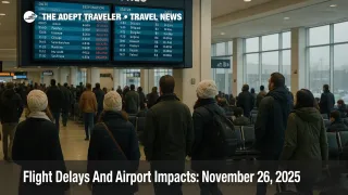
Flight Delays And Airport Impacts: November 26, 2025
Travelers flying through major United States hubs on Wednesday, November 26, 2025 face a day shaped by low clouds, gusty winds, and lingering thunderstorms at some of the busiest Thanksgiving airports. The Federal Aviation Administration, FAA, daily air traffic report highlights low clouds around Boston Logan International Airport (BOS), the three main New York airports, Philadelphia International Airport (PHL), Washington area airports, Seattle Tacoma International Airport (SEA), and San Francisco International Airport (SFO), while thunderstorms threaten to slow traffic at Hartsfield Jackson Atlanta International Airport (ATL) and Charlotte Douglas International Airport (CLT), and gusty winds are forecast at Chicago O Hare International Airport (ORD), Chicago Midway International Airport (MDW), Detroit Metropolitan Wayne County Airport (DTW), and Minneapolis Saint Paul International Airport (MSP). With record Thanksgiving volumes, a still constrained national airspace, and new flow controls into Florida, US airport delays November 26 2025 are likely to build into the afternoon, so travelers using these hubs should favor early flights, build extra connection time, and keep backup plans ready.
In plain terms, the FAA daily air traffic report shows that US airport delays November 26, 2025 will center on low ceilings in the Northeast and on the West Coast, thunderstorms in the Southeast corridor, and winds in the upper Midwest, layered over a network that remains partially capacity capped after the recent government shutdown.
Low Clouds At Northeast And West Coast Hubs
The clearest signal in today s FAA outlook is a belt of low clouds stretching across Boston, New York, Philadelphia, and the Washington, District of Columbia area, then reappearing at Seattle and San Francisco. For travelers, that combination typically translates into slower arrival rates, longer final approach spacing, and occasional holding or ground delay programs during peak banks.
At Boston Logan, low ceilings can force use of specific instrument approaches that reduce how many aircraft can land each hour, especially when winds limit runway configuration options. In the New York terminal area, which includes John F. Kennedy International Airport (JFK), LaGuardia Airport (LGA), and Newark Liberty International Airport (EWR), low clouds stacked on top of heavy Thanksgiving schedules make it harder for controllers to maintain rapid arrival and departure sequences, so even short slowdowns can ripple into wide schedule delays. Philadelphia sits in the same weather regime, but today it carries an extra complication.
According to the FAA Air Traffic Control System Command Center operations plan, a dedicated Philadelphia arrival delay advisory has been issued because the instrument landing system on Runway 27R is out of service at the same time low ceilings are present, which further limits the arrival rate and increases the odds of extended holding or metering. In Washington, Ronald Reagan Washington National Airport (DCA) has already been placed under a ground stop due to low ceilings, a strong signal that at least part of the day will bring rolling arrival or departure holds at one of the region s most constrained urban airports.
On the West Coast, low clouds at Seattle and San Francisco bring their own operational quirks. Seattle Tacoma often sees morning marine layers that cut visibility and force arrivals into specific approach paths, and San Francisco s famously strict runway spacing rules under instrument conditions can sharply reduce how many simultaneous arrivals are possible when ceilings drop. For passengers, the pattern is similar in all of these hubs, early flights have a better chance of escaping before metering takes full effect, while mid day and afternoon banks are likely to encounter longer taxi queues, airborne holding, or both.
Thunderstorms In The Southeast Corridor
While the Northeast and West deal with low clouds, the Southeast faces pockets of thunderstorms that could slow key connection banks at Atlanta and Charlotte. The FAA points specifically to thunderstorms that may slow flights at Hartsfield Jackson Atlanta International Airport and Charlotte Douglas International Airport, two of the most important connection hubs for routes linking the Midwest and Northeast to Florida, the Caribbean, and Latin America.
Thunderstorms rarely shut these airports entirely, but they do force rerouting around storm cells, impose temporary ground stops during lightning or microburst activity, and reduce the number of usable arrival and departure paths when cumulonimbus build directly along preferred corridors. With the FAA also publishing a flow constrained area, FCA003, to meter traffic from the central United States into Florida in order to relieve volume in Jacksonville center airspace, flights from the Midwest into Florida face an extra layer of delay risk even when their origin weather seems benign.
If you are connecting through Atlanta or Charlotte today, the practical implication is that mid day and afternoon connections into Florida, the Gulf Coast, and island destinations are more likely to see creeping delays than morning departures. A 50 or 60 minute connection that might be safe on a typical weekday becomes fragile when thunderstorms and flow restrictions bite into departure rates, so building at least a 2 hour buffer through these hubs is prudent.
Windy Midwest Hubs And Capacity Limits
The third weather piece is gusty wind across the upper Midwest. The FAA highlights gusty winds at Chicago Midway and Chicago O Hare, Detroit, and Minneapolis Saint Paul, all of which are already operating on tight capacity margins during the holiday peak. Strong or shifting winds can force airports to favor crosswind tolerant runways, limit departures when tailwinds approach safety limits, or require additional spacing between arrivals, each of which trims hourly throughput.
Those weather driven constraints sit on top of a structural capacity reduction that has been in place for weeks. Earlier this month, the FAA ordered phased flight reductions at 40 high impact airports to protect safety as controller staffing was stretched by the protracted federal government shutdown, initially targeting cuts of up to 10 percent. A subsequent order froze those flight reductions at 6 percent instead of ramping to the full 10 percent after air traffic controller callouts began to improve, leaving the system operating with a slightly reduced but steadier schedule going into Thanksgiving week.
For travelers, that means that hubs such as Chicago O Hare, Chicago Midway, Detroit, and Minneapolis are not experiencing the acute schedule cuts of mid November, but they are also not back at full pre shutdown capacity. When gusty winds or upstream weather delays hit, there are fewer spare slots to absorb catch up surges, so minor disruptions can turn into longer delays during mid day and late afternoon peaks.
How Today Fits Into The Thanksgiving Surge
The FAA expects this Thanksgiving holiday travel period to be the busiest in 15 years, with more than 360,000 flights scheduled between November 21 and December 1 and Tuesday, November 25, forecast as the single busiest day with more than 52,000 flights. Airlines and industry groups estimate that roughly 31 million passengers will fly over the broader holiday window, with average daily passenger volumes near 2.8 million and peak flows on the Sunday return.
At the same time, the federal government shutdown that triggered the November capacity cuts has finally ended, and FAA officials now describe the aviation system as back to normal, even as they keep the 6 percent reductions in place at the 40 previously targeted airports until safety metrics stabilize further. In practical terms, that means more flights are operating than during the peak of the shutdown, but the network still has less slack than in a typical pre pandemic year when controllers and support staff were fully resourced.
Against that backdrop, today sits between the record outbound wave of November 25 and the heavy weekend return flows. Schedules are still dense, aircraft are heavily booked, and recovery options are limited, so any delays driven by low clouds in the Northeast, thunderstorms in the Southeast, or winds in the Midwest are more likely to cascade as the day wears on.
Practical Tips For Travelers On November 26
If you are flying today, especially through Boston, the New York area, Philadelphia, Washington National, Atlanta, Charlotte, Chicago, Detroit, Minneapolis, Seattle, or San Francisco, the best leverage you have is time. Where possible, move to the earliest departure from your origin, particularly if your itinerary connects through one of these hubs into Florida, the Caribbean, Mexico, or Europe, because early flights are more likely to depart close to schedule and give you more fallback options if delays build later in the day.
Second, treat short connections as a luxury the system does not support well on a day like this. Aim for at least 2 hours between domestic legs at the most affected hubs and at least 3 hours where a domestic leg connects into a long haul international flight. This is especially important if you are relying on the late afternoon and evening departure banks to Florida and transatlantic destinations out of Newark, Philadelphia, Boston, New York, Chicago, or San Francisco, where combined weather and flow constraints can shave minutes off the connection margin without warning.
Third, lean on digital tools. Airline apps and text alerts remain the fastest way to see rolling delay estimates, gate changes, and equipment swaps, while the FAA s National Airspace System Status page and delay map show whether your airport is under a ground stop, a ground delay program, or simple volume related spacing. Check those tools before leaving for the airport, then again at security and at the gate, and be prepared to rebook yourself through alternative hubs if your initial connection starts to slip.
Fourth, protect onward travel. If your flight today connects to a cruise departure, an escorted tour, or a long distance train, assume that low clouds, storms, and capacity limits could eat into your buffers. Where possible, arrive in your embarkation city at least a day early, or choose flexible transfer options that allow you to retime pickups or ground segments without steep penalties.
Finally, treat today as part of a broader risk pattern. Our earlier analysis of Thanksgiving storms and shutdown era flight caps provides a deeper structural backdrop, including specific regional storm tracks and the mechanics of FAA flow programs, and those pieces are worth revisiting if you are flying again later this week. Adept Traveler s evergreen Guide To US Airport Delays And Cancellations walks through insurance, backup planning, and rebooking strategies that can soften the blow if disruptions extend into the weekend or if new weather systems emerge.
Sources
- FAA Daily Air Traffic Report, November 26 2025
- FAA ATCSCC Advisory 041, November 26 2025 Operations Plan
- National Airspace System Status Dashboard
- FAA Expects Busiest Thanksgiving Travel Period in 15 Years
- Flight Reductions To Hold At 6 Percent Amid Rapid Decline In Controller Callouts
- FAA Says Air Travel Is Back To Normal As Millions Prepare To Fly This Thanksgiving
- Airlines Expect A Record 31 Million Flyers Over Thanksgiving
- Thanksgiving Travelers, Hurry Up And Wait. Expect Crowds And Bad Weather
- Flight Delays And Airport Impacts: November 24, 2025
- Thanksgiving Storms Threaten U.S. Flights Nov 25-26