Flight Delays And Airport Impacts: November 27, 2025
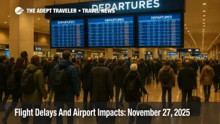
Winter storms, low clouds, and holiday demand are creating US airport delays November 27 2025 at key hubs like Chicago O Hare, New York, Seattle, and South Florida, as the Thanksgiving rush continues. Travelers passing through these airports and nearby spokes face elevated risks of departure holds, reroutes, and missed connections, especially on mid day and afternoon banks. Most passengers will still reach their destinations, but they should expect longer lines, allow extra buffer for connections, and be ready to adjust routings if conditions worsen.
Put simply, the FAA operations plan and national weather forecasts show that US airport delays November 27 2025 are being driven by lake effect snow around the Great Lakes, low ceilings and wind in the Northeast and Pacific Northwest, thunderstorms near South Florida, and ongoing runway and taxiway construction at several major hubs, all layered on top of a still tight post shutdown system.
Storm systems and holiday volume shape today's pattern
Thanksgiving week air travel is near a fifteen year high, with the FAA projecting roughly three hundred sixty thousand flights across the holiday period and more than fifty thousand in a single day at the peak earlier this week. Officials stress that controllers are now adequately staffed for the holiday after the autumn government shutdown and flight cut period, but they continue to warn that weather and residual staffing gaps can still cause meaningful delays.
For today, national forecasts highlight a belt of intense lake effect snow and strong winds in the Great Lakes snow belts, especially along the Interstate 90 corridor from Cleveland to near Buffalo, and continuing into western Michigan. The Weather Channel singles out Cleveland Hopkins International Airport as a likely impact point on Thanksgiving Day, with localized whiteout conditions possible in nearby bands. At the same time, a developing system in the Pacific Northwest is bringing showers and gusty winds to Seattle and Portland, while post frontal winds and cooler air keep New England and parts of the Northeast choppy even where skies are mostly clear.
Third party airline and travel reporting already confirms delays and cancellations across major hubs, particularly in the Midwest and Northeast, with Chicago O Hare International Airport, LaGuardia Airport, John F. Kennedy International Airport, and Denver International Airport all experiencing weather related disruptions this morning. The same coverage notes knock on impacts at San Francisco International Airport and Los Angeles International Airport as heavy national flows and reroutes ripple across the system.
What the FAA operations plan is signaling
The clearest official signal for November 27 comes from the Air Traffic Control System Command Center operations plan. An early advisory, ATCSCC Advisory 005, shows a ground stop at John F. Kennedy International Airport around midnight Eastern that was expected to be extended due to excessive demand, an active Ground Delay Program at Chicago O Hare into the overnight hours, and the possibility of a Ground Delay Program at Harry Reid International Airport in Las Vegas after 0500Z. The same advisory flags low ceilings at Boston Logan International Airport, the New York terminal area, and Seattle Tacoma International Airport, thunderstorms at Philadelphia International Airport, and winds affecting Detroit Metropolitan Wayne County Airport, Chicago O Hare and Chicago Midway International Airport, and Indianapolis International Airport.
By the midday update, ATCSCC Advisory 039 shows the focus shifting southward. Washington National and New York reliever airports Teterboro and White Plains are removed from the plan as demand and crosswinds become manageable, but Miami International Airport, Fort Lauderdale Hollywood International Airport, and Palm Beach International Airport are added for possible ground stops after 1800Z due to forecast thunderstorms. Terminal constraint notes still list low ceilings at Seattle and winds in the Great Lakes tower facilities, while en route constraints highlight thunderstorms across the Boston, New York, Miami, and Houston en route centers, plus an ongoing suspension of preferred routes in the Washington en route center through late February.
For travelers, these advisories mean that the clearest structural pressure points today are early congestion and demand management at JFK and O Hare, evolving thunderstorm risks and reroute constraints into South Florida, and weather driven spacing restrictions at Seattle and several Great Lakes hubs. Even if your particular flight is not under a formal Ground Delay Program, you may still see flow related reroutes, departure metering, or extended taxi times into and out of these regions.
Runway works and volcanic ash add extra friction
In addition to weather, several high profile runway and taxiway projects are trimming usable capacity at major airports. The operations plan lists a temporary closure of Runway 16R 34L and ongoing taxiway phase three construction at Seattle Tacoma International Airport, a closure of Runway 17L 35R at Denver International Airport, multiple runway and taxiway closures at Nashville International Airport, east side taxiway construction at Chicago O Hare, runway rehabilitation at Chicago Midway, the closure of Runway 14 32 at Palm Beach International Airport, and phase 5.1 construction at San Diego International Airport. Any of these constraints can shave a few percentage points off arrival and departure rates during peak periods.
On the international side, the most recent ATCSCC advisory is a volcanic activity bulletin for Guatemala's Santa Maria volcano, issued by the Washington Volcanic Ash Advisory Center. It tracks ash plumes to around Flight Level 140 moving west from the summit, with forecasts showing dispersion within about twelve hours and no ash expected after the overnight window. While this is primarily an issue for Central American routes, some U S bound flights from the region may be rerouted or altitude restricted as a precaution.
How this compares with Wednesday
Compared with Wednesday's pattern, described in yesterday's Flight Delays And Airport Impacts: November 26, 2025, today's risk map shifts some focus from the Northeast and West Coast toward the Great Lakes and South Florida. Low clouds and winds remain a common thread for Boston, New York, and Seattle, but lake effect snow near Cleveland, Buffalo, and parts of Michigan, plus the thunderstorm threat in Miami and Fort Lauderdale, are more prominent ingredients.
At the same time, the system is operating under slightly less structural strain than earlier in November, when a record long government shutdown forced the FAA to cut roughly ten percent of flights at about forty major airports and left thousands of controllers working unpaid. Those cuts have since been eased to around six percent and then frozen, and official comments this week emphasize that air traffic staffing is now sufficient to handle the holiday period, even though airlines and airports are still recovering from the backlog of earlier delays and cancellations.
Airport by airport risk snapshot
In the Northeast, travelers connecting through Boston Logan, the New York metro airports, and Philadelphia should still expect weather driven metering, especially in the morning and early afternoon. Low ceilings and winds can reduce arrival rates and force controllers to use more conservative approach patterns, which tends to amplify the impact of any small schedule perturbations when terminals are as full as they are this week.
Across the Great Lakes and upper Midwest, the combination of lake effect snow and strong winds will be the main issue, particularly for flights touching Cleveland Hopkins, Detroit, Chicago O Hare, Chicago Midway, and Minneapolis Saint Paul. Localized snow bands can create sudden visibility drops on final approach paths and along departure corridors, which can in turn generate holding, miles in trail restrictions, or short notice diversion decisions.
In Florida, the key signal is the clustering of Miami, Fort Lauderdale, and Palm Beach in the FAA operations plan as candidates for afternoon and evening ground stops if thunderstorms develop near the terminals. Alongside that, a suite of flow constrained airspace advisories is already in place for general aviation and business traffic into the Miami and Boca Raton areas, which means that both private and commercial flights will be threading a narrower needle through crowded airspace later in the day.
For the West, Seattle Tacoma's runway work and low ceiling constraints stand out, with Portland also exposed to showers and gusty winds. Denver International Airport has a closed runway and remains sensitive to both crosswinds and any wraparound snow or low cloud bands from the broader storm pattern, and West Coast trunk routes into Los Angeles and San Francisco may inherit delays from upstream congestion in the Midwest and East even if their local weather is manageable.
Practical strategies for travelers today
Given this setup, the classic Thanksgiving playbook remains the smartest approach. Early departures usually offer the best odds of leaving on time, so if you can move to a first wave flight out of New York, Chicago, Cleveland, Miami, Fort Lauderdale, Seattle, or Denver, the extra alarm clock pain may pay off in reduced risk.
Connections under two hours through those hubs should be treated as fragile, particularly for itineraries that continue onward to Florida, the Caribbean, Mexico, or Europe. Where possible, build three hour buffers, avoid last departures of the day on critical legs, and consider single stop routings that keep you inside one airline's network so that rebooking options are wider if things unravel.
If your plans hinge on a same day cruise departure, tour start, or long distance train, it is safer to arrive in the gateway city a full day early given the weather and construction picture. For those locked into tight timing, flexible airport transfers and refundable hotels can create vital room to maneuver if inbound flights slip.
Finally, watch both your airline's app and the FAA's public delay tools for updates throughout the day. Ground delay programs and route advisories often evolve every few hours, and seeing an early signal that your airport has moved into the "program possible" bucket can give you time to ask for a rebooking before queues grow. Travelers who remain flexible on routing and timing will be best positioned to ride out today's mixed pattern of storms, winds, and runway work across the United States network.
Sources
- FAA Daily Air Traffic Report index
- ATCSCC Advisory 005, November 27 2025 Operations Plan
- ATCSCC Current Operations Plan Advisory 039, November 27 2025
- ATCSCC Most Recent Advisory, Santa Maria volcanic ash bulletin
- FAA Thanksgiving 2025 travel outlook
- Thanksgiving Travel Weather Forecast, The Weather Channel
- Now, Flight Delays, Cancellations and Long Lines: Severe Weather Hits US Thanksgiving Travel
- Thanksgiving air travel plans cut by US government shutdown, Reuters
- US airlines brace for government mandated flight cuts, Reuters
- US freezes flight cuts at 6 percent as controller absences shrink, Reuters