Flight Delays and Airport Impacts: Feb 23
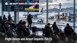
FAA planning for Monday, February 23, 2026, points to a weather dominated system day, with Winter Storm Hernando driving cancellations and delays across the Northeast airspace complex. Travelers moving through Boston Logan International Airport (BOS), Newark Liberty International Airport (EWR), John F. Kennedy International Airport (JFK), LaGuardia Airport (LGA), and Philadelphia International Airport (PHL) face the highest risk of missed connection banks and limited same day rebooking. The practical move is to treat this as a network problem, not a single airport problem, and either reroute away from the Northeast core, shift to the recovery window, or postpone discretionary trips.
The change that matters for traveler outcomes is that the FAA daily air traffic report explicitly ties delays and cancellations to Boston, the New York metro airports, and Philadelphia, with wind also raising risk in the Washington, D.C., region. That combination is the classic failure mode where multiple major hubs degrade at once, which removes the usual escape hatches because alternates share the same constrained airspace and weather regime. The FAA Command Center's operations plan also signals that broad Northeast ground delay program references were removed because cancellations are already absorbing demand, but ground stop language remains on the table for key Northeast airports through late evening.
Who Is Affected
The highest exposure group is anyone whose itinerary relies on the Northeast hub and spoke machine, including transatlantic arrivals into the New York area, Florida and Caribbean connections through the New York and Philadelphia banks, and short haul spokes that only operate a few times per day. When Boston Logan, the New York metro airports, and Philadelphia are simultaneously constrained by snow, low ceilings, visibility, and wind, you can lose both your inbound aircraft and your rebooking inventory at the same time, which is why "my departure city looks fine" is a trap on days like this.
Travelers connecting through the Washington, D.C., area also need to watch the wind and ceiling component closely. FAA guidance flags gusty winds as a delay driver for Baltimore Washington International Thurgood Marshall Airport (BWI), Ronald Reagan Washington National Airport (DCA), and Washington Dulles International Airport (IAD), which matters because Washington area disruptions often show up as missed late afternoon connections and cascading evening delays when aircraft rotations arrive behind schedule.
There is also a quieter, second layer risk for travelers nowhere near the storm footprint. When the Northeast cancels aggressively, airlines protect remaining aircraft and crews for the next recovery day, which can cause late day cancellations at out of region airports because the inbound aircraft never arrives, or arrives too late to operate legally under crew duty time limits. The FAA plan also notes tactical reroutes tied to military activity affecting flows toward central Florida, plus additional tactical reroutes east of Miami, which can turn a "normal weather" Florida arrival into longer routings and connection breakage.
What Travelers Should Do
Start with immediate actions that preserve options. Open your airline app, check your flight status, then check the inbound aircraft and its prior station, because the earliest warning is often that your plane never left its last airport. If your itinerary touches Boston Logan, the New York metro airports, or Philadelphia, assume customer service lines will be long once the cancellation wave builds, and move yourself into a protected itinerary before you are forced into airport counter triage.
Use a real decision threshold for rebooking versus waiting, and do not negotiate with false hope. Rebook if you are down to one remaining departure that still gets you to your destination without an overnight stay, or if your connection is under about 90 minutes through the New York or Philadelphia system. Waiting is only rational when you are protected on a single ticket, you have multiple later backups that still meet your hard constraints, and you can tolerate the realistic failure modes, including de icing queues, gate holds, and rolling ground stops.
Over the next 24 to 72 hours, monitor the signals that actually move outcomes, not social media noise. Watch for continued FAA ground stop language at Northeast airports into the evening, because that implies arrival rates are not recovering inside the day. Watch your carrier's waiver terms and seat maps, because waivers only help while inventory exists. Watch whether cancellations spill into Tuesday schedules, because that is the tell for aircraft and crew mispositioning rather than a clean one day weather hit.
How It Works
When winter weather reduces how fast aircraft can land and depart safely, the system's main lever is metering demand to match reduced arrival rates. Snow, low ceilings, reduced visibility, and strong winds expand spacing on approaches and departures, shrink runway acceptance rates, and slow surface movement, all while de icing and snow removal consume time and pavement capacity. That is why FAA planning often pairs a weather description with operational tools like ground stops and ground delay programs, because the goal is to prevent airborne holding from becoming unsafe or unmanageable.
The disruption propagates in layers, and the traveler pain often shows up away from the storm. The first order effect starts at the Northeast hubs, airlines cancel to match reduced capacity, remaining flights absorb longer taxi times and gate holds, and connection banks compress. The second order ripple spreads across the network, aircraft and crews drift out of position, duty time limits trigger additional cancellations, and what looked like a local storm becomes a next day schedule integrity problem. A third layer lands on the ground, hotel inventory tightens near major hubs, car rentals and rail alternatives fill, and travelers attempt to reroute through secondary airports that may still be constrained by the same regional airspace limits.
For travelers who want deeper structural context on why the U.S. system runs brittle under stress, and why New York area constraints can ripple nationwide, see U.S. Air Traffic Control Privatization: Reality Check. For immediate storm related context from the prior day, see Northeast Blizzard Grounds NYC, Philly Flights Feb 22 and Flight Delays and Airport Impacts: Feb 22.