Flight Delays and Airport Impacts: March 13
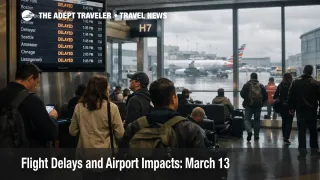
March 13 flight delays are shaping up as a wind driven hub risk day, not a full system meltdown. The Federal Aviation Administration said on Friday, March 13, 2026, that high winds could slow flights in Boston, New York, Philadelphia, Washington, Chicago, Minneapolis, and Denver, while low clouds may delay Seattle. That matters because the weather footprint overlaps with several of the country's most connection heavy airports, and Chicago O'Hare International Airport (ORD) was already showing both an arrival traffic management program averaging 43 minutes for some inbound flights and general departure delays of more than an hour early in the day. Travelers should check status before leaving for the airport, avoid tight same day connections through the biggest hubs, and treat checkpoint time and flight time as two separate risks today.
March 13 flight delays matter most for travelers moving through hub airports rather than those flying simple local nonstop trips. The FAA's daily report is broad by design, but the first live signs of strain at O'Hare show how a weather alert can turn into a real connection problem once wind, sequencing limits, and traffic management programs start stacking together. That makes this a planning day, not a panic day.
March 13 Flight Delays: What Changed
The core change from calmer operating days is the size of the wind corridor. The FAA's March 13 report flags major East Coast airports, both large Chicago airports, Minneapolis St. Paul, and Denver for weather related slowdown risk, with Seattle also facing possible low cloud delays. That is a wide map, and it matters because these are not isolated leisure airports. They are hubs and spoke endpoints that push delay risk into onward flights later in the day.
Chicago O'Hare is the clearest early warning sign. FAA status information showed an arrival traffic management program tied to equipment or outage conditions, with average inbound delays around 43 minutes, while general departure traffic was already seeing gate hold and taxi delays between 1 hour 1 minute and 1 hour 15 minutes, and increasing. The main traveler takeaway is simple, a March 13 ticket through Chicago is now a reliability question, not just a schedule question.
The FAA command center's current operations advisory also pointed to possible ground stop or delay programs later in the day at Denver, Ronald Reagan Washington National Airport (DCA), LaGuardia Airport (LGA), Fort Lauderdale Hollywood International Airport (FLL), Miami International Airport (MIA), Minneapolis St. Paul International Airport (MSP), and Philadelphia International Airport (PHL). Possible does not mean certain, but it does tell travelers where the next layer of pressure may form if conditions deteriorate this afternoon and evening.
Which Travelers Face the Most Airport Impact
The most exposed travelers are the ones trying to use big hubs as precise transfer machines. Same day domestic to international connections, separate ticket itineraries, final departures of the day, and trips with prepaid timed commitments on arrival all carry more risk than a straightforward origin to destination nonstop. Wind days often look manageable on paper until arrival spacing grows, aircraft and crews fall out of position, and later banks inherit delays from earlier ones. That first order effect is slower departures and arrivals. The second order effect is missed onward flights, disrupted car pickups, and hotel check in plans pushed later into the evening.
Chicago is not the only place to watch. The FAA's daily report puts New York area airports, Boston Logan International Airport (BOS), Philadelphia, the Washington airports, Denver International Airport (DEN), and Minneapolis St. Paul in the same wind risk bucket, which means travelers connecting across multiple hubs should not assume a backup routing will be clean. In other words, a rebook from one stressed hub to another may only move the problem, not solve it.
Checkpoint strain is the separate airport problem. Adept Traveler's recent reporting has already shown that shutdown linked TSA variability is making some spring break airport lines less predictable, even when the flight operation itself is still moving. A flight that departs on time does not help if the security line breaks the itinerary first.
What Travelers Should Do Now
Start with the basic threshold. If your itinerary depends on a tight connection through Chicago, New York, Boston, Philadelphia, Washington, Minneapolis, or Denver on March 13, recheck your reservation before heading out, and strongly consider a proactive change if the next available option is materially safer. Travelers with weddings, cruises, tours, or long haul departures on the far side of a domestic connection should lean toward protecting the trip, not squeezing the schedule.
If your trip is a simple nonstop and the inbound aircraft is still reasonably on track, waiting may be the better move. Wind days are uneven. Some flights will operate with tolerable delay, while others slip badly once runway flow rates tighten. The practical decision point is whether a moderate delay is merely inconvenient or whether it breaks something expensive and hard to replace after arrival. That tradeoff matters more than the raw delay number alone.
At the airport, add extra buffer even if your app still looks normal. The safest approach today is to separate three clocks, security, boarding, and pushback. Those clocks can fail independently. Travelers should keep monitoring the FAA live status picture, their airline notifications, and airport security conditions over the next several hours, especially if flying in late afternoon and evening banks when network ripple effects usually grow. Related coverage that may help: Flight Delays and Airport Impacts: March 11, TSA Shutdown Strain Deepens at U.S. Airports, and United Spring Break Forecast Raises Airport Stress.
Why Wind and Low Clouds Spread Delays So Fast
The mechanism is straightforward. When high winds affect major hubs, air traffic controllers may need wider spacing between aircraft or different runway use, which reduces how many planes can arrive and depart in a given period. That does not always produce a headline ground stop, but it does reduce throughput. Once throughput drops at major banks, aircraft queue longer, crews time out more easily, and downstream flights inherit delay from assets that are now late leaving the prior city. The FAA's daily report is essentially warning travelers where that throughput squeeze is most likely to appear.
Low clouds work differently, but the result can look similar to passengers. Cloud related restrictions can reduce arrival efficiency and make sequencing harder, especially at busy airports that already have little slack. Seattle is the only airport specifically called out for low clouds in the FAA's March 13 report, but the broader lesson is that localized weather at one hub can still spread into city pairs and aircraft rotations elsewhere.
Chicago deserves special attention because it is carrying both the daily weather risk and live delay evidence already. On top of that, O'Hare is entering a period where the FAA is already trying to reduce overscheduling for the summer season, a sign that spare capacity there remains tight. Travelers moving through O'Hare today should assume the system has less room to absorb small disruptions than they would prefer. FAA Pushes O'Hare Summer Cuts Deeper Into Peak Season adds useful context on that broader capacity issue.
Sources
- FAA Daily Air Traffic Report, March 13, 2026
- FAA Chicago O'Hare International Airport (ORD) Real Time Status
- FAA Current Operations Plan Advisory, March 13, 2026
- Flight Delays and Airport Impacts: March 11
- TSA Shutdown Strain Deepens at U.S. Airports
- United Spring Break Forecast Raises Airport Stress
- FAA Pushes O'Hare Summer Cuts Deeper Into Peak Season