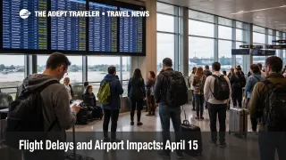
Flight Delays and Airport Impacts: April 15
April 15 flight delays are shaping up as a split weather and air traffic control day rather than a single national choke point. The Federal Aviation Administration said on Wednesday, April 15, 2026 that thunderstorms could disrupt Detroit Metropolitan Wayne County Airport (DTW) and both Chicago hubs, wind could slow Boston Logan International Airport (BOS), the New York airports, and Philadelphia International Airport (PHL), and low clouds could reduce flexibility at Seattle-Tacoma International Airport (SEA). The practical risk is highest for travelers connecting through Boston and Chicago this afternoon and evening, and the safest move is to protect tight same day onward plans before airport slowdowns compound.
April 15 Flight Delays: What Changed
The clearest operational change by midafternoon was that Boston had already moved from forecast risk into a live FAA traffic management program. FAA status showed arriving flights bound for Boston being delayed an average of 1 hour and 15 minutes because of weather and low ceilings, with those delays being pushed back to departure airports across the network. Chicago O'Hare International Airport (ORD) was also running under more serious surface delay than the broader national picture alone suggested, with FAA status showing thunderstorm related departure gate hold and taxi delays of 46 minutes to 1 hour and increasing. By contrast, LaGuardia Airport (LGA), Newark Liberty International Airport (EWR), John F. Kennedy International Airport (JFK), Chicago Midway International Airport (MDW), Philadelphia, Detroit, and Seattle were still mostly reporting delays of 15 minutes or less when those airport status pages were last updated.
That makes April 15 different from a generic bad weather day. Boston is already in formal metering, which means travelers elsewhere can be delayed before they even board if they are flying into Logan. Chicago, meanwhile, is still the main place where local thunderstorms can turn a manageable schedule into rolling late turns, missed connections, and aircraft arriving out of position later in the day. The FAA's live operations plan also said a ground stop or ground delay program was possible for ORD and MDW after 1900 Zulu, with a possible ground stop for Detroit after 0000 Zulu.
Which Travelers Face The Most Disruption
The most exposed travelers are people connecting through Boston or Chicago during afternoon and evening banks, especially those linking into transatlantic departures, last flight of the day domestic segments, cruises, tours, or long distance ground transfers that do not absorb late arrivals well. Boston's current delay program matters far beyond Massachusetts because flights headed there are being held at origin, which can distort aircraft and crew rotations in other cities even if those airports are still operating near normal. Chicago matters for a different reason, because thunderstorm disruption at one of the country's largest hubs tends to spread through aircraft sequencing and crew timing across multiple airline networks.
Travelers using the New York airports and Philadelphia should not treat the day as clear just because airport pages still show only minor delays. The FAA operations plan listed BOS, the New York terminal complex, and Philadelphia under wind constraints, and it kept the New York metro hotline and traffic swap tools active into the evening. That usually means the system is still managing airspace carefully even before airport level delays spike. Seattle is the other quieter watch point, with low ceilings listed in both the FAA daily report and the operations plan, plus an active runway closure that reduces margin if conditions worsen.
What Travelers Should Do Now
The first move is to protect any tight connection through Boston or Chicago before the late day banks fill up with disrupted passengers. For domestic to domestic connections, anything under about 90 minutes through the most affected hubs is now carrying more risk than the schedule suggests. For domestic to international connections, especially out of Boston and Chicago, travelers should be thinking in terms of preserving the long haul segment rather than squeezing the shortest legal layover. The tradeoff is simple, rebooking earlier can cost convenience, but waiting can cost the itinerary.
Travelers bound for Boston should also check their flight status before leaving for the airport, even if their origin airport appears normal. Because the FAA delay program is destination based, a traveler departing from a lightly affected city can still be held back on the ground for Boston flow control. Travelers heading into Chicago should expect the opposite pattern, a flight may board close to schedule but still sit in a gate hold or long taxi queue if thunderstorms tighten departure rates.
Over the next several hours, the signals that matter most are whether Boston's delay program lengthens, whether ORD and MDW move into a formal ground stop or ground delay program, and whether Detroit's later thunderstorm risk turns into active flow control. Airline apps remain the fastest passenger tool for gate and rebooking changes, but the FAA airport status pages and operations plan are the better way to judge whether a problem is staying local or turning into a broader network issue. In an earlier Adept Traveler article, Flight Delays and Airport Impacts: April 14, the main pressure point was Chicago inside a wider forecast map. In another earlier Adept Traveler article, Chicago Flight Delays Lead Broad U.S. Weather Day, that forecast had already started to harden into live delay at O'Hare.
How The Disruption Spreads Through Travel
The mechanism on April 15 is not one airport shutting down. It is several different constraints hitting high leverage hubs at once. Boston's low ceilings reduce arrival flexibility and trigger controlled metering, which pushes delay back to origin cities. Chicago's thunderstorms slow departures and make gate usage less predictable. Wind in the Northeast terminal complex can force wider spacing between flights, and low clouds in Seattle reduce tolerance on a part of the network that already has a runway closure in place. Each problem is manageable on its own, but together they create the kind of uneven national map that strands aircraft and crews away from their next scheduled legs.
That is where second order effects begin. A late aircraft into Boston can delay an outbound turn to another city. A Chicago departure held close to an hour can cause a missed onward connection even if the second airport has good weather. A traveler who lands only 30 to 45 minutes late can still lose a rail booking, airport hotel shuttle window, or evening rental car pickup if the whole itinerary was built too tightly. FlightAware's national data also showed more than 1,300 delays within, into, or out of the United States on April 15, which is consistent with a stressed but not collapsed system.
Sources
- FAA Daily Air Traffic Report, April 15, 2026
- FAA Current Operations Plan Advisory, April 15, 2026
- FAA Boston Logan International Airport Status
- FAA Chicago O'Hare International Airport Status
- FAA LaGuardia Airport Status
- FAA Newark Liberty International Airport Status
- FAA John F. Kennedy International Airport Status
- FAA Chicago Midway International Airport Status
- FAA Detroit Metropolitan Wayne County Airport Status
- FAA Philadelphia International Airport Status
- FAA Seattle-Tacoma International Airport Status
- FlightAware Live Flight Delay and Cancellation Statistics