Thanksgiving Storms And FAA Cuts Hit US Flights
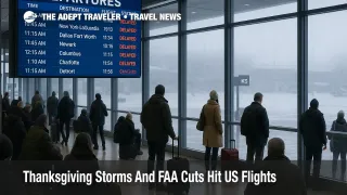
Thanksgiving storm US flight delays are increasingly likely for travelers crossing the Upper Midwest and Great Lakes, as a fast deepening winter storm collides with a still recovering U.S. air traffic system after the recent federal government shutdown. Holidaymakers flying through Chicago, Minneapolis, Detroit, Cleveland, and New York now face a combination of heavy snow, lake effect bands, low clouds, and gusty winds. Anyone with tight connections should be ready to shift flights, add overnight buffers, or switch to driving for short regional trips.
The Thanksgiving storm US flight delays outlook now reflects a sharper storm track over the Upper Midwest and Great Lakes plus lingering Federal Aviation Administration, FAA, capacity constraints from the shutdown, which together raise the odds of missed connections and extended travel days for millions of passengers.
Storm Track And Timeline For Thanksgiving Week
National Oceanic and Atmospheric Administration, NOAA, and National Weather Service forecasts show a strong winter system sweeping from the Northern Plains into the Upper Midwest and Great Lakes from Tuesday November 25 through Thanksgiving Day, with snow and strong winds continuing into the weekend. Winter storm and blizzard warnings cover parts of North Dakota, Minnesota, northern Wisconsin, and Michigan, where forecasters warn of gusts above 50 miles per hour and localized totals that could approach 2 to 3 feet in the Upper Peninsula.
Behind the main system, colder air flowing across the relatively warm lakes will fuel classic lake effect snow bands. Lake effect warnings are in place downwind of Lakes Erie and Ontario, including parts of Ohio, Pennsylvania, and New York, with projections of up to 20 inches of additional snow in the most persistent bands from Thursday November 27 through Saturday November 29.
While the sharpest impacts target the Great Lakes snow belts, national outlooks also flag rain, low ceilings, and gusty winds along key corridors from the Mid Atlantic into New England, plus early season cold across the Great Plains and upper Midwest. A second disturbance trailing the main storm could bring another round of mixed rain and snow to parts of the Midwest and Ohio Valley just as many travelers head home on Sunday and Monday, reinforcing the case for longer buffers on return legs.
Shutdown Hangover And FAA Capacity
The weather is arriving on top of an air traffic system that has spent weeks operating under reduced capacity. During the recent 2025 federal government shutdown, the FAA ordered phased flight reductions at around 40 of the busiest U.S. airports, cutting scheduled operations by up to 10 percent as unpaid air traffic controllers, ATC, stopped coming to work and staffing gaps widened. Even before the shutdown, the agency estimated it was about 3,500 controllers short of its staffing targets, a deficit that left little slack when overtime was restricted and some staff stayed home without pay.
The FAA emergency order that formalized several of these limits, including reductions in general aviation and visual flight rule arrivals at key facilities, officially ended on November 17, when the Department of Transportation announced a return to normal operations across the National Airspace System. However, officials have warned that it will take time for schedules, controller rosters, and airline networks to fully rebalance, particularly at hubs where carriers did not cut flights as sharply as requested and now face FAA scrutiny.
Unions and local media have highlighted how the shutdown period already produced days of significant delay, for example more than 1,000 delays and over 100 cancellations in a single day at Dallas Fort Worth International Airport, as staffing and weather collided. The key message for travelers is that even though the shutdown has formally ended, the operational cushion that would normally absorb a winter storm is thinner than usual.
Demand And Baseline Delay Risk
The FAA expects this Thanksgiving travel period to be the busiest in 15 years, with more than 360,000 flights scheduled over the holiday window and over 52,000 flights on Tuesday November 25 alone, the peak day. AAA estimates that 81.8 million Americans will travel at least 50 miles from home between November 25 and December 1, including about 6.07 million by air, which would set a new record for the holiday.
Transportation Security Administration, TSA, and airline leaders have echoed those projections, telling outlets such as CBS News and the Los Angeles Times to expect record crowds at security checkpoints and full flights for much of the week, especially on the Sunday after Thanksgiving. With so many passengers on each departure, the options to rebook after a cancellation or long delay are more limited than in a typical week, and a disruption in one hub can ripple quickly into other regions.
In practice, that means even travelers flying from cities with clear skies may feel knock on effects if their aircraft, crew, or ATC slot is tied to a snow hit airport earlier in the day. FlightAware data that local stations have cited this week already show elevated nationwide delays on pre holiday days, underscoring how little slack exists before the storm fully arrives.
Hub By Hub Outlook
For Wednesday through Friday, the highest risk centers on hubs that sit directly in or upstream of the storm and lake effect zones. Chicago O Hare International Airport (ORD) and Chicago Midway International Airport (MDW) straddle a transition zone of rain turning to snow, low ceilings, and gusty winds, conditions that often trigger arrival and departure metering and long taxi times. Minneapolis Saint Paul International Airport (MSP) and Detroit Metropolitan Wayne County Airport (DTW) face periods of moderate to heavy snow, strong crosswinds, and cold temperatures that can require repeated deicing, slowing operations.
Secondary hubs and spokes around the lakes, including Milwaukee Mitchell International Airport (MKE), Cleveland Hopkins International Airport (CLE), and airports in western and northern Michigan, are vulnerable both to direct snowfall and to lake effect bands that can quickly change visibility along key arrival and departure paths. Travelers connecting into smaller regional airports should be prepared for last minute cancellations when airlines choose to protect their mainline hubs at the expense of thin routes.
Along the East Coast, the earlier Thanksgiving outlook highlighted rain and storms at Northeastern and Gulf hubs. Those threats remain, but current guidance suggests that low clouds, periods of rain, and gusty crosswinds at airports such as John F Kennedy International Airport (JFK), Newark Liberty International Airport (EWR), LaGuardia Airport (LGA), and Boston Logan International Airport (BOS) may play more of a supporting role than the primary Great Lakes system. Travelers can still expect occasional ground delay programs and holding patterns, especially during peak afternoon banks, even when precipitation is light.
This story updates our earlier coverage in US Thanksgiving Storms Threaten Delays At Northeast And Gulf Hubs, which outlined the first pass at storm threats for New York, Boston, Atlanta, and Houston. Readers planning complex itineraries may want to review that piece alongside this more focused Midwest and Great Lakes outlook. US Thanksgiving Storms Threaten Delays At Northeast And Gulf Hubs.
How Weather And ATC Constraints Cascade
When winter weather hits a hub, the impacts extend beyond the immediate snow or rain. Air traffic managers may implement ground delay programs, which hold departures at their origin airports until a projected slot is available at the destination, reducing airborne stacking but increasing total journey time. Simultaneously, airport operators must clear runways and taxiways, manage deicing queues, and keep ramp workers safe in poor visibility and strong winds, all of which slow the rate at which flights can arrive and depart.
In a normal year, extra ATC staffing, spare gate capacity, and lightly loaded off peak flights provide a buffer that limits the knock on effects. This year, the combination of post shutdown staffing strain, recent flight reduction orders, and record load factors means that any slowdown lasts longer and spreads farther. A two hour ground stop at a snow hammered Great Lakes hub can trigger late arrivals for aircraft that then miss their next departure window out of New York or Atlanta, for example, creating rolling waves of delay.
Background: How ATC Staffing And Flight Cuts Affect Travelers
The FAA uses a mix of scheduled capacity limits, dynamic flow management, and local tower and center staffing to decide how many flights can operate safely in a given hour. When controller staffing is short, as it has been through 2025, the agency can mandate schedule cuts, cap arrivals and departures during peak hours, or restrict certain visual approaches that are more workload intensive.
For travelers, those internal levers show up as thinner flight options on peak days, longer times between waves of departures, and a greater chance that an airline will cancel flights preemptively rather than risk stranding an aircraft and crew out of position. The recent shutdown did not create the controller shortage, but it concentrated the pain into a short period and forced the FAA to formalize cuts that still influence schedules heading into Thanksgiving.
Practical Strategies To Reduce Your Delay Risk
If you have not yet locked in flights, the safest pattern for outbound travel is to depart on Tuesday November 25 or early Wednesday November 26 on a morning nonstop, ideally on a route that avoids the tightest storm bands and the most constrained hubs. For example, a traveler going from Denver to New York might prefer a nonstop to Newark over an itinerary that connects through Chicago or Minneapolis, even if the latter is slightly cheaper.
For those already ticketed, the first step is to watch for weather waivers from your airline, which may allow free date changes for itineraries touching high risk airports in the Upper Midwest and Great Lakes. Moving a Wednesday afternoon connection at O Hare to a Tuesday night or Friday morning nonstop, even with an overnight hotel, can be cheaper and less stressful than waiting to see whether your original flight operates.
On connections, aim for at least three hours through any Midwest or Northeast hub this week, particularly if you are connecting to an international long haul flight or a cruise departure that would be difficult to replace. Avoid self connecting on separate tickets, where the second airline has no obligation to rebook you if the first leg is delayed. Whenever possible, route through southern hubs with more benign weather patterns, even if they are slightly out of the way, to keep your exposure to the storm short.
Onward travel also needs more slack than usual. Build extra time between your scheduled arrival and any intercity rail or long distance bus connections, and consider flexible hotel bookings near key hubs if you would rather plan an overnight up front than scramble for rooms after a late cancellation. For short regional trips, particularly those under 300 miles that stay within the storm zone, driving may be a better option than taking a tight two segment flight routed through a vulnerable hub.
Finally, pack for delays. Keep essential medication, chargers, a change of clothes, and basic toiletries in your carry on, along with snacks and any items you would need if your checked bag arrives a day later. Make sure your airline app is installed and notifications enabled, and bookmark both the FAA system status and your airline s travel advisory page so you can track emerging disruptions and rebook yourself while call centers and airport desks are overwhelmed. For a deeper look at how U.S. air traffic control staffing shapes delay patterns year round, see our evergreen overview, How Air Traffic Control Staffing Shortages Drive US Flight Delays.
Sources
- Thanksgiving forecast, wet and wintry weather cause widespread travel troubles
- A storm will give these states a snowy Thanksgiving
- Lake effect snow warnings issued across Ohio, Pennsylvania, and New York
- FAA Expects Busiest Thanksgiving Travel Period in 15 Years
- DOT and FAA announce termination of FAA emergency order, return to normal operations
- DOT and FAA announce temporary 10 percent reduction in flights at 40 airports
- Flight cuts will stay at 6 percent because more air traffic controllers are coming to work, FAA says
- FAA to investigate airlines that did not comply with shutdown flight cuts
- A guide to Thanksgiving travel after the government shutdown
- Nearly 82 million Americans projected to travel over Thanksgiving
- Maps show where storms threaten Thanksgiving travel across the U.S.